Safety Score: 3,4 of 5.0 based on data from 9 authorites. Meaning please reconsider your need to travel to India.
Travel warnings are updated daily. Source: Travel Warning India. Last Update: 2024-08-13 08:21:03
Explore Napara
Napara in North 24 Parganas (West Bengal) is a city in India about 812 mi (or 1,307 km) south-east of New Delhi, the country's capital.
Local time in Napara is now 03:14 AM (Friday). The local timezone is named Asia / Kolkata with an UTC offset of 5.5 hours. We know of 8 airports in the vicinity of Napara, of which one is a larger airport. The closest airport in India is Netaji Subhash Chandra Bose International Airport in a distance of 2 mi (or 3 km), South-West. Besides the airports, there are other travel options available (check left side).
There are several Unesco world heritage sites nearby. The closest heritage site in India is Sundarbans National Park in a distance of 57 mi (or 92 km), South-East. If you need a place to sleep, we compiled a list of available hotels close to the map centre further down the page.
Depending on your travel schedule, you might want to pay a visit to some of the following locations: Kolkata, Khulna, Magura, Bagerhat and Rajshahi. To further explore this place, just scroll down and browse the available info.
Local weather forecast
Todays Local Weather Conditions & Forecast: 30°C / 85 °F
| Morning Temperature | 23°C / 74 °F |
| Evening Temperature | 29°C / 84 °F |
| Night Temperature | 26°C / 79 °F |
| Chance of rainfall | 0% |
| Air Humidity | 55% |
| Air Pressure | 1014 hPa |
| Wind Speed | Light breeze with 4 km/h (3 mph) from South-West |
| Cloud Conditions | Clear sky, covering 0% of sky |
| General Conditions | Sky is clear |
Friday, 8th of November 2024
29°C (85 °F)
25°C (78 °F)
Sky is clear, light breeze, clear sky.
Saturday, 9th of November 2024
30°C (85 °F)
24°C (76 °F)
Sky is clear, gentle breeze, clear sky.
Sunday, 10th of November 2024
29°C (85 °F)
24°C (76 °F)
Sky is clear, light breeze, clear sky.
Hotels and Places to Stay
Swissotel Kolkata
The Westin Kolkata Rajarhat
Howard Johnson
The Fern Residency Kolkata
AIRPORT CITY HOTEL
Celesta Kolkata
Ethnotel
Viceroy Kolkata (Boutique Hotel)
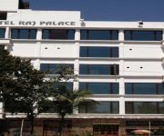
Hotel Raj Palace
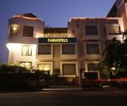
FabHotel Club Royale Airport
Videos from this area
These are videos related to the place based on their proximity to this place.
Fortune City - Madhyam Gram, Kolkata
Visit: http://www.propertywala.com/fortune-city-kolkata Fortune City - Madhyam Gram, Kolkata - 1BHK, 2BHK and 3BHK Residential Apartments in Madhyam Gram, Ko...
08. Images - Bengali Marriage: Soumendra Weds Aparna Part-1
Wedding of Soumendra and Aparna 30-Jan-09 & 01-Feb-09. Part - 1 of (1-5)
Parvati Garden - Madhyam Gram, Kolkata
Visit: http://www.propertywala.com/parvati-garden-kolkata Parvati Garden - Madhyam Gram, Kolkata - Residential Apartments A 2.60 lakhs square feet residentia...
Take-off from Calcutta - Landing gear view
Taking off from Calcutta/Kolkata, India (VECC/CCU) in a GMG Airlines (Bangladesh)DeHavilland Dash-8. Rwy 19L, around 8:25 AM local time on 23-FEB-2007.
Christ Church Moments.wmv
i miss my school a lot.! so i made this video. i do not own the songs' copyright. hope u all will enjoy.
Videos provided by Youtube are under the copyright of their owners.
Attractions and noteworthy things
Distances are based on the centre of the city/town and sightseeing location. This list contains brief abstracts about monuments, holiday activities, national parcs, museums, organisations and more from the area as well as interesting facts about the region itself. Where available, you'll find the corresponding homepage. Otherwise the related wikipedia article.
Netaji Subhas Chandra Bose International Airport
Netaji Subhas Chandra Bose International Airport is an airport located in Kolkata, West Bengal, India, serving the greater Kolkata metropolitan area. It is located approximately 17 km from Kolkata's city centre. The airport was known as Dum Dum Airport before being renamed in the honor of Netaji Subhas Chandra Bose, one of the most prominent Indian nationalist leaders of Indian independence movement.
Barasat II (community development block)
Barasat II (community development block) is an administrative division in Barasat Sadar subdivision of North 24 Parganas district in the Indian state of West Bengal. Barasat and Airport police station serves this block. Headquarters of this block is at Krishnapur. Urban area under this block consists of one census town: Nebadhai Duttapukur.
Hridaypur railway station
Hridaypur railway station (Bengali: হৃদয়পুর রেল স্টেশন) is a minor railway station in the neighbourhood of Barasat. It serves the local areas of Hridaypur, Udayrajpur and Chandigarh in the North 24 Parganas district, West Bengal, India. Many people use it every day, especially to travel to Kolkata during the peak periods.
Madhyamgram railway station
Madhyamgram railway station (Bengali: মধ্যমগ্রাম রেল স্টেশন) is a minor railway station in the town of Madhyamgram. It serves the local areas of Madhyamgram, Badu and Sajirhat in the North 24 Parganas district, West Bengal, India. Many people use it every day, especially to travel to Kolkata during the peak periods.








!['Air India A321(VT-PPT) harsh landing in Kolkata airport(VECC) rnwy 19R [FULL HD]' preview picture of video 'Air India A321(VT-PPT) harsh landing in Kolkata airport(VECC) rnwy 19R [FULL HD]'](https://img.youtube.com/vi/1g5YrF42_LY/mqdefault.jpg)