Safety Score: 3,4 of 5.0 based on data from 9 authorites. Meaning please reconsider your need to travel to India.
Travel warnings are updated daily. Source: Travel Warning India. Last Update: 2024-08-13 08:21:03
Discover Baranagar
The district Baranagar of Kāmārhāti in North 24 Parganas (West Bengal) with it's 260,072 citizens Baranagar is a district in India about 808 mi south-east of New Delhi, the country's capital city.
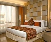
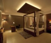
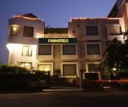
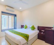
Looking for a place to stay? we compiled a list of available hotels close to the map centre further down the page.
When in this area, you might want to pay a visit to some of the following locations: Kolkata, Khulna, Magura, Bagerhat and Rajshahi. To further explore this place, just scroll down and browse the available info.
Local weather forecast
Todays Local Weather Conditions & Forecast: 27°C / 81 °F
| Morning Temperature | 19°C / 66 °F |
| Evening Temperature | 26°C / 78 °F |
| Night Temperature | 22°C / 71 °F |
| Chance of rainfall | 0% |
| Air Humidity | 32% |
| Air Pressure | 1014 hPa |
| Wind Speed | Gentle Breeze with 7 km/h (4 mph) from South-East |
| Cloud Conditions | Clear sky, covering 1% of sky |
| General Conditions | Sky is clear |
Monday, 18th of November 2024
27°C (81 °F)
21°C (70 °F)
Sky is clear, gentle breeze, clear sky.
Tuesday, 19th of November 2024
27°C (81 °F)
22°C (72 °F)
Sky is clear, gentle breeze, clear sky.
Wednesday, 20th of November 2024
28°C (83 °F)
22°C (72 °F)
Sky is clear, light breeze, clear sky.
Hotels and Places to Stay
The Sonnet
Simi International The Imperial
Celesta Kolkata
Kingston Boutique Hotel
Simi International - The Imperial
FabHotel Club Royale Airport
AIRPORT CITY HOTEL
Next Generation - AD 255 Sect 1
Ethnotel
Treebo Platinum
Videos from this area
These are videos related to the place based on their proximity to this place.
Journy from Bonhoogly to Dunlop by bus
This Jorney is from Bonhoogly stoppage to Dunlop by public bus.How general public travel in the bus and busy to go their destination that is show in this video. Beautiful people are busy at...
Baranagar Kancher Mandir, North Kolkata - Mani Mandir of Baranagar
Baranagar Kancher Mandir [Temple made of Glasses] founded by Swami Satyananda Dev situated inside Sri Sri Ramakrishna Ashram on the bank of River Ganga at Baranagar in North Kolkata.
12313 Sealdah Rajdhani Honks With A GZB WAP 7 (P7) Printed Blazes Away Dakhineshwar
It Was A Lovely Evening When White Beauty(WAP-7) Shows Its Face While Negotiates A Curve And Honks For Mee..
B.T. Road, Dunlop More Crossing - Traffic Signalling System Kolkata
Bike ride on B.T. Road near Dunlop More (Kolkata). Going towards Barrackpore from Shyambazar through B.T. Road. An evening on B.T. Road at Dunlop crossing. Waiting for Green Signal to cross...
Langur with the visitors
Colobines are medium-sized primates with long tails and diverse colorations. The coloring of nearly all the young animals differs remarkably from that of the adults. Most species are arboreal,...
Glass Temple Kolkata - Sheesha Mandir / Kanch Mandir Baranagar, Kolkata
Glass Temple Kolkata - Sheesha Mandir / Kanch Mandir Baranagar, Kolkata - Swami Satyananda Dev founded Kanch Mandir [Sheesha Mandir / Glass Temple] is located at Baranagar beside River ...
Rajasthani Gatte Ki Sabzi - Indian Curry Recipe
Gatte ki sabji is a popular and famous dish of Rajasthan. Learn how to make gatte ki sabzi in Rajasthani Style. If you don't have any vegetable at home this is the best dish you can easily...
Grandes ciudades
Vídeo fotográfico del blogg de viajes "En un lugar más alla de La Mancha" en el que se muestran nuestras fotografias tomadas por las megaciudades de Delhi, C...
Rajasthani Moong Dal Parantha - Indian Recipe
This is popularly known as Roti or Mungdal Parantha. It contains Mung Dal Ingredients: 2 cups wheat flour ¼ tsp Red chily powder ¼ tsp cumin seeds (jeera) Salt to taste 1 tbsp Moong Dal...
Videos provided by Youtube are under the copyright of their owners.
Attractions and noteworthy things
Distances are based on the centre of the city/town and sightseeing location. This list contains brief abstracts about monuments, holiday activities, national parcs, museums, organisations and more from the area as well as interesting facts about the region itself. Where available, you'll find the corresponding homepage. Otherwise the related wikipedia article.
Vivekananda Setu
Vivekananda Setu (Bengali: বিবেকানন্দ সেতু also called Willingdon Bridge and Bally Bridge) is a bridge over the Hooghly River in West Bengal, India. It links the city of Howrah, at Bally, to its twin city of Kolkata, at Dakshineswar. Built in December 1932, it is a multispan steel bridge and was built to provide road cum rail link between the Calcutta Port and its hinterland. It is 2,887 feet long.
Indian Statistical Institute
Indian Statistical Institute (ISI) is an academic institute of national importance as recognised by a 1959 act of the Indian parliament. It grew out of the Statistical Laboratory set up by Prasanta Chandra Mahalanobis in Presidency College, Kolkata.
Kamarhati
Kamarhati is a city and a municipality under Belghoria police station of Barrackpore subdivision. in North 24 Parganas district in the Indian state of West Bengal. It is a part of the area covered by Kolkata Metropolitan Development Authority.
Uttarpara
Uttarpara is a town of Hooghly District, West Bengal, India. It is a part of the area covered by Uttarpara Kotrung Municipality. It is a town of historical importance. Uttarpara is home to some of the biggest industrial setups in the state. It has the United Spirits Distilliery, Shalimar Wire Products, Hindustan Motors which is the only vehicle plant in West Bengal which manufactures the car Ambassador. Uttarpara Kotrung is the municipality.
Baranagar
Baranagar or Barahanagar, meaning the big (Bara or Burra) and town or land (nagar) of the pig (baraha), is a town in the northern outskirts of Kolkata. It is a municipality in North 24 Parganas district in the state of West Bengal, India. A railway station of the same name is on the Dankuni line off the Sealdah north section. It is home to the Indian Statistical Institute, a famous institution devoted to the research, teaching and application of statistics, natural sciences and social sciences.
Aamar FM
Aamar FM (literally meaning My FM) is a FM radio channel in Kolkata, India. The on- air presentation language of the station is in the Bengali language, the only private radio station to do so. Aamar 106.2FM is self-described as “The Radio Station Built for Kolkata by Kolkatans”. All of the elements heard on Aamar 106.2FM were designed from the input and feedback collected from extensive local research studies and its “FM Radio Start-Up” pre-launch campaign.
Chakapara
Chakapara is a census town under Liluah police station in Sadar subdivision of Howrah district in the Indian state of West Bengal.
South Dumdum
South Dumdum is a city and a municipality in North 24 Parganas district in the Indian state of West Bengal. South Dum Dum consists of localities like, Nagerbazar, Bangur Avenue, Dum Dum Park, Lake Town, Paikpara.
Don Bosco High & Technical School, Liluah
Don Bosco School Liluah, or DBL, is an all-boys, English medium school covering lower kindergarten through grade twelve. Located in Liluah, near the city of Kolkata, India, the school was established in 1937, and is run by the Salesians of Don Bosco S.D.B. which is a minority institution within the Catholic Church. The patron saint of the school is St. John Bosco, popularly known as Don Bosco. The motto of the school is "Virtus et Labor".
Bally, Howrah
Bally is a city, municipality in Howrah District, West Bengal, India. It is a part of the area covered by Kolkata Metropolitan Development Authority. It is a town of historical importance. Located at the north-eastern tip of the Howrah district, on the banks of the River Hooghly, it is just across the river from the Dakshineswar Kali Temple and near the Belur Math.
Uttarpara Govt. High School
Uttarpara Government High School (also known as Uttarpara Rastriya Uchcha Vidyalaya) is a school situated in Uttarpara, a town of Hooghly District, West Bengal, India. The school is directly under the Government of West Bengal. The present Headmaster is Mr. Pradip Kumar Basu.
Bagbazar
Bagbazar (also spelt Baghbazar) is a neighbourhood in north Kolkata, in the Indian state of West Bengal. The area, under Shyampukur police station of Kolkata Police, has been, along with neighbouring Shyambazar, the citadel of the Bengali aristocracy. Bagbazar has played an active role in growth and development of Kolkata.
Sunrise English Medium School
Ramakrishna Mission Vidyamandira
Ramakrishna Mission Vidyamandira is an autonomous degree college affiliated with the University of Calcutta, India.
Nivedita Setu
Nivedita Setu (also called Second Vivekananda Setu) is a cable-stayed bridge over Hooghly River in Kolkata, West Bengal. It runs parallel to and around 50 m downstream of the old Vivekananda Setu opened in 1932. The bridge is named after Sister Nivedita, the social worker-disciple of Swami Vivekananda. Belghoria Expressway that connects the meeting point of NH 2 with NH 6 at Dankuni to NH 34, NH 35, Dum Dum Airport and northern parts of Kolkata passes over the bridge.
R. G. Kar Medical College and Hospital
R. G. Kar Medical College and Hospital is one of the oldest medical college and tertiary care hospital of Kolkata, West Bengal in India named after the famous physician Dr. Radha Gobinda Kar, the founder of the institution.
Kolkata railway station
Kolkata Station (also known as Chitpur station) is the newest of the four intracity railway stations serving Howrah and Kolkata, India; the others are Sealdah Station, in Kolkata, Shalimar Station in Howrah and Howrah Station in Howrah. Kolkata station is situated in the Chitpur locality of north central Kolkata.
Raja Peary Mohan College
Raja Peary Mohan College is a general purpose college in Hooghly District of West Bengal, India under University of Calcutta. It offers intermediate and undergraduate courses in various arts, science and commerce subjects. The college is one of the most popular instituttion for higher study in the neighbourhood of Kolkata.
Belgachia East (Vidhan Sabha constituency)
Belgachia East (Vidhan Sabha constituency) (Bengali: বেলগাছিয়া পূ্র্ব বিধানসভা কেন্দ্র) was an assembly constituency in Kolkata in the Indian state of West Bengal. As a consequence of the orders of the Delimitation Commission, Belgachia East (Vidhan Sabha constituency) ceases to exist from 2011. It was part of Dum Dum (Lok Sabha constituency).:
Belgachia West (Vidhan Sabha constituency)
Belgachia West (Vidhan Sabha constituency) (Bengali: বেলগাছিয়া পশ্চিম বিধানসভা কেন্দ্র) was an assembly constituency in Kolkata in the Indian state of West Bengal. As a consequence of the orders of the Delimitation Commission, Belgachia West (Vidhan Sabha constituency) ceases to exist from 2011. It was part of Calcutta North East (Lok Sabha constituency).:
Cossipur (Vidhan Sabha constituency)
Cossipur (Vidhan Sabha constituency) (Bengali: কাশীপুর বিধানসভা কেন্দ্র) was an assembly constituency in Kolkata in the Indian state of West Bengal. As a consequence of the orders of the Delimitation Commission, Cossipur (Vidhan Sabha constituency) ceases to exist from 2011. It was part of Calcutta North West (Lok Sabha constituency).
Belgachhia metro station
Belgachhia is a station of the of the Kolkata Metro.
Dum Dum metro station
Dum Dum is a station of the of Kolkata Metro. The metro station adjoins the platforms of the railway station where connections can be made with Indian Railways services.
Sagar Dutta Memorial Medical College and Hospital
The Sagar Dutta Memorial Medical College and Hospital is a Government Medical College located in Kolkata, in the Indian state of West Bengal. It is affiliated with the Medical Council of India (MCI). This medical college was established in 2011 with around 100 students. The West Bengal Joint Entrance Examination provides the state-government controlled centralised test for admission to the college.
Sinthee
Sinthee or Sinthi is a neighbourhood in north Kolkata. It is surrounded by Dum Dum in the west and South, Baranagar in the north and east, Cossipore/ Shyambazar in the South. The Barrackpore Trunk Road passes through here.


