Safety Score: 3,4 of 5.0 based on data from 9 authorites. Meaning please reconsider your need to travel to India.
Travel warnings are updated daily. Source: Travel Warning India. Last Update: 2024-08-13 08:21:03
Discover Parbatipur
Parbatipur in Hāora (West Bengal) with it's 8,657 citizens is a place in India about 799 mi (or 1,286 km) south-east of New Delhi, the country's capital city.
Current time in Parbatipur is now 05:03 AM (Friday). The local timezone is named Asia / Kolkata with an UTC offset of 5.5 hours. We know of 8 airports near Parbatipur, of which one is a larger airport. The closest airport in India is Netaji Subhash Chandra Bose International Airport in a distance of 14 mi (or 23 km), East. Besides the airports, there are other travel options available (check left side).
There are several Unesco world heritage sites nearby. The closest heritage site in India is Sundarbans National Park in a distance of 66 mi (or 106 km), South-East. If you need a hotel, we compiled a list of available hotels close to the map centre further down the page.
While being here, you might want to pay a visit to some of the following locations: Kolkata, Khulna, Magura, Bagerhat and Rajshahi. To further explore this place, just scroll down and browse the available info.
Local weather forecast
Todays Local Weather Conditions & Forecast: 30°C / 86 °F
| Morning Temperature | 24°C / 75 °F |
| Evening Temperature | 29°C / 84 °F |
| Night Temperature | 27°C / 80 °F |
| Chance of rainfall | 0% |
| Air Humidity | 53% |
| Air Pressure | 1014 hPa |
| Wind Speed | Light breeze with 4 km/h (3 mph) from South-West |
| Cloud Conditions | Clear sky, covering 0% of sky |
| General Conditions | Sky is clear |
Friday, 8th of November 2024
30°C (86 °F)
27°C (80 °F)
Sky is clear, light breeze, clear sky.
Saturday, 9th of November 2024
30°C (87 °F)
25°C (78 °F)
Sky is clear, gentle breeze, clear sky.
Sunday, 10th of November 2024
30°C (86 °F)
25°C (77 °F)
Sky is clear, light breeze, clear sky.
Hotels and Places to Stay
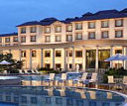
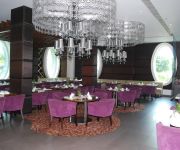
Fortune Park Panchwati
Barsana Hotel & Resort
Lake Land Country Club Residency
Videos from this area
These are videos related to the place based on their proximity to this place.
Kolkata West International City - NH-6, Kolkata
Visit: http://www.propertywala.com/kolkata-west-international-city-kolkata Kolkata West International City - NH-6, Kolkata - 2 & 3 BHK apartments available at KWIC Kolkata West International...
Journey to NH6(Friend Driving 3)
Return Trip...my friend was driving. Vehicle used was Hero Honda Hunk (1 cyl, 150cc, 14.4bhp).
Journey to NH6(Me Driving 4)
Early Morning ride to the National Highway 6...better known as the Delhi Road. Vehicle used was Hero Honda Hunk (1 cyl, 150cc, 14.4bhp). Last part of the video.
Journey to NH6(Friend Driving)
Return Trip...my friend was driving. Vehicle used was Hero Honda Hunk (1 cyl, 150cc, 14.4bhp).
Turtle, juvenile (ID?)
Every year during monsoon one or two village boys find a pair or two of these juvenile turtles around their village outskirts. These turtles are also getting rarer and can only be found in...
High Speed Night Action::: Raw Crossing by Vibhuti Express!!!
Time:20:21 Location: Dankuni outer Date:07th June,2012. After having a great day of railfanning trip with arkchat921(arkya da) and baban da(mrcheersbagha;tho...
wasp colony
On 03/09/11 I recorded this colony in another village where the poor juvenile crested honey buzzard met its fate. This wasp is also very common in our area. species - Polistes olivaceus...
12345 Saraighat Express with a madly honking WDP-4 #20072!!!
Time:16:15 Date:01/06/12 Location: Dankuni 12345 hwh-ghy saraighat express usually enters dankuni and passes through at 16:05. On this day, i was going for a railfanning trip at baruipara...
Videos provided by Youtube are under the copyright of their owners.
Attractions and noteworthy things
Distances are based on the centre of the city/town and sightseeing location. This list contains brief abstracts about monuments, holiday activities, national parcs, museums, organisations and more from the area as well as interesting facts about the region itself. Where available, you'll find the corresponding homepage. Otherwise the related wikipedia article.
Bhandardaha
Bhandardaha is a census town under Domjur police station in Sadar subdivision of Howrah district in the state of West Bengal, India.
Dakshin Jhapardaha
Dakshin Jhapardaha is a census town under Domjur police station in Sadar subdivision of Howrah district in the state of West Bengal, India.
Domjur
Domjur is a census town in Sadar subdivision of Howrah district in the Indian state of West Bengal.
Khantora
Khantora is a census town under Domjur police station in Sadar subdivision of Howrah district in the Indian state of West Bengal.
Makardaha
Makardaha is a census town under Domjur police station in Sadar subdivision of Howrah district in the Indian state of West Bengal.
Krishnapur, West Bengal
See Krishnapur for disambiguation Krishnapurকৃষ্ণপুর — Town — Krishnapur, West Bengal is located in West BengalKrishnapurKrishnapur Coordinates: {{#invoke:Coordinates|coord}}{{#coordinates:22.67|N|88.26|E|type:city(6676)_region:IN-X|||| |primary |name= }} Country 22x20px India State West Bengal District Hooghly Population (2001) • Total 6,676 Languages • Official Bengali, English Time zone IST Krishnapur is a census town in Hooghly district in the Indian state of West Bengal.
Chanditala II (community development block)
Chanditala II (community development block) is an administrative division in Srirampore subdivision of Hooghly district in the Indian state of West Bengal. Chanditala and Dankuni police stations serve this block. Headquarters of this block is at Chanditala. Purba Tajpur, Kharsarai, Begampur, Chikrand, Pairagachha, Monoharpur, Barijhati, Garalgachha, Krishnapur and Mrigala are urban areas in this block.
Domjur (community development block)
Domjur (community development block) (Bengali: ডোমজুড় সমষ্টি উন্নয়ন ব্লক) is an administrative division in Howrah Sadar subdivision of Howrah district in the Indian state of West Bengal. Domjur police station serves this block. Headquarters of this block is at Domjur. Domjur, Dakshin Jhapardaha, Khantora, Bhandardaha, Makardaha, Kantlia, Tentulkuli, Salap, Bankra, Nibra, Ankurhati, Bipra Noapara, Kalara, Kesabpur, Natibpur, and Mahiari are urban areas in this block.


