Safety Score: 3,4 of 5.0 based on data from 9 authorites. Meaning please reconsider your need to travel to India.
Travel warnings are updated daily. Source: Travel Warning India. Last Update: 2024-08-13 08:21:03
Delve into Sungawān
Sungawān in Kānpur (Uttar Pradesh) is located in India about 248 mi (or 399 km) south-east of New Delhi, the country's capital town.
Current time in Sungawān is now 12:29 PM (Saturday). The local timezone is named Asia / Kolkata with an UTC offset of 5.5 hours. We know of 8 airports close to Sungawān. The closest airport in India is Kanpur Airport in a distance of 5 mi (or 7 km), North. Besides the airports, there are other travel options available (check left side).
There is one Unesco world heritage site nearby. It's Khajuraho Group of Monuments in a distance of 109 mi (or 175 km), South. If you need a hotel, we compiled a list of available hotels close to the map centre further down the page.
While being here, you might want to pay a visit to some of the following locations: Lucknow, Bardiya, Agra, Birendranagar and Surkhet. To further explore this place, just scroll down and browse the available info.
Local weather forecast
Todays Local Weather Conditions & Forecast: 24°C / 75 °F
| Morning Temperature | 17°C / 63 °F |
| Evening Temperature | 25°C / 78 °F |
| Night Temperature | 20°C / 68 °F |
| Chance of rainfall | 0% |
| Air Humidity | 32% |
| Air Pressure | 1017 hPa |
| Wind Speed | Light breeze with 4 km/h (2 mph) from South-East |
| Cloud Conditions | Clear sky, covering 0% of sky |
| General Conditions | Sky is clear |
Sunday, 24th of November 2024
25°C (77 °F)
20°C (69 °F)
Sky is clear, gentle breeze, clear sky.
Monday, 25th of November 2024
25°C (78 °F)
20°C (69 °F)
Few clouds, light breeze.
Tuesday, 26th of November 2024
27°C (81 °F)
20°C (68 °F)
Few clouds, light breeze.
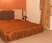
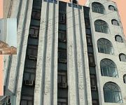
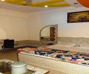
Hotels and Places to Stay
Hotel Gagan Plaza
Hotel Mahadeva Regency
HOTEL MMK
Hotel Chandra Deep
Hotel Deep
Videos from this area
These are videos related to the place based on their proximity to this place.
PANCHAL Animal Driven Flour Mill (Atta Chakki)
PANCHAL Animal Driven "Flour Mill" (Atta Chakki) Manufacturer: ================================================ M/S. PANCHAL PUMPS & SYSTEMS Kanpur, Uttar Pradesh, India ...
Ride Fast - Timelapse/Hyperlapse
iPhone 7 Hyperlapse, First video on YouTube, In love with Timelapses and Hyperlapses. Will make beyond last one if you guys love it and gives a thumbs up!
Rooma kanPur train haadsa 20/04/2019
When I heard the sound like thunder I ran away towards destination where train poorva express was out of railway track n I tried to save people of our india.
Videos provided by Youtube are under the copyright of their owners.
Attractions and noteworthy things
Distances are based on the centre of the city/town and sightseeing location. This list contains brief abstracts about monuments, holiday activities, national parcs, museums, organisations and more from the area as well as interesting facts about the region itself. Where available, you'll find the corresponding homepage. Otherwise the related wikipedia article.
Air Force School Kanpur
Air Force School, Kanpur Location Kanpur, Uttar Pradesh India Information Type Private Motto विद्या ददाति विनयम् (Education gives humility) Established 1954 President Air Officer Commanding, Kanpur Air Force Station Principal Rajesh Pandey Faculty OP Bajpai, SCL Srivastava, Manoj Tewari, Seema Sharma, Seema Shukla, Indu Bajpai, Kalpana Dixit.
Kanpur Airport
Kanpur Airport aka Chakeri Air Force Station is an airport that was originally designated for the Indian Air Force. In the 1970s, flights operated from this airport regularly to Delhi, Ahmedabad, Allahabad, Kolkata, Banglore, Chennai, Pune and Mumbai. For a long time, passengers of Kanpur and surrounding developing cities have had to travel about 80 kilometers northwards to Amausi Airport in Lucknow, a 2–3 hours drive, for taking a flight to New Delhi, Mumbai or overseas.
Tilsahri
Tilsahri is a town in Kanpur district in the state of Uttar Pradesh, India. Nearby towns include Narwal and Maharajpur, 10 km north and 7 km west respectively.


