Safety Score: 3,4 of 5.0 based on data from 9 authorites. Meaning please reconsider your need to travel to India.
Travel warnings are updated daily. Source: Travel Warning India. Last Update: 2024-08-13 08:21:03
Delve into Upalgūda
Upalgūda in Rangareddi (Telangana) is located in India about 780 mi (or 1,255 km) south of New Delhi, the country's capital town.
Current time in Upalgūda is now 05:38 PM (Friday). The local timezone is named Asia / Kolkata with an UTC offset of 5.5 hours. We know of 6 airports close to Upalgūda, of which one is a larger airport. The closest airport in India is Rajiv Gandhi International Airport, Shamshabad in a distance of 14 mi (or 23 km), South-West. Besides the airports, there are other travel options available (check left side).
We encountered 1 points of interest near this location. If you need a hotel, we compiled a list of available hotels close to the map centre further down the page.
While being here, you might want to pay a visit to some of the following locations: Hyderabad, Kagaznagar, Latur, Osmanabad and Beed. To further explore this place, just scroll down and browse the available info.
Local weather forecast
Todays Local Weather Conditions & Forecast: 26°C / 79 °F
| Morning Temperature | 17°C / 62 °F |
| Evening Temperature | 24°C / 75 °F |
| Night Temperature | 19°C / 66 °F |
| Chance of rainfall | 0% |
| Air Humidity | 34% |
| Air Pressure | 1014 hPa |
| Wind Speed | Light breeze with 5 km/h (3 mph) from West |
| Cloud Conditions | Few clouds, covering 15% of sky |
| General Conditions | Few clouds |
Saturday, 23rd of November 2024
26°C (79 °F)
19°C (67 °F)
Scattered clouds, light breeze.
Sunday, 24th of November 2024
26°C (78 °F)
18°C (65 °F)
Overcast clouds, light breeze.
Monday, 25th of November 2024
24°C (76 °F)
18°C (65 °F)
Overcast clouds, gentle breeze.
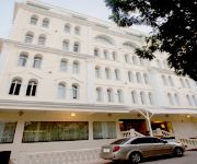
Hotels and Places to Stay
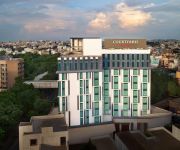
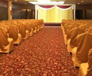
Hyderabad Marriott Hotel & Convention Centre
Courtyard Hyderabad
ZO Rooms SR Nagar
The Platinum
HOTEL MINERVA GRAND
Vaishnaoi Hotel
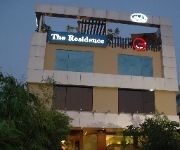
Justa The Residence
Taj Tristar
Royal Reves
Hyderabad United-21
Videos from this area
These are videos related to the place based on their proximity to this place.
Hyderabad Metro construction at Uppal
Seen in video is the In-Situ type of bridge construction at Uppal X Roads . These type of construction would be carried out at all major junctions and cross roads . In-Situ construction mainly...
Hyderabad Metro Rail (HMR) - under construction - Uppal Cross Road
This video show the undergoing work of Hyderabad Metro Rail (HMR) at the Uppal to Shilparamam phase. It is recorded near uppal ring road with a HD camera while on a bike. BY - A.ROHIT RAJ.
Hyderabad Metro Rail construction - Uppal to Mettuguda
Hyderabad Metro Rail construction - Uppal to Mettuguda Location: Uppal - Mettuguda on IRR DATE: 15-FEB-2013 Raw File: VIDEO0042.HMR const. Uppal-Mettuguda.15022013.3gp.
Hyderabad metro construction Habshiguda to Tarnaka.
http://www.youtube.com/watch?v=YshCY6uQ6bU Nagole to Uppal construction video. The construction of metro beside Tarnaka flyover .
CHAITANYA BHARATHI HIGH SCHOOL - RAMANTHAPUR
CHAITANYA BHARATHI HIGH SCHOOL Shanthi Nagar, Ramanthapur Hyderabad Ph: 040 - 64513275, 65302045 info@chaitanyabharathi.com For More Details Visit us on: ...
Hyderabad metro rail bridge
The construction of bridges have started at Nagole and Genpact. The bridge seen in the video is from N.G.R.I. to Habshiguda. So far it is the longest constructed bridge. Nagole metro bridge...
MMTS Journey From Secunderabad to Sitaphalmandi.
This Video is taken from a Running MMTS Train Showing the Journey Between Secunderabad Junction and the Sitaphalmandi Railway Station. And in between the MMTS Local confronts wdm3a led ...
Opening Antenna the MMTS Train at Sitaphalmandi Railway station.
This video is taken at Sitaphalmandi Railway staion showing the Antenna of a Local Hyderabadi MMTS Train is being opened.
Videos provided by Youtube are under the copyright of their owners.
Attractions and noteworthy things
Distances are based on the centre of the city/town and sightseeing location. This list contains brief abstracts about monuments, holiday activities, national parcs, museums, organisations and more from the area as well as interesting facts about the region itself. Where available, you'll find the corresponding homepage. Otherwise the related wikipedia article.
Rajiv Gandhi International Cricket Stadium
Rajiv Gandhi International Cricket Stadium (Telugu: రాజీవ్ గాంధీ అంతర్జాతీయ క్రికెట్ మైదానం), formerly known as Visaka International Cricket Stadium Ground, is the principal cricket stadium in Hyderabad, India and is the home ground of the Hyderabad Cricket Association (HCA). It is located in Uppal, an eastern suburb of the city. It has a capacity of 55,000 spectators presently and extends across 16 acres of land. The ends are named Pavilion End and North End.
Gandhi Medical College
Gandhi Medical College, founded 14 September 1954, is a medical college in Padmarao Nagar, Secunderabad in the state of Andhra Pradesh, India.
Jamia Osmania
Jamia Osmania is a suburb of Hyderabad, India.
Adikmet
Adikmet is a suburb of Hyderabad, India. Mainly a residential area, it is very close to Osmania University's campus. The neighbourhood has a hanuman temple and is located near the road from Nallakunta to Tarnaka: following the closure of the road from the Osmania campus, this has become an important road to Taranaka. Recently a fly-over was built in this area.
Arts College railway station
Arts College Railway Station is a railway station in Hyderabad, Andhra Pradesh, India. Localities like Osmania University, Habsiguda, Warasiguda and Adikmet are accessible from this station.
St. John's Regional Seminary
St. John's Regional Seminary is the theologate of the Catholic Church of Andhra Pradesh. It is a major seminary training students to become priests. St. John's Regional Seminary is situated in Ramanthapur in Hyderabad.
Bethapudi
Bethapudi is a village in Bapatla mandal, Guntur district, Andhra Pradesh, India.
Musheerabad Jail
Musheerabad Jail was a correctional facility located in Musheerabad area of Hyderabad, India. The facility was demolished in 2003 and a hospital and a medical college were constructed in the same area. Prior to its demolition, director Nagesh Kukunoor obtained a stay order for some time in order to complete filming of 3 Deewarein (2003).


