Safety Score: 3,4 of 5.0 based on data from 9 authorites. Meaning please reconsider your need to travel to India.
Travel warnings are updated daily. Source: Travel Warning India. Last Update: 2024-08-13 08:21:03
Discover Pīpal Chaur
Pīpal Chaur in Naini Tāl (State of Uttarakhand) is a place in India about 135 mi (or 218 km) north-east of New Delhi, the country's capital city.
Current time in Pīpal Chaur is now 08:50 AM (Wednesday). The local timezone is named Asia / Kolkata with an UTC offset of 5.5 hours. We know of 9 airports near Pīpal Chaur, of which one is a larger airport. The closest airport in India is Pantnagar Airport in a distance of 26 mi (or 41 km), South-East. Besides the airports, there are other travel options available (check left side).
There is one Unesco world heritage site nearby. It's Nanda Devi and Valley of Flowers National Parks in a distance of 96 mi (or 154 km), North. If you need a hotel, we compiled a list of available hotels close to the map centre further down the page.
While being here, you might want to pay a visit to some of the following locations: Dehra Dun, Dipayal, Achham, Burang and Toding. To further explore this place, just scroll down and browse the available info.
Local weather forecast
Todays Local Weather Conditions & Forecast: 22°C / 72 °F
| Morning Temperature | 13°C / 55 °F |
| Evening Temperature | 17°C / 62 °F |
| Night Temperature | 14°C / 58 °F |
| Chance of rainfall | 0% |
| Air Humidity | 36% |
| Air Pressure | 1016 hPa |
| Wind Speed | Light breeze with 4 km/h (2 mph) from South-West |
| Cloud Conditions | Clear sky, covering 0% of sky |
| General Conditions | Sky is clear |
Thursday, 28th of November 2024
23°C (73 °F)
15°C (58 °F)
Sky is clear, light breeze, clear sky.
Friday, 29th of November 2024
24°C (75 °F)
15°C (59 °F)
Sky is clear, light breeze, clear sky.
Saturday, 30th of November 2024
25°C (76 °F)
15°C (60 °F)
Sky is clear, light breeze, clear sky.
Hotels and Places to Stay
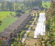
JUNGLE ECO RESORT
Videos from this area
These are videos related to the place based on their proximity to this place.
Rejser Ferie Hoteller i Indien Camp Corbett Kaladhungi Uttaranchal Indien rejser Ferie
Besøg http://www.ferie.cc Rejser Ferie Hoteller i Indien Camp Corbett Kaladhungi Uttaranchal Indien rejser Ferie.
TIGERS near Camp Corbett
Video and Commentary of Places where Tigers have been seen nr Camp Corbett(www.blazeatrailadventures.com)by Kaladhungi Canal @ Boar Riverbed.
BARKING DEER IN INDIA
Close ups of male Barking Deer on Boar riverbed nr CampCorbett,Kaladhungi.I took the video with my back to a large boulder opp. a small pool of water .The 'Kakar' (Barking Deer) didnt see...
CHITAL DEER AT 4 YARDS IN JUNGLE
Was sitting in a Sal Forest nr Camp Corbett,Kaladhungi,India as it got dark when this Chital came past me.Videoed it at a few feet with Sony'Nightshot'.You will notice the deer scented me as...
Nainital To Kaladhungi || नैनीताल से कालाढूंगी || Full Journey || पूर्ण यात्रा || Naini Vlogs Ntl.||
Hello Friends In This Video I will Show You My Full Journey Of Nainital To Kaladhungi. This Video Is Full Of Greenery, Hills and Mountains Enjoy Curvy Roads ...
UK Forest in Kaladhungi
Forest in Kaladhungi between Haldwani to Ramnagar State Highway at District Nainital Uttarakhand India.
UK Forest in Kaladhungi.
Forest in Kaladhungi between Haldwani to Ramnagar State Highway at District Nainital Uttarakhand India.
how to capture sunrays . some practical work of PIC KLICK students
PIC KLICK PROFESSIONAL PHOTOGRAPHY AND CLASSES students understanding the Elements of PHOTOGRAPHY ..( practical time ) follow us on ...
how to shoot best portrait with landscape # PIC KLICK PROFESSIONAL PHOTOGRAPHY AND CLASSES
PIC KLICK PROFESSIONAL PHOTOGRAPHY AND CLASSES ADVANCE PHOTOGRAPHY follow us on instagram - www.instagram.com/Picklick5/ for our latest ...
Heavy flood
Hello friend's welcome to my channel 'HJV Vlogs'....... Aaj m ir mera dost Rahul eek choti see scooty ride m gaye h..... Hope aap sabe ko ye video m maza ...
Videos provided by Youtube are under the copyright of their owners.


