Safety Score: 3,4 of 5.0 based on data from 9 authorites. Meaning please reconsider your need to travel to India.
Travel warnings are updated daily. Source: Travel Warning India. Last Update: 2024-08-13 08:21:03
Discover Dhūra
Dhūra in Naini Tāl (State of Uttarakhand) is a place in India about 141 mi (or 227 km) east of New Delhi, the country's capital city.
Current time in Dhūra is now 06:22 AM (Wednesday). The local timezone is named Asia / Kolkata with an UTC offset of 5.5 hours. We know of 9 airports near Dhūra, of which one is a larger airport. The closest airport in India is Pantnagar Airport in a distance of 22 mi (or 36 km), South. Besides the airports, there are other travel options available (check left side).
There is one Unesco world heritage site nearby. It's Nanda Devi and Valley of Flowers National Parks in a distance of 96 mi (or 154 km), North. If you need a hotel, we compiled a list of available hotels close to the map centre further down the page.
While being here, you might want to pay a visit to some of the following locations: Dipayal, Dehra Dun, Achham, Burang and Toding. To further explore this place, just scroll down and browse the available info.
Local weather forecast
Todays Local Weather Conditions & Forecast: 22°C / 72 °F
| Morning Temperature | 13°C / 55 °F |
| Evening Temperature | 17°C / 62 °F |
| Night Temperature | 14°C / 58 °F |
| Chance of rainfall | 0% |
| Air Humidity | 36% |
| Air Pressure | 1016 hPa |
| Wind Speed | Light breeze with 4 km/h (2 mph) from South-West |
| Cloud Conditions | Clear sky, covering 0% of sky |
| General Conditions | Sky is clear |
Thursday, 28th of November 2024
23°C (73 °F)
15°C (58 °F)
Sky is clear, light breeze, clear sky.
Friday, 29th of November 2024
24°C (75 °F)
15°C (59 °F)
Sky is clear, light breeze, clear sky.
Saturday, 30th of November 2024
25°C (76 °F)
15°C (60 °F)
Sky is clear, light breeze, clear sky.
Hotels and Places to Stay
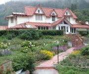
The Earls Court UNA Hotels
Shervani Hilltop
Arif Castles
Vikram Vintage Inn
Dynasty Resort
The Earl's Court
Country Inn Sattal
Hotel Channi Raja
Hotel Ankur Plaza
Prim rose
Videos from this area
These are videos related to the place based on their proximity to this place.
Nainital Nainital Tour Nainital Tourism Fishes in Nainital Lake
http://www.nainitaltourism.com/ NAINITAL TOURISM: Since 1 9 9 9 - 1000 + Pages - 5000 + Photos - THE LAKE DISTRICT OF INDIA Fishes in Nainital Lake.
Nainital Tours & Package - Nainital Package Tour - Nainital Packages - Nainital Tour
http://www.nainitaltourism.com/nainital_tours_and_package.html Nainital Tours & Package - Since 1999 - The Leading Travel Agency of Uttarakhand - Nainital & Mussoorie. We cover almost whole...
Khurpatal - An Anglers Paradise - Khurpatal Tourism - Khurpatal Nainital - Khurpatal Lake
Since 1 9 9 9 http://www.nainitaltourism.com/Khurpatal.html KHUPRATAL :-At an altitude of 5500 ft (1635 MT) there lies just another beautiful spot at a distance of 12 km from Nainital popularly...
Just my blog first time introduce new places for journey and their importqnce
Description until 100. Subscribers.
देवीधुरा का बग्वाल मेला "पाषाण युद्ध" - जहां लोग एक दूसरे पर बरसाते हैं पत्थर, Devidhura Uttarakhand
Check out our Travel short film *"The Unpredictable Monsoon "* This video will surely gonna take you to mesmerizing journey of unpredictable monsoon ...
Nainital Adventures tour, Camping,Trekking,close to nature..
Camp Brookhill is a place designed and setup to provide a chance to relax and appreciate the nature. There is opportunity for the visitors from bird watching to ...
Travel diary Entering the Government House Nainital
The Government House{Raj bhawan} Nainital is an ancient building from the Britisher era .It is now open for public .The place is beautiful with great architiecture ...
Videos provided by Youtube are under the copyright of their owners.
Attractions and noteworthy things
Distances are based on the centre of the city/town and sightseeing location. This list contains brief abstracts about monuments, holiday activities, national parcs, museums, organisations and more from the area as well as interesting facts about the region itself. Where available, you'll find the corresponding homepage. Otherwise the related wikipedia article.
Nainital
Nainital pronunciation is a popular hill station in the Indian state of Uttarakhand and headquarters of Nainital district in the Kumaon foothills of the outer Himalayas. Situated at an altitude of 2,084 metres above sea level, Nainital is set in a valley containing a pear-shaped lake, approximately two miles in circumference, and surrounded by mountains, of which the highest are Naina (2,615 m) on the north, Deopatha (2,438 m) on the west, and Ayarpatha (2,278 m) on the south.
St. Mary's Convent High School
St Mary’s High School, Ramnee Park, Nainital, Uttarakhand, is a girls residential/ boarding and day school in Nainital, Uttarakhand, India providing public school education.


