Safety Score: 3,4 of 5.0 based on data from 9 authorites. Meaning please reconsider your need to travel to India.
Travel warnings are updated daily. Source: Travel Warning India. Last Update: 2024-08-13 08:21:03
Delve into Manjathala
Manjathala in State of Tamil Nādu is a city located in India about 1,194 mi (or 1,921 km) south of New Delhi, the country's capital town.
Current time in Manjathala is now 01:05 PM (Friday). The local timezone is named Asia / Kolkata with an UTC offset of 5.5 hours. We know of 8 airports closer to Manjathala, of which 3 are larger airports. The closest airport in India is Coimbatore International Airport in a distance of 29 mi (or 47 km), South-East. Besides the airports, there are other travel options available (check left side).
There is one Unesco world heritage site nearby. It's Mountain Railways of India in a distance of 15 mi (or 24 km), North-East. We saw 1 points of interest near this location. In need of a room? We compiled a list of available hotels close to the map centre further down the page.
Since you are here already, you might want to pay a visit to some of the following locations: Kozhikode, Trichur, Bengaluru, Dasarahalli and Kollam. To further explore this place, just scroll down and browse the available info.
Local weather forecast
Todays Local Weather Conditions & Forecast: 19°C / 67 °F
| Morning Temperature | 9°C / 48 °F |
| Evening Temperature | 14°C / 57 °F |
| Night Temperature | 11°C / 51 °F |
| Chance of rainfall | 0% |
| Air Humidity | 51% |
| Air Pressure | 1013 hPa |
| Wind Speed | Light breeze with 3 km/h (2 mph) from West |
| Cloud Conditions | Few clouds, covering 16% of sky |
| General Conditions | Light rain |
Saturday, 23rd of November 2024
18°C (65 °F)
11°C (51 °F)
Light rain, calm, overcast clouds.
Sunday, 24th of November 2024
19°C (66 °F)
11°C (51 °F)
Light rain, calm, overcast clouds.
Monday, 25th of November 2024
17°C (63 °F)
9°C (48 °F)
Overcast clouds, calm.
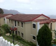
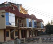
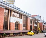
Hotels and Places to Stay
Hill Country Lovedale
Fortune Resort Sullivan Court
The Gateway Hotel Church Road
MGM HILL WORTH RESORTS
Tulips Elkhill Resort
Hotel Preethi Classic Towers
Sinclairs Ooty
Sherlock Hotel
Sagar Holiday Resort
Orchid Square A Boutique Hotel (23 Kms from Ooty)
Videos from this area
These are videos related to the place based on their proximity to this place.
A Magical Journey to Ooty on Nilgiri Mountain Railway
More Travel Videos of India click: http://www.indiavideo.org This video features the Aravankadu station near Ooty, Tamil Nadu state of India. This place is located at the Nilgiris district...
Token Exchange @ Wellington, Niligiri Mountain Railway.
No one to receive the token (0:11) at Wellington station on 05-Feb-2015 and train honking before receiving the token.
1338 COONOOR -OOTY TRAVEL VIEWS by www.travelviews.in, www.sabukeralam.blogspot.in
1338 COONOOR -OOTY TRAVEL VIEWS by www.travelviews.in, www.sabukeralam.blogspot.in.
Bridging a gap
The train from Ootacamund to Mettupalayam negotiates a new bridge near Aravankadu. The earth beneath the track was washed away by heavy rains on Nov. 9, 2009 necessitating the construction...
Acres Wild Organic Cheesemaking Farm, Coonoor, India
Acres Wild is a family-run farm 6000 ft high in the biosphere of Nilgiris Hills in Coonoor, India. Bisons, elephants, panther, wild boar and wild cat inhabit the area. The farm has cows, goats,...
Trip to Coonoor
Coonoor is a small town next Ooty. It is more peaceful and less commercialized than Ooty. In this trip we explored Lamb's Rock and Dolphin's Nose. On the way ...
Videos provided by Youtube are under the copyright of their owners.
Attractions and noteworthy things
Distances are based on the centre of the city/town and sightseeing location. This list contains brief abstracts about monuments, holiday activities, national parcs, museums, organisations and more from the area as well as interesting facts about the region itself. Where available, you'll find the corresponding homepage. Otherwise the related wikipedia article.
Coonoor
Coonoor is a Taluk and a municipality in the Nilgiris district in the state of Tamil Nadu, India. It is known for its production of Nilgiri tea. Coonoor is located at an altitude of 1,850 m above sea level, and is the second largest hill station in the Nilgiri hills after Ooty. It is an ideal base for a number of trekking expeditions leading into the Nilgiris. The Nearest airport is Coimbatore International Airport about 56 km from Coonoor town.
Nilgiri Mountain Railway
The Nilgiri Mountain Railway is a railway in Tamil Nadu, India, built by the British in 1908, and was initially operated by the Madras Railway. The railway still relies on its fleet of steam locomotives. NMR comes under the jurisdiction of the newly formed Salem Division. In July 2005, UNESCO added the Nilgiri Mountain Railway as an extension to the World Heritage Site of Darjeeling Himalayan Railway, the site then became known as "Mountain Railways of India.
Wellington, Tamil Nadu
Wellington is a town in The Nilgiris District in the Indian state of Tamil Nadu. Wellington is home to The Defence Services Staff College (DSSC), a premier tri-service training establishment that imparts training to middle level officers of the three wings of the Indian Armed Forces, friendly foreign countries and various Indian Civil Service departments. The Nilgiri Passenger train passes through Wellington, which has a railway station.
Nilgiri mountains
The Nilgiri, often referred to as the Nilgiri Hills, are a range of mountains with at least 24 peaks above 2,000 metres, in the westernmost part of Tamil Nadu state at the junction of Karnataka and Kerala states in Southern India. They are part of the larger Western Ghats mountain chain making up the southwestern edge of the Deccan Plateau.
Droog Fort, Coonoor
Droog Fort (also called Bakasura Malai) is a historic fort located 15 kilometres from Coonoor, The Nilgiris, Tamil Nadu. The fort was used as an outpost by Tipu Sultan in the 16th century. Today, the fort is in ruins, with only one wall remaining. The site attracts tourists, who reach the fort by hiking through the Nonsuch Tea Estate.


