Safety Score: 3,4 of 5.0 based on data from 9 authorites. Meaning please reconsider your need to travel to India.
Travel warnings are updated daily. Source: Travel Warning India. Last Update: 2024-08-13 08:21:03
Delve into Malabar Hill
The district Malabar Hill of in Mumbai (State of Mahārāshtra) is a subburb in India about 725 mi south of New Delhi, the country's capital town.
If you need a hotel, we compiled a list of available hotels close to the map centre further down the page.
While being here, you might want to pay a visit to some of the following locations: Silvassa, Nashik, Daman, Valsad and Ratnagiri. To further explore this place, just scroll down and browse the available info.
Local weather forecast
Todays Local Weather Conditions & Forecast: 28°C / 82 °F
| Morning Temperature | 25°C / 77 °F |
| Evening Temperature | 28°C / 82 °F |
| Night Temperature | 27°C / 81 °F |
| Chance of rainfall | 0% |
| Air Humidity | 43% |
| Air Pressure | 1013 hPa |
| Wind Speed | Moderate breeze with 11 km/h (7 mph) from South-East |
| Cloud Conditions | Few clouds, covering 18% of sky |
| General Conditions | Few clouds |
Friday, 22nd of November 2024
28°C (83 °F)
27°C (81 °F)
Broken clouds, moderate breeze.
Saturday, 23rd of November 2024
27°C (81 °F)
27°C (81 °F)
Broken clouds, gentle breeze.
Sunday, 24th of November 2024
28°C (82 °F)
27°C (81 °F)
Scattered clouds, moderate breeze.
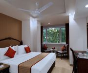
Hotels and Places to Stay
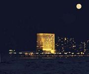
Nariman Point Trident
Mumbai The Oberoi
InterContinental Hotels MARINE DRIVE-MUMBAI
The Ambassador Marine Drive
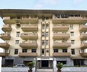
Hotel Al Madina
Chateau Windsor Hotel
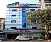
Hotel Fortune
Regency Hotel
Hotel Suba Palace
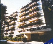
West End Hotel
Videos from this area
These are videos related to the place based on their proximity to this place.
Journey of Diamond From Mines to Market
know the value of a Diamond from the time it is mined, polished, traded, set in jewellery and sold in a store. interesting figures reveal that most of the markup adds after the polishing process....
travel india@ mumbai tourism chowpatty beach / marine drive /queen's necklace
mumbai's famous landmark marine drive & chowpatty beach...... for more india tours videos watch playlist........ http://www.youtube.com/playlist?list=PL4275462FDA84F85D chowpatty is the most...
The City of Mumbai - from another view (Poetical)
I created this video with the YouTube Video Editor (http://www.youtube.com/editor)
Mumbai's Marine Drive
Marine Drive — a perfect place to relax and to breathe in some fresh air amidst the bustling city of Mumbai. For more - http://www.indiavideo.org/maharashtra/travel/marine-drive-bombay-8452.php.
Enlightened Khotachi Wadi During Christmas Days - Girgaon Mumbai
A mesmerizing view not to miss during christmas at Khotachi wadi located at Girgaon (Nearest Station Marine Lines) in South Mumbai. The christmas decoration is at the best when you pass through...
World Cup Semi Final Celebration in Mumbai
Absolute mayhem on the streets of Mumbai after the Cricket World Cup 2011 semi-final win over Pakistan. Video filmed on the city's main downtown thoroughfare - Marine Drive. WARNING: It contains...
Air Show in Mumbai - (v1)
Air Show in Mumbai - (Video-1) Spectacular Aerobatic Air Show by the IAF-Suryakiran Team at Girgaum Chowpatty in Mumbai City on Sunday, 17-October-2004. Captured LIVE by Rajan N. Panchal....
Worli - Bandra Sea link drive - Day time and Night time
The latest tourist destination is Mumbai's 5.7km Sea link bridge. Heavy rush of visitors to get a feel driving on this unique sea bridge linking suburban Bandra to main Mumbai city. Will cut...
Police Gymkhana at Marine Line - Mumbai
A perfect afternoon short clip during breezy hour at Marine lines located Police Gymkhana, One of the oldest and iconic gymkhana in south Mumbai.
Videos provided by Youtube are under the copyright of their owners.
Attractions and noteworthy things
Distances are based on the centre of the city/town and sightseeing location. This list contains brief abstracts about monuments, holiday activities, national parcs, museums, organisations and more from the area as well as interesting facts about the region itself. Where available, you'll find the corresponding homepage. Otherwise the related wikipedia article.
Mahalaxmi (location)
Mahalaxmi is a neighbourhood within Mumbai. It is also the name of a railway station on the Mumbai suburban railway.
Grant Road railway station
Grant Road, named after Sir Robert Grant, the Governor of Bombay between 1835 and 1839, is currently a suburban railway station and former terminus of the erstwhile Bombay Baroda and Central India Railway. The terminus was established in 1859 to connect to Surat, over the years the terminus facilities were moved to Bombay Central and facilities at Grant road were converted to cargo operations.
Charni Road railway station
Charni Road is a railway station on the Western Line of the Mumbai Suburban Railway. The main significance of Charni Road station is that it is near the Girgaum Chowpatti beach and Marine Drive promenade, a major destination for tourists in Mumbai. It is also important because of the diamond trading industry located here, mainly in the Panchratna building near the railway station.
South Mumbai
South Mumbai, the southernmost precinct of the city of Mumbai, India, comprises the city's main business localities and its adjoining areas. It is the richest urban precinct in India. Geographically, South Mumbai lies at the southern corner of Salsette Island.
Raj Bhavan (Maharashtra)
Raj Bhavan (Hindi for Government House) is the official residence of the Governor of Maharashtra. It is located in the capital city of Mumbai, Maharashtra on Malabar Hill. The present governor of Maharashtra is Kateekal Sankaranarayanan. The Raj Bhavan is located in 50 acres of sylvan surroundings, surrounded on three sides by the sea. The estate has several heritage bungalows, trees, large lawns and a beach.
Mahalakshmi Temple, Mumbai
Mahalaxmi Temple is one of the most famous temples of Mumbai situated on Bhulabhai Desai Road. It is dedicated to Mahalakshmi the central deity of Devi Mahatmyam. The temple was built in 1831 by Dhakji Dadaji (1760–1846), a Hindu merchant.
Babulnath
Babulnath is an ancient Shiva temple in Mumbai, India. Situated on a small hillock near Girgaum Chowpatty, it is one of oldest temples in the city, Shiva in the form of the Lord of the Babul tree is the main deity in this temple. The faithful climb up to the temple and obtain Darshan of the shivling and obtain blessings of the Lord. It is also possible to take an elevator up to the temple. The temples is visited by lakhs of devotees on annual Mahashivratri festival.
Wilson College, Mumbai
The Wilson College, set up in 1832 in Mumbai, is one of India’s oldest colleges, with its foundation preceding that of the University of Mumbai by 25 years, to which it is presently affiliated. It was awarded an A rating by the National Assessment and Accreditation Council (NAAC) in 2005. Located opposite Mumbai’s iconic Girgaum Chowpatty, the college building was constructed in 1889 and designed by John Adams in the domestic Victorian Gothic style.
Mumbai Harbour
Mumbai Harbour, or Front Bay (sometimes referred as Bombay Harbour), is a natural deep-water harbor in the southern portion of the Ulhas River estuary. The narrower, northern part of the estuary is called Thane Creek. The harbor opens to the Arabian Sea to the south. The historical island of Elephanta is one of the six islands that lie in the harbor. Front Bay is the official name of the harbor, so named because the city started as a tiny settlement facing the harbor.
Banganga Tank
Banganga or Banganga Tankis an ancient water tank which is part of the Walkeshwar Temple Complex in Malabar Hill area of Mumbai in India.
Saifee Hospital
The Saifee Hospital is a hospital in the Charni Road region of Mumbai, India. It has 33 specialised departments, more than 400 doctors and 236 beds. In 1884, Sir Adamji Peerbhoy, a well known bohra philanthropist from Mumbai, India, originally built several properties (a burial ground, a Senatorium, and a Community Hospital) for the benefit of the poor and the needy. A trust was formed for undertaking the properties use for the benefit, service and well being of the Kaum (community).
Mumbai City district
Mumbai City District (मुंबई जिल्हा) is a district of Maharashtra in Konkan Division. As a city district, it has no headquarters or subdivisions. It, along with the Mumbai Suburban District make up the metropolis of Mumbai. The city area is called the "island city" or South Mumbai or Old Mumbai. It extends from Colaba in the south to Mahim and Sion in the north. Until the 1960s, the area was known as Mumbai. Today, Mumbai municipality includes both districts. The city's area covers 67.7 km².
Hurkisondas Hospital
Sir Hurkisondas Nurrotumdas Hospital specializing in cardiac treatments is located in Girgaum, Mumbai, India.
Mani Bhavan
Mani Bhavan, located at # 19, Laburnum Road in the Gamdevi precinct of downtown Mumbai, acted as the focal point of Gandhi's political activities in Mumbai between 1917 and 1934. The mansion belonged to Revashankar Jagjeevan Jhaveri and the Mani family prior to that, Gandhi's friend and host in Mumbai during this period.
Royal Bombay Yacht Club
The Royal Bombay Yacht Club (RBYC) was founded in 1846, in the Colaba neighbor of Mumbai in the state of Maharashtra. The club offers a bar, restaurant in addition to sailing facilities.
Chikitsak Samuha Shirolkar High School
Chikitsak Samuha Shirolkar High School is an educational institute, established in 1906, and located in Girgaon area of Mumbai, Maharashtra State in India. It has been a Marathi medium school since its inception, and has recently incorporated an English medium section. CSS High school has been especially well recognized as the Alma Mater of numerous top ranking students in Maharashtra State Secondary School (SSC) Board Examinations year after year.
Jaslok Hospital
Jaslok Hospital and Research Centre was founded in the early 1970s by philanthropist Seth Lokoomal Chanrai. Dr. Shantilal J. Mehta, the doyen of the medical profession in India, was the one who translated Seth Lokoomal Chanrai's vision into reality. Jaslok Hospital is located at Dr. G. Deshmukh Marg. , Peddar Road, South Mumbai, overlooking the Arabian Sea. The name Jaslok was derived from the names of Seth Lokoomal and his wife, Smt. Jasotibai.
Taraporewala Aquarium
Taraporewala Aquarium is the sole aquarium in the city of Mumbai, India. Built in 1951 at a cost of Rs 800,000, it hosts marine and freshwater fishes. The aquarium is located on the famous Marine Drive. The aquarium is named after a Parsee who donated Rs. 200,000 for the construction. There are 100 species of marine and fresh water fish including seven types of coral fish from the Lakshadweep Islands.
Mumbai Port Trust
Mumbai Port, earlier known as Bombay Port, lies midway (Latitude 18° 56.3' N, Longitude 72° 45.9' E) on the West coast of India, on the natural deep-water harbour of Mumbai. The harbour spread over 400 square kilometres is protected by the mainland of Konkan to its east and north and by the island city of Mumbai to its west. The harbour opens to the south to the Arabian Sea.
Cumbala Hill
Cumbala Hill (also spelled Cumballa) is a hill and upmarket neighbourhood in South Mumbai. The hill is at an elevation of 56 metres .
Altamount Road
Altamount Road or Altamont Road (more correctly) is an upmarket residential street in South Mumbai, parallel to Peddar Road which it meets at the well-known intersection called Kemp's Corner. On Altamont Road are the consulates of Indonesia and of South Africa; on the connecting Carmichael Road are the Belgian, Chinese, and Japanese consulates.
BD Somani International School
The BD Somani International School is an International Baccalaureate and IGCSE certified school in Mumbai, India. It is located in the Cuffe Parade area in South Mumbai. It was the first IB school setup in South Mumbai. It was opened in July, 2006 and runs the IGCSE board and the International Baccalaureate. The Principal of the school is Mr. Don Gardner.
2011 Mumbai bombings
The 2011 Mumbai bombings (often referred to as 13 July or 13/7) were a series of three coordinated bomb explosions at different locations in Mumbai, India, on 13 July 2011 between 18:54 and 19:06 IST. The blasts occurred at the Opera House, Zaveri Bazaar, and Dadar West localities, leaving 26 killed, and 130 injured.
Aryan E S High School
Aryan E S High School is an educational institute located in Girgaon, Mumbai, Maharashtra. The school is over 110 years old. It is a Marathi medium school. It has a semi-English division too. The of the school is "KARMANYE VADHIKARASTE". At Aryan High school, students are encouraged to participate in various extra-curricular activities. The school focuses on holistic development of students.
Hill Grange High School
Hill Grange High School was a private school for boys and girls located on Pedder Road, Mumbai, Maharashtra, India.


