Safety Score: 3,4 of 5.0 based on data from 9 authorites. Meaning please reconsider your need to travel to India.
Travel warnings are updated daily. Source: Travel Warning India. Last Update: 2024-08-13 08:21:03
Delve into Kūd
Kūd in Udhampur (State of Jammu and Kashmīr) with it's 1,242 habitants is located in India about 327 mi (or 527 km) north of New Delhi, the country's capital town.
Current time in Kūd is now 05:34 PM (Saturday). The local timezone is named Asia / Kolkata with an UTC offset of 5.5 hours. We know of 9 airports close to Kūd, of which two are larger airports. The closest airport in India is Jammu Airport in a distance of 37 mi (or 60 km), South-West. Besides the airports, there are other travel options available (check left side).
There are two Unesco world heritage sites nearby. The closest heritage site is Rohtas Fort in Pakistan at a distance of 99 mi (or 159 km). If you need a hotel, we compiled a list of available hotels close to the map centre further down the page.
While being here, you might want to pay a visit to some of the following locations: Sialkot, Narowal, Srinagar, Gujrat and Gujranwala. To further explore this place, just scroll down and browse the available info.
Local weather forecast
Todays Local Weather Conditions & Forecast: 24°C / 76 °F
| Morning Temperature | 14°C / 57 °F |
| Evening Temperature | 20°C / 68 °F |
| Night Temperature | 17°C / 62 °F |
| Chance of rainfall | 0% |
| Air Humidity | 19% |
| Air Pressure | 1016 hPa |
| Wind Speed | Light breeze with 5 km/h (3 mph) from East |
| Cloud Conditions | Clear sky, covering 8% of sky |
| General Conditions | Sky is clear |
Sunday, 24th of November 2024
25°C (77 °F)
16°C (61 °F)
Light rain, gentle breeze, clear sky.
Monday, 25th of November 2024
24°C (74 °F)
16°C (60 °F)
Sky is clear, light breeze, clear sky.
Tuesday, 26th of November 2024
23°C (73 °F)
15°C (59 °F)
Sky is clear, light breeze, clear sky.
Hotels and Places to Stay
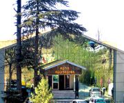
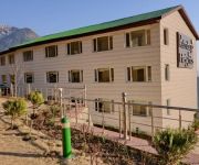
Hotel Samson
Hotel Forest View
Hotel Holiday Inn
Maharaja Resorts
Greentop
Hotel Patnitop Heights
Videos from this area
These are videos related to the place based on their proximity to this place.
Inde 2010 : Jammu - Patnitop - Trafic sur la NH1A
Trafic sur la National Hightway 1A, entre Jammu et Patnitop, dans l'État indien du Jammu & Kashmir.
Patnitop,a beautiful Hill Station, J&K, India
A scenic and beautiful hill station of J&K, has almost same height as of Srinagar. This is also very near to Jammu in way to Srinagar. Tourist must take a break journey here to enjoy the snow...
Heavy Snowfall in kashmir patnitop nathatop 2018
snowfall in jammu kashmir nathatop patnitop vaishno devi 2018.
Nashri tunnel, ...Asia's largest tunnel in J&K
My own experience to travel in this tunnel Under CCTV ,Under well health facility provided by the govt in this tunnel, 9.. Emergency exit tunnel are in this tunnel.
Chenani-Nashri Tunnel ll India's longest road Tunnel ll by MG vlogs 27
Chenani-Nashri Tunnel, also known as Patnitop Tunnel, is a road tunnel in state of Jammu and Kashmir on NH 44. It is India's longest road tunnel with a length ...
Videos provided by Youtube are under the copyright of their owners.
Attractions and noteworthy things
Distances are based on the centre of the city/town and sightseeing location. This list contains brief abstracts about monuments, holiday activities, national parcs, museums, organisations and more from the area as well as interesting facts about the region itself. Where available, you'll find the corresponding homepage. Otherwise the related wikipedia article.
Batote
Batote is a town and a notified area committee in Doda District in the state of Jammu & Kashmir, under Indian Occupation.
Chenani
Chenani is a small town and a notified area committee in Udhampur district of Indian state of Jammu & Kashmir. India's longest road tunnel, the 9.2 km long Chenani-Nashri Tunnel or Patnitop Tunnel is being constructed about 2 km from Chenani town to reduce the distance from Jammu to Srinagar and reduce traffic jams on NH-1A that occur due to snowfall and avalanche in winter at Patnitop.
Kud
Kud is a town and a notified area committee in Udhampur District in the Indian state of Jammu and Kashmir.


