Safety Score: 3,4 of 5.0 based on data from 9 authorites. Meaning please reconsider your need to travel to India.
Travel warnings are updated daily. Source: Travel Warning India. Last Update: 2024-08-13 08:21:03
Discover Mauna
Mauna in Sāran (State of Bihār) is a place in India about 503 mi (or 809 km) east of New Delhi, the country's capital city.
Current time in Mauna is now 04:41 PM (Saturday). The local timezone is named Asia / Kolkata with an UTC offset of 5.5 hours. We know of 8 airports near Mauna. The closest airport in India is Lok Nayak Jayaprakash Airport in a distance of 25 mi (or 40 km), South-East. Besides the airports, there are other travel options available (check left side).
There are several Unesco world heritage sites nearby. The closest heritage site in India is Mahabodhi Temple Complex at Bodh Gaya in a distance of 77 mi (or 124 km), South. If you need a hotel, we compiled a list of available hotels close to the map centre further down the page.
While being here, you might want to pay a visit to some of the following locations: Patna, Kathmandu, Bhaktapur, Ramechhap and Nagarkot. To further explore this place, just scroll down and browse the available info.
Local weather forecast
Todays Local Weather Conditions & Forecast: 24°C / 76 °F
| Morning Temperature | 16°C / 60 °F |
| Evening Temperature | 25°C / 76 °F |
| Night Temperature | 19°C / 66 °F |
| Chance of rainfall | 0% |
| Air Humidity | 25% |
| Air Pressure | 1017 hPa |
| Wind Speed | Light breeze with 4 km/h (3 mph) from East |
| Cloud Conditions | Clear sky, covering 0% of sky |
| General Conditions | Sky is clear |
Sunday, 24th of November 2024
25°C (78 °F)
19°C (67 °F)
Sky is clear, light breeze, clear sky.
Monday, 25th of November 2024
26°C (78 °F)
20°C (67 °F)
Few clouds, light breeze.
Tuesday, 26th of November 2024
27°C (81 °F)
20°C (68 °F)
Overcast clouds, light breeze.
Hotels and Places to Stay
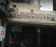
Hotel Ramdoot
TAHITI RESORT
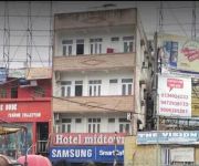
Hotel Midtown
Raj Kumar Hotel
Videos from this area
These are videos related to the place based on their proximity to this place.
Horror Animated Clip By Kaushlesh Garg
This is a short clip. I animated this clip for fun because I am a student.
wheat harvesting 004
Harvesting of wheat by power tiller at chapra , agriculture activity by ashish kumar , bihar , india.
Bihar Sampark Kranti Superfast Express (Up) Meets Vaishali Superfast Express (Down) At Chhapra Kache
15054 Lucknow Chapra arriving Chapra station
The Suhaildev Superfast Express is a Superfast train belonging to Northern Railway zone that runs between Ghazipur City and Anand Vihar Terminal in India.
बिहार के सैकड़ों बेरोजगार छात्र युवा दर्दे की ठोकर खा रहे हैं
भारत मे बेरोजगारी एक जटिल समस्या है जिसके सैकड़ों छात्र बेरोजगार है भारत...
Videos provided by Youtube are under the copyright of their owners.
Attractions and noteworthy things
Distances are based on the centre of the city/town and sightseeing location. This list contains brief abstracts about monuments, holiday activities, national parcs, museums, organisations and more from the area as well as interesting facts about the region itself. Where available, you'll find the corresponding homepage. Otherwise the related wikipedia article.
Chhapra
Chhapra is a city and headquarters of the Saran district in the Indian state of Bihar. Also known as Chapra, it is situated near the junction of the Ghaghara River and the Ganges River. Chhapra grew in importance as a river mart in the 18th century when the Dutch, French, Portuguese, and English established saltpeter refineries there. It was recognized as a municipality in 1864. The town has major rail and road connections with the rest of India.
Saran division
Saran division is an administrative geographical unit of Bihar state of India. Chhapra is the administrative headquarters of the division. Currently (2005), the division consists of Saran District, also called Chhapra District, Siwan District, Gopalganj District. Hathwa Raj was a zamindari in the Saran Division of Bihar belonging to Bhumihar Brahmins which encompassed 1,365 villages, was inhabited by more than 391,000 people, and produced an annual rental of almost a million rupees.


