Safety Score: 3,4 of 5.0 based on data from 9 authorites. Meaning please reconsider your need to travel to India.
Travel warnings are updated daily. Source: Travel Warning India. Last Update: 2024-08-13 08:21:03
Explore Nombikodu
Nombikodu in Kerala is a city in India about 1,236 mi (or 1,988 km) south of New Delhi, the country's capital.
Local time in Nombikodu is now 05:17 AM (Wednesday). The local timezone is named Asia / Kolkata with an UTC offset of 5.5 hours. We know of 9 airports in the vicinity of Nombikodu, of which 4 are larger airports. The closest airport in India is Coimbatore International Airport in a distance of 27 mi (or 43 km), North-East. Besides the airports, there are other travel options available (check left side).
There is one Unesco world heritage site nearby. It's Mountain Railways of India in a distance of 53 mi (or 86 km), North. If you need a place to sleep, we compiled a list of available hotels close to the map centre further down the page.
Depending on your travel schedule, you might want to pay a visit to some of the following locations: Trichur, Kozhikode, Kollam, Thiruvananthapuram and Bengaluru. To further explore this place, just scroll down and browse the available info.
Local weather forecast
Todays Local Weather Conditions & Forecast: 28°C / 83 °F
| Morning Temperature | 23°C / 73 °F |
| Evening Temperature | 24°C / 75 °F |
| Night Temperature | 23°C / 74 °F |
| Chance of rainfall | 2% |
| Air Humidity | 61% |
| Air Pressure | 1010 hPa |
| Wind Speed | Gentle Breeze with 8 km/h (5 mph) from West |
| Cloud Conditions | Overcast clouds, covering 100% of sky |
| General Conditions | Light rain |
Wednesday, 27th of November 2024
25°C (77 °F)
23°C (73 °F)
Light rain, gentle breeze, overcast clouds.
Thursday, 28th of November 2024
29°C (84 °F)
22°C (72 °F)
Overcast clouds, light breeze.
Friday, 29th of November 2024
30°C (87 °F)
22°C (72 °F)
Scattered clouds, light breeze.
Hotels and Places to Stay
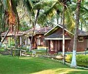
Kairali The Ayurvedic Healing Village
Kairali - The Ayurvedic Healing Village
Videos from this area
These are videos related to the place based on their proximity to this place.
PIR Motion Sensor Detector circuit (How to make PIR motion detector)
This video demonstrates PIR motion detector with a pir circuitry. This circuit is a home made. The circuit uses p i r sensor which detects motion and amplifies the signal. relay is switched...
My Village My World- Part 4
This time we are going through - Tattamangalam Thumbichira,Mannathukavu,Sree Kurumbakavu, Parakkat Lane, Neelikkad, Mettupalayam,Chittur Puzha Bridge,Chittur College,Chittur ...
My Village - My world
On the way to my office from Home @ Tattamangalam Palakkad dotcompals Videography: Prashanth.
Rain and heavy winds @ Chittur
tried to show the live streaming of the rain and wind, but failed...so a deferred live of the rain(rare here)
Videos provided by Youtube are under the copyright of their owners.
Attractions and noteworthy things
Distances are based on the centre of the city/town and sightseeing location. This list contains brief abstracts about monuments, holiday activities, national parcs, museums, organisations and more from the area as well as interesting facts about the region itself. Where available, you'll find the corresponding homepage. Otherwise the related wikipedia article.
Walayar River
Walayar River is one of the tributaries of the river Kalpathipuzha. Kalpathipuzha is one of the main tributaries of the Bharathapuzha River, the second-longest river in Kerala, south India. Walayar Dam is constructed across this river. It was completed and opened in 1964. It has got a beautiful garden equipped with children play area, but currently due to the lack of forest officers and some officials, the condition of the park and dam is pathetic.


