Safety Score: 3,4 of 5.0 based on data from 9 authorites. Meaning please reconsider your need to travel to India.
Travel warnings are updated daily. Source: Travel Warning India. Last Update: 2024-08-13 08:21:03
Explore Koyāl
Koyāl in Solan (Himachal Pradesh) is located in India about 160 mi (or 258 km) north of New Delhi, the country's capital.
Local time in Koyāl is now 02:51 PM (Saturday). The local timezone is named Asia / Kolkata with an UTC offset of 5.5 hours. We know of 9 airports in the wider vicinity of Koyāl, of which two are larger airports. The closest airport in India is Shimla Airport in a distance of 9 mi (or 14 km), North. Besides the airports, there are other travel options available (check left side).
There is one Unesco world heritage site nearby. It's Great Himalayan National Park Conservation Area in a distance of 67 mi (or 108 km), North-East. If you need a place to sleep, we compiled a list of available hotels close to the map centre further down the page.
Depending on your travel schedule, you might want to pay a visit to some of the following locations: Shimla, Panchkula, Chandigarh, Dehra Dun and Diyag. To further explore this place, just scroll down and browse the available info.
Local weather forecast
Todays Local Weather Conditions & Forecast: 14°C / 58 °F
| Morning Temperature | 5°C / 41 °F |
| Evening Temperature | 9°C / 47 °F |
| Night Temperature | 6°C / 42 °F |
| Chance of rainfall | 0% |
| Air Humidity | 28% |
| Air Pressure | 1017 hPa |
| Wind Speed | Light breeze with 5 km/h (3 mph) from South-West |
| Cloud Conditions | Overcast clouds, covering 100% of sky |
| General Conditions | Overcast clouds |
Sunday, 24th of November 2024
15°C (59 °F)
6°C (42 °F)
Sky is clear, light breeze, clear sky.
Monday, 25th of November 2024
15°C (58 °F)
5°C (41 °F)
Sky is clear, light breeze, clear sky.
Tuesday, 26th of November 2024
14°C (58 °F)
5°C (41 °F)
Sky is clear, light breeze, clear sky.
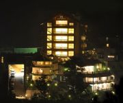
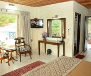
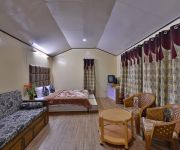
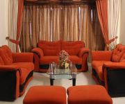
Hotels and Places to Stay
Resort Eutopia
Baba Resorts
Zurich Resorts
Club Mahindra Kandaghat
Oakwood Hamlet
Maple Resort
Raikot Resort Shoghi Shimla
Neovedic Resort
Barog Barog Heights
Fernhill Resort Chail
Videos from this area
These are videos related to the place based on their proximity to this place.
Natti performed Silb,solan Part-1
Natti (Himachali Folk Dance) performed by students of silb at prize distribution function Part 2- http://youtu.be/ZpBd6xGAPy8 choreographed by Rudr.
476 KALKA SHIMLA TRAVEL VIEWS by www.travelviews.in, www.sabukeralam.blogspot.in
476 KALKA SHIMLA TRAVEL VIEWS by www.travelviews.in, www.sabukeralam.blogspot.in.
New Metal riffs (must see)
Red ink inc. is an instrumental metal band from the region of himalayas in india.We are adding some kicksass metal riffs created by the lead guitarist of red ink inc.
Inde 2010 : Chandigarh - Shimla 4
Vidéo filmée depuis le car lors du trajet entre Chandigarh et Shimla.
Unboxing Xiaomi Redmi 1S (Flipkart-Indian Version)
We apologize for the poor audio and video quality as this is our first video. Here we unbox the Redmi 1S and take a quick look. The Redmi 1S is powered by the Snapdragon 400 Quad that houses...
Deepak Ranta !! Bobby !!
Deepak Ranta from Shimla (chaupal) college of digital marketing India shimla.
yoga anuj sharma 1
yoga [rear] by anuj sharma ,Kandaghat , distt. Solan (H. P) INDIA , mobile no. +919882171008.
mercury[budh] planet - rajeev shur .wmv-+919882191008
jyotishacharya pt.rajeev shrma "shur" ,kandaghat,distt.solan [H.P.] India....budh grah [mercury planet] ke sinh rashi me pravesh ka result...m.no...+919418063108...
Videos provided by Youtube are under the copyright of their owners.
Attractions and noteworthy things
Distances are based on the centre of the city/town and sightseeing location. This list contains brief abstracts about monuments, holiday activities, national parcs, museums, organisations and more from the area as well as interesting facts about the region itself. Where available, you'll find the corresponding homepage. Otherwise the related wikipedia article.
Solan
Solan is a city and a Municipal Corporation in Solan district (created on 1 September 1972) in the Indian state of Himachal Pradesh. It is located 50 kilometres south of the state capital Shimla. The place is named after the Hindu goddess Shoolini devi. Every year in the month of June, a fair celebrating the goddess is held, featuring a 3-day mela at the central Thoudo grounds. Solan was the capital of the erstwhile princely state, Bhagat.
Kandaghat
Kandaghat is a small town on the Kalka-Shimla National Highway No. 22 in the Solan District of Himachal Pradesh. Kandaghat is located at Latitude : 30.983 Longitude : 77.117. It can be located at http://www. tageo. com/index-e-in-v-11-d-m2914800. htm?Kandaghat. Situated at a height of 1425 metres Kandaghat enjoys moderate climate. The road to the famous tourist destination of Chail turns from Kandaghat which is at a distance of 29 km.







!['mercury[budh] planet - rajeev shur .wmv-+919882191008' preview picture of video 'mercury[budh] planet - rajeev shur .wmv-+919882191008'](https://img.youtube.com/vi/O5c--aw1i8M/mqdefault.jpg)