Safety Score: 3,4 of 5.0 based on data from 9 authorites. Meaning please reconsider your need to travel to India.
Travel warnings are updated daily. Source: Travel Warning India. Last Update: 2024-08-13 08:21:03
Explore Bambawāla Pīr
Bambawāla Pīr in Ambāla (Haryana) is located in India about 116 mi (or 187 km) north of New Delhi, the country's capital.
Local time in Bambawāla Pīr is now 04:50 PM (Saturday). The local timezone is named Asia / Kolkata with an UTC offset of 5.5 hours. We know of 9 airports in the wider vicinity of Bambawāla Pīr, of which two are larger airports. The closest airport in India is Chandigarh Airport in a distance of 27 mi (or 44 km), North. Besides the airports, there are other travel options available (check left side).
There are several Unesco world heritage sites nearby. The closest heritage site in India is Great Himalayan National Park Conservation Area in a distance of 114 mi (or 184 km), North. If you need a place to sleep, we compiled a list of available hotels close to the map centre further down the page.
Depending on your travel schedule, you might want to pay a visit to some of the following locations: Panchkula, Chandigarh, Shimla, Dehra Dun and Delhi. To further explore this place, just scroll down and browse the available info.
Local weather forecast
Todays Local Weather Conditions & Forecast: 24°C / 74 °F
| Morning Temperature | 14°C / 57 °F |
| Evening Temperature | 21°C / 70 °F |
| Night Temperature | 17°C / 62 °F |
| Chance of rainfall | 0% |
| Air Humidity | 25% |
| Air Pressure | 1016 hPa |
| Wind Speed | Light breeze with 4 km/h (2 mph) from West |
| Cloud Conditions | Overcast clouds, covering 100% of sky |
| General Conditions | Overcast clouds |
Sunday, 24th of November 2024
26°C (79 °F)
18°C (64 °F)
Sky is clear, moderate breeze, clear sky.
Monday, 25th of November 2024
26°C (79 °F)
16°C (62 °F)
Sky is clear, moderate breeze, clear sky.
Tuesday, 26th of November 2024
24°C (75 °F)
16°C (61 °F)
Sky is clear, gentle breeze, clear sky.
Hotels and Places to Stay
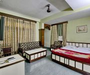
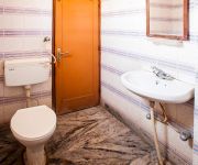
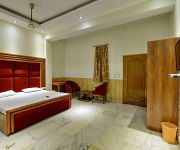
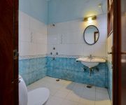
Hotel Grace
Hotel Swagat
Ashoka Regency
Hotel Deep Palace
Hotel D.R. International
Videos from this area
These are videos related to the place based on their proximity to this place.
Nishat Bagh - Second Largest Mughal Garden in Srinagar, Kashmir, India Video
Nishat Bagh, Srinagar, Kashmir, India: Nishat Bagh is a terraced Mughal garden built on the eastern side of the Dal Lake, close to Srinagar in the state of Jammu and Kashmir, India. It is the...
Speeding on the Highway (Timelapse on NH1, India)
This video has been made using Time Lapse photography. I used about 700 pics shot from my Nikon D60 for this. The pictures were shot on NH1, India, between Delhi & Chandigarh. I was driving...
22355 PPTA CDG SF EXPRESS REACHING AMBALA CANTT IN EVENING
Ppta CHD sf express reaching ambala cantt junction.
HOW TO GET CANADA TOURIST/VISITOR VISA(CANADA 10 YEARS MULTIPLE VISA) GUIDANCE BY VISA EXPERT
Secrets to a successful visitor visa application. A lot of people who are applying for a Canadian visitor visa are nervous whether or not they will succeed.
How to apply canada tourist visa
Hello friends this video is very important to those people who are interested in applying Canadian tourist visa by their self and I hope I have given satisfied ...
LIVE FROM AMBALA CANTT(UMB), Coupling of 22926 to 12926 Paschim exp
A Live coupling of 12926 Amritsar Bandra Paschim express & 22926 Kalka Bandra Slip Exp at Ambala Station.
Videos provided by Youtube are under the copyright of their owners.
Attractions and noteworthy things
Distances are based on the centre of the city/town and sightseeing location. This list contains brief abstracts about monuments, holiday activities, national parcs, museums, organisations and more from the area as well as interesting facts about the region itself. Where available, you'll find the corresponding homepage. Otherwise the related wikipedia article.
Patiala Airport
Patiala Airport (Patiala Aviation Complex) is a civil aerodrome serving Patiala, Punjab in India. It was built by Maharajadhiraj Bhupinder Singh of Patiala in the first decade of the twentieth century as a place to operate his aircraft. After Independence it was taken over by the Government of India and turned into a civil aerodrome. There are in total five hangars in Patiala Aviation Complex. The First Hangar is used by Patiala Aviation Club (P.A.C.


