Safety Score: 3,4 of 5.0 based on data from 9 authorites. Meaning please reconsider your need to travel to India.
Travel warnings are updated daily. Source: Travel Warning India. Last Update: 2024-08-13 08:21:03
Delve into Adabari
Adabari in Kāmrūp (Assam) is located in India about 902 mi (or 1,452 km) east of New Delhi, the country's capital town.
Current time in Adabari is now 03:03 PM (Sunday). The local timezone is named Asia / Kolkata with an UTC offset of 5.5 hours. We know of 8 airports close to Adabari. The closest airport in India is Lokpriya Gopinath Bordoloi International Airport in a distance of 7 mi (or 11 km), South-West. Besides the airports, there are other travel options available (check left side).
There is one Unesco world heritage site nearby. It's Manas Wildlife Sanctuary in a distance of 56 mi (or 90 km), North-West. If you need a hotel, we compiled a list of available hotels close to the map centre further down the page.
While being here, you might want to pay a visit to some of the following locations: Dispur, Mushalpur, Shillong, Samdrup Jongkhar and Morigaon. To further explore this place, just scroll down and browse the available info.
Local weather forecast
Todays Local Weather Conditions & Forecast: 27°C / 81 °F
| Morning Temperature | 20°C / 69 °F |
| Evening Temperature | 24°C / 75 °F |
| Night Temperature | 21°C / 70 °F |
| Chance of rainfall | 0% |
| Air Humidity | 63% |
| Air Pressure | 1013 hPa |
| Wind Speed | Light breeze with 5 km/h (3 mph) from South-West |
| Cloud Conditions | Few clouds, covering 14% of sky |
| General Conditions | Few clouds |
Monday, 18th of November 2024
27°C (80 °F)
20°C (68 °F)
Sky is clear, light breeze, clear sky.
Tuesday, 19th of November 2024
27°C (80 °F)
20°C (68 °F)
Sky is clear, gentle breeze, clear sky.
Wednesday, 20th of November 2024
28°C (82 °F)
19°C (67 °F)
Sky is clear, light breeze, clear sky.
Hotels and Places to Stay
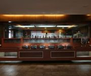
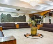
Radisson Blu Hotel Guwahati
Dynasty
Hotel Prag Continental
Hotel Brahmaputra Residency
The Contour Hotel
Hotel Bhargav Grand
Hotel Rialto
Hotel Horn Bill
Hotel Brahmaputra Ashok
Hotel Ambarish Grand Residency
Videos from this area
These are videos related to the place based on their proximity to this place.
Association Rule Mining in Hadoop.webm
Demo For Project QFP By Team Skies for the CS568 DataMining course in IITG Project is done in hadoop framework and association rule mining algorithm is implemented.
[IIT Guwahati] [Data Mining] Project Eagle Eye
Real Time Threat Detection and Classification from Documents or Queries. Made as part of Data Mining Term Project @ Department of CSE, Indian Institute of Technology Guwahati, India. Trivia:...
Bhog Aarati, Guru Purnima 2012
Swami Keshavanandaji performing Bhog aarati at the IVS Headquarters at Amingaon, Guwahati.
A trip to Kameng Hostel! @ IIT Guwahati
This was a fun little trip from our dibang hostel to kameng hostel. We had a lot of fun with the B.Tech friends, they are not just dynamic in the academics, but also ...
Videos provided by Youtube are under the copyright of their owners.
Attractions and noteworthy things
Distances are based on the centre of the city/town and sightseeing location. This list contains brief abstracts about monuments, holiday activities, national parcs, museums, organisations and more from the area as well as interesting facts about the region itself. Where available, you'll find the corresponding homepage. Otherwise the related wikipedia article.
Indian Institute of Technology Guwahati
Indian Institute of Technology Guwahati (IIT Guwahati, IITG) is an autonomous engineering and technology-oriented institute of higher education established by the Government of India, located in Guwahati, in the state of Assam in India. It is the sixth Indian Institute of Technology established in India. IITG is officially recognised as an Institute of National Importance by the government of India.
Dipor Bil
Dipor Bil, also spelt Deepor Beel (Bil or Beel means "lake" in the local Assamese language), is located to the south-west of Guwahati city, in Kamrup district of Assam, India It is a permanent freshwater lake, in a former channel of the Brahmaputra River, to the south of the main river.
Assam Engineering College
Assam Engineering College established in 1955 is located in the Jalukbari area of Guwahati city. It is the premier technical institute of North East India. It is the first undergraduate engineering college in northeastern India and today is a premier technical institute of the entire country. AEC has been the hub of many academic and supplementary activities in Assam for almost half a century. The college is approved by the All India Council for Technical Education AICTE.
Amingaon
Amingaon is a town in Kamrup district of Assam, India
Faculty Higher Secondary School, Amingaon
Faculty Higher Secondary School is a private school in Guwahati, Assam, India part of Osom Educational Trust. Around the school is a park area, including a large field and pond. When the school opened in 1980, it was designed for less than 1000 people, but now there are around 3000 students.
Kamakhya, Guwahati
Kamakhya is a Locality in Guwahati which is 20 km from the Guwahati Airport and about 6 km from Guwahati Railway Station, it also have own railway junction. Locality is known for presence of ancient Kamakhya Temple in Nilachal pahar or hill. Ambubachi Mela helds here annually which attracts pilgrimage from other parts of country as well as from aboard. In February 2012, area come in limelight due to discovery of rock cut caves built during the reign of Kamarupa king Mahendra Varman.
Pandu, Guwahati
Pandu is a Locality in Guwahati with nearest airport at Guwahati Airport and railway station at Paltan Bazaar. It is named after Pandunath Temple located in Tilla hills part of locality. It is situated north of Maligaon locality and have Brahmaputra river to north. Due to its location on shores of Brahmaputra river, it is major hub of river transport facilities with a port managed by port authority of India.
NETES Institute of Technology and Science Mirza
NETES Institute of Technology & Science Mirza (abbreviated as NITS Mirza) is a private engineering college which started in 2009 and is located in Mirza, 6 km from Lokapriya Gopinath Bordoloi International Airport, Guwahati, Assam, India. The college is approved by the All India Council for Technical Education.


!['[IIT Guwahati] [Data Mining] Project Eagle Eye' preview picture of video '[IIT Guwahati] [Data Mining] Project Eagle Eye'](https://img.youtube.com/vi/Kl0k8XYsEdg/mqdefault.jpg)


