Safety Score: 2,8 of 5.0 based on data from 9 authorites. Meaning we advice caution when travelling to Hungary.
Travel warnings are updated daily. Source: Travel Warning Hungary. Last Update: 2024-08-13 08:21:03
Delve into Nyakasháza
The district Nyakasháza of Zalaszombatfa in Zala megye is a subburb in Hungary about 135 mi south-west of Budapest, the country's capital town.
If you need a hotel, we compiled a list of available hotels close to the map centre further down the page.
While being here, you might want to pay a visit to some of the following locations: Kobilje, Lendava, Lenti, Dobrovnik and Velika Polana. To further explore this place, just scroll down and browse the available info.
Local weather forecast
Todays Local Weather Conditions & Forecast: 6°C / 43 °F
| Morning Temperature | 0°C / 32 °F |
| Evening Temperature | 6°C / 42 °F |
| Night Temperature | 3°C / 38 °F |
| Chance of rainfall | 0% |
| Air Humidity | 57% |
| Air Pressure | 1027 hPa |
| Wind Speed | Light breeze with 3 km/h (2 mph) from South-East |
| Cloud Conditions | Overcast clouds, covering 99% of sky |
| General Conditions | Overcast clouds |
Saturday, 16th of November 2024
8°C (46 °F)
3°C (37 °F)
Sky is clear, gentle breeze, clear sky.
Sunday, 17th of November 2024
7°C (44 °F)
3°C (38 °F)
Broken clouds, light breeze.
Monday, 18th of November 2024
6°C (43 °F)
7°C (44 °F)
Overcast clouds, light breeze.
Hotels and Places to Stay
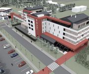
Thermal Hotel Balance Lenti
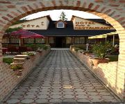
Hotel Zéta
Gosztola Gyöngye Spa és Élményhotel
Videos from this area
These are videos related to the place based on their proximity to this place.
Concerto del Coro partigiano triestino Pinko Tomažič a Lendava
TPPZ Pinko Tomažič: koncert v Lendavi (18.10.2014)
Grozljivo neurejeno bivališče romske družine v občinski stavbi v Lendavi, Slovenija
This is a blatant truth of living conditions of Romany family in town of Lendava, Slovenia. The house is governed by municipality of Lendava. The "apartment" inside of the house was allocated...
Karinthy Frigyes - Lógok a szeren - Pál Péter előadása - Hosszúfalu (Dolga vas) 2014
Karinthy Frigyes - Lógok a szeren - Pál Péter előadása - Hosszúfalu (Dolga vas) 2014.
Bella István - Halotti beszéd - Pál Péter előadása - Hosszúfalu (Dolga vas) 2014
Bella István - Halotti beszéd - Pál Péter előadása - Hosszúfalu (Dolga vas) 2014.
Lendva - a magyarság szellemi végvára
Beszélgetés Horváth Ferenccel, a Muravidéki Magyar Önkormányzati Nemzeti Közösség elnökével, Lendva város alpolgármesterével, a budapesti Polgárok Háza "Lendvai varázs" c....
Videos provided by Youtube are under the copyright of their owners.
Attractions and noteworthy things
Distances are based on the centre of the city/town and sightseeing location. This list contains brief abstracts about monuments, holiday activities, national parcs, museums, organisations and more from the area as well as interesting facts about the region itself. Where available, you'll find the corresponding homepage. Otherwise the related wikipedia article.
Mursko Središće
Mursko Središće is the northernmost city in Croatia, located at {{#invoke:Coordinates|coord}}{{#coordinates:46.509|N|16.441|E||||| | |name= }} and one of the oldest localities in Međimurje County. Mursko Središće is a city with a total population of 6,334 (2011), and an area of 34 km . It lies on the river Mura, the natural line dividing Croatia from Slovenia. Nearby places are Čakovec, Sveti Martin na Muri, Lendava, and Podturen.
Extreme points of Croatia
The geographical extreme points of Croatia are Northernmost point: Žabnik, municipality of Sveti Martin na Muri (administratively in the Međimurje County) - {{#invoke:Coordinates|coord}}{{#coordinates:46|33|N|16|22|E|region:HR_type:landmark|| | |name=Žabnik (Northernmost point) }} Southernmost point: Islet Galijula, an islet in Palagruža archipelago in the Adriatic Sea (administratively belongs to the city of Komiža on the Isle of Vis, Split-Dalmatia County) - {{#invoke:Coordinates|coord}}{{#coordinates:42|23|N|16|21|E|region:HR_type:isle|| | |name=Galijula (Southernmost point) }} On the mainland: Rt Oštra at the Prevlaka peninsula - {{#invoke:Coordinates|coord}}{{#coordinates:42|24|N|18|32|E|region:HR_type:landmark|| | |name=Rt Oštra (Southernmost point on the mainland) }} Easternmost point: Rađevac, a part of Ilok (administratively part of the city of Ilok, Vukovar-Srijem County) - {{#invoke:Coordinates|coord}}{{#coordinates:45|12|N|19|27|E|region:HR_type:landmark|| | |name=Rađevac (Easternmost point) }} Westernmost point: Cape Lako (rt Lako), Bašanija (administratively part of the city of Umag, Istria County) - {{#invoke:Coordinates|coord}}{{#coordinates:45|29|N|13|30|E|region:HR_type:landmark|| | |name=Cape Lako (Westernmost point) }}
Lendava Sports Park
Lendava Sports Park (Slovene: Športni park Lendava) is a multi-use stadium in Lendava, Slovenia. It is currently used mostly for football matches and was the home ground of NK Nafta. The stadium was rebuilt in 2006 and has a capacity of 2,020 seats. Before it was known as Lendava City Stadium. Recently the stadium is used as one of the main venues in Slovenia for hosting youth tournaments for U19 and U17 national teams.
Sveti Martin na Muri
Sveti Martin na Muri is a municipality in Međimurje County, Croatia. There are 2,509 inhabitants, most of whom are Croats (2001 census).
Peklenica
Peklenica is a village in Međimurje County, Croatia. As of the 2001 census, there were 1347 inhabitants. The absolute majority of the population are Croats.
Gosztola
Gosztola is a village in Zala county, Hungary.
Lendvadedes
Lendvadedes is a village in Zala county, Hungary.
Kobilje Creek
Kobilje Creek (Hungarian: Kebele, Slovene: Kobiljski potok or Kobiljanski potok) is a brook in northeastern Slovenia and western Hungary. The brook is 33 kilometres long; 24 km of the course is in Slovenia. Its source is at Kamenek Hill and it flows through Kobilje, crosses the Slovenian–Hungarian border, returns to Slovenia, and joins the Ledava from its left side. It is the longest tributary of the Ledava.
Kerkáskápolna
Kerkáskápolna is a village in Vas county, Hungary.
Velemér
Velemér, is a village in Vas county, Hungary.
Alsószenterzsébet
Alsószenterzsébet is a village in Zala county, Hungary.
Belsősárd
Belsősárd is a village in Zala county, Hungary.
Bödeháza
Bödeháza is a village in Zala county, Hungary.
Felsőszenterzsébet
Felsőszenterzsébet is a village in Zala county, Hungary.
Gáborjánháza
Gáborjánháza is a village in Zala county, Hungary.
Kálócfa
Kálócfa is a village in Zala county, Hungary.
Kerkabarabás
Kerkabarabás is a village in Zala county, Hungary.
Kerkateskánd
Kerkateskánd is a village in Zala county, Hungary.
Külsősárd
Külsősárd is a village in Zala county, Hungary.
Magyarföld
Magyarföld is a village in Zala county, Hungary.
Lovászi
Lovászi is a village in Zala county, Hungary.
Márokföld
Márokföld is a village in Zala county, Hungary.
Rédics
Rédics is a village in Zala county, Hungary. Recently a video posted on YouTube of Reverend Zoltan Lendvai skateboarding clad in full clerical garb has made international headlines.
Szijártóháza
Szijártóháza is a village in Zala county, Hungary.
Lendava Synagogue
Lendava Synagogue constitutes one of the most important Jewish monuments in Slovenia along the Maribor Synagogue. The former synagogue, currently a museum, is located in the small town of Lendava, Slovenia, close to the Hungarian border, dominated by a hilltop castle. It was built in the 18th century and today has a permanent exhibition on the History of Jews in Lendava.


