Safety Score: 2,8 of 5.0 based on data from 9 authorites. Meaning we advice caution when travelling to Hungary.
Travel warnings are updated daily. Source: Travel Warning Hungary. Last Update: 2024-08-13 08:21:03
Explore Pénzesgyőr
Pénzesgyőr in Veszprém megye is a city in Hungary about 61 mi (or 99 km) west of Budapest, the country's capital.
Local time in Pénzesgyőr is now 11:33 AM (Friday). The local timezone is named Europe / Budapest with an UTC offset of one hour. We know of 10 airports in the vicinity of Pénzesgyőr, of which 5 are larger airports. The closest airport in Hungary is Győr-Pér International Airport in a distance of 27 mi (or 44 km), North. Besides the airports, there are other travel options available (check left side).
There are several Unesco world heritage sites nearby. The closest heritage site in Hungary is Millenary Benedictine Abbey of Pannonhalma and its Natural Environment in a distance of 23 mi (or 37 km), North. If you need a place to sleep, we compiled a list of available hotels close to the map centre further down the page.
Depending on your travel schedule, you might want to pay a visit to some of the following locations: Veszprem, Ajka, Balatonfured, Balatonalmadi and Pannonhalma. To further explore this place, just scroll down and browse the available info.
Local weather forecast
Todays Local Weather Conditions & Forecast: 2°C / 35 °F
| Morning Temperature | 0°C / 32 °F |
| Evening Temperature | 1°C / 34 °F |
| Night Temperature | 0°C / 33 °F |
| Chance of rainfall | 11% |
| Air Humidity | 72% |
| Air Pressure | 1002 hPa |
| Wind Speed | Fresh Breeze with 17 km/h (10 mph) from South-East |
| Cloud Conditions | Overcast clouds, covering 100% of sky |
| General Conditions | Snow |
Saturday, 23rd of November 2024
3°C (38 °F)
0°C (33 °F)
Few clouds, fresh breeze.
Sunday, 24th of November 2024
6°C (42 °F)
3°C (38 °F)
Broken clouds, gentle breeze.
Monday, 25th of November 2024
6°C (43 °F)
5°C (41 °F)
Few clouds, gentle breeze.
Hotels and Places to Stay
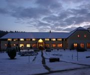
Forest Hills Biohotel & Golf
Szépalma Horse Ranch
Videos from this area
These are videos related to the place based on their proximity to this place.
Forest Hills Golf & Country Club - Az első ütések
Megnyílt a Forest Hills Golf & Country Club Szarvaskúton Zirc mellett. A 25 hektáros objektum a golf mellett szállodai, éttermi szolgáltatást és egyéb szabadidő eltöltési formákat...
Lake Balaton Charity_cycle's photos around Balatonamali, Hungary (janos halapy cherry tree)
Preview of Charity_cycle's blog at TravelPod. Read the full blog here: http://www.travelpod.com/travel-blog-entries/charity_cycle/charity_cycle/1082055780/tpod.html This blog preview was...
Nyugat Mountain Bike Maraton 2013
http://www.facebook.com/edzesrefel www.zelenij.hu Nyugat Mountain Bike Maraton 2013, Zirc.
Nyugat Maraton Kupa, zirci futam - 2013.06.23.
Összefoglaló a versenyről. Minden infó a neten: http://www.x-trame.hu/
MTB 2014-08-10 II. Nyugat MTB maraton kupa, Zirc rövidtáv
2./3 forduló a Nyugat MTB maraton sorozatban (Eplény/Zirc/Balatonfűzfő), rövidtáv: 33 km/800 m szintkülönbség. 2nd round of 3 in the Nyugat (West) MTB maraton series (Eplény/Zirc/Balaton...
Videos provided by Youtube are under the copyright of their owners.
Attractions and noteworthy things
Distances are based on the centre of the city/town and sightseeing location. This list contains brief abstracts about monuments, holiday activities, national parcs, museums, organisations and more from the area as well as interesting facts about the region itself. Where available, you'll find the corresponding homepage. Otherwise the related wikipedia article.
Bakony
Bakony is a mountainous region in Transdanubia, Hungary. It forms the largest part of the Transdanubian Mountains. It is located north of Lake Balaton and lies almost entirely in Veszprém county. The Bakony is divided into the Northern and Southern Bakony through the Várpalota-Veszprém-Ajka-Devecser line. (706 m) high Kőris-hegy in the Northern Bakony is the highest peak of the range.
Transdanubian Mountains
The Transdanubian Mountains (sometimes also referred to as Bakony Forest, Dunántúl Highlands, Highlands of Dunántúl, Highlands of Transdanubia, Mountains of Dunántúl, Mountains of Transdanubia, Transdanubian Central Range, Transdanubian Hills, Transdanubian Midmountains or Transdanubian Mid-Mountains, Hungarian: Dunántúli-középhegység) are a mountain range in Hungary covering about 7000 km². Its highest peak is the Pilis, with a height of 757 metres.


