Safety Score: 2,8 of 5.0 based on data from 9 authorites. Meaning we advice caution when travelling to Hungary.
Travel warnings are updated daily. Source: Travel Warning Hungary. Last Update: 2024-08-13 08:21:03
Explore Rétimajor
Rétimajor in Vas megye is located in Hungary about 122 mi (or 197 km) west of Budapest, the country's capital.
Local time in Rétimajor is now 09:47 PM (Thursday). The local timezone is named Europe / Budapest with an UTC offset of one hour. We know of 8 airports in the wider vicinity of Rétimajor, of which 3 are larger airports. The closest airport in Hungary is Sármellék International Airport in a distance of 35 mi (or 56 km), South-East. Besides the airports, there are other travel options available (check left side).
There are several Unesco world heritage sites nearby. The closest heritage site is Fertö / Neusiedlersee Cultural Landscape in Austria at a distance of 53 mi (or 85 km). The closest in Hungary is Millenary Benedictine Abbey of Pannonhalma and its Natural Environment in a distance of 71 mi (or 85 km), North. We found 2 points of interest in the vicinity of this place. If you need a place to sleep, we compiled a list of available hotels close to the map centre further down the page.
Depending on your travel schedule, you might want to pay a visit to some of the following locations: Moschendorf, Heiligenbrunn, Strem, Eberau and Kleinmurbisch. To further explore this place, just scroll down and browse the available info.
Local weather forecast
Todays Local Weather Conditions & Forecast: 5°C / 41 °F
| Morning Temperature | 2°C / 36 °F |
| Evening Temperature | 6°C / 42 °F |
| Night Temperature | 4°C / 40 °F |
| Chance of rainfall | 0% |
| Air Humidity | 46% |
| Air Pressure | 1007 hPa |
| Wind Speed | Moderate breeze with 12 km/h (8 mph) from North |
| Cloud Conditions | Few clouds, covering 21% of sky |
| General Conditions | Light snow |
Friday, 22nd of November 2024
2°C (36 °F)
-1°C (31 °F)
Snow, moderate breeze, overcast clouds.
Saturday, 23rd of November 2024
5°C (40 °F)
-1°C (31 °F)
Sky is clear, gentle breeze, clear sky.
Sunday, 24th of November 2024
4°C (40 °F)
1°C (34 °F)
Broken clouds, gentle breeze.
Hotels and Places to Stay
Mjus World Resort & Thermal Park****Superior
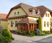
Berki Vendéglő és Hotel
Videos from this area
These are videos related to the place based on their proximity to this place.
Tőzikés, Dobogó-Erdő, Körmend
A Körmend-Horvátnádalja melletti Dobogó-erdőt kora tavasszal ezernyi tavaszi tőzike borít virágba.
Kardos Horváth János az 5. AlteRába Fesztiválon
13 perc Kardos Horváth Jánossal, az 5. AlteRába Fesztivál zárónapjának délutánján. Jó szórakozást hozzá!
A Mátyás Attila Band az 5. AlteRába Fesztiválon
A Mátyás Attila Band zárta az 5. AlteRába Fesztivált, nem is akárhogyan! Két dal a repertoárból, amelyek közül az első Mátyás Attila Hegének, az AlteRába Fesztivál főszervezőjén...
Hófúvás és lezárt utak Körmend térségében
Vas megyében, az Őrség térségében egyre erősödik a hóesés és a szél is. Két utat már délelőtt lezártak, hogy megelőzzék a járművek elakadását. Ezek a Nádasd és Daraboshegy,...
Videos provided by Youtube are under the copyright of their owners.
Attractions and noteworthy things
Distances are based on the centre of the city/town and sightseeing location. This list contains brief abstracts about monuments, holiday activities, national parcs, museums, organisations and more from the area as well as interesting facts about the region itself. Where available, you'll find the corresponding homepage. Otherwise the related wikipedia article.
Pinka
The Pinka is a river in Central Europe with a length of approximately 55 km. Its source is located in Styria, eastern Austria, next to the provincial border of Burgenland. It passes into Hungary between the villages of Burg and Felsőcsatár, and crosses the Austrian-Hungarian border five times. Further it flows into the Rába river near Körmend. Its main tributary is the Strem brook. Important towns on its course are Pinkafeld and Oberwart .
Kemestaródfa
Kemestaródfa is a village in Vas county, Hungary.
Magyarnádalja
Magyarnádalja is a village in Vas county, Hungary.


