Safety Score: 2,8 of 5.0 based on data from 9 authorites. Meaning we advice caution when travelling to Hungary.
Travel warnings are updated daily. Source: Travel Warning Hungary. Last Update: 2024-08-13 08:21:03
Explore Kétvölgy
Kétvölgy in Vas megye is located in Hungary about 139 mi (or 224 km) west of Budapest, the country's capital.
Local time in Kétvölgy is now 02:28 AM (Friday). The local timezone is named Europe / Budapest with an UTC offset of one hour. We know of 8 airports in the wider vicinity of Kétvölgy, of which 4 are larger airports. The closest is airport we know is Graz Airport in Austria in a distance of 37 mi (or 60 km). The closest airport in Hungary is Sármellék International Airport in a distance of 47 mi (or 60 km), West. Besides the airports, there are other travel options available (check left side).
There are several Unesco world heritage sites nearby. The closest heritage site is City of Graz – Historic Centre and Schloss Eggenberg in Austria at a distance of 41 mi (or 66 km). The closest in Hungary is Millenary Benedictine Abbey of Pannonhalma and its Natural Environment in a distance of 87 mi (or 66 km), West. If you need a place to sleep, we compiled a list of available hotels close to the map centre further down the page.
Depending on your travel schedule, you might want to pay a visit to some of the following locations: Weichselbaum, Mogersdorf, Gornji Petrovci, Sankt Martin an der Raab and Jennersdorf. To further explore this place, just scroll down and browse the available info.
Local weather forecast
Todays Local Weather Conditions & Forecast: 7°C / 44 °F
| Morning Temperature | -0°C / 31 °F |
| Evening Temperature | 4°C / 40 °F |
| Night Temperature | 2°C / 36 °F |
| Chance of rainfall | 0% |
| Air Humidity | 60% |
| Air Pressure | 1027 hPa |
| Wind Speed | Light breeze with 3 km/h (2 mph) from East |
| Cloud Conditions | Overcast clouds, covering 91% of sky |
| General Conditions | Overcast clouds |
Saturday, 16th of November 2024
7°C (45 °F)
2°C (36 °F)
Sky is clear, light breeze, clear sky.
Sunday, 17th of November 2024
7°C (45 °F)
3°C (37 °F)
Scattered clouds, light breeze.
Monday, 18th of November 2024
5°C (42 °F)
5°C (41 °F)
Light rain, gentle breeze, overcast clouds.
Hotels and Places to Stay
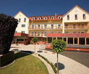
Das Eisenberg
Hotel Raffel
Gotthard Therme Hotel & Conference
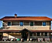
Apát Hotel and Restaurant
Lipa
Andante Hotel & Restaurant
Maitz Pension
Bauernhof Biohof Koller
Körblereck
Videos from this area
These are videos related to the place based on their proximity to this place.
Laternenfest 2013 des Kindergarten Jennersdorf
Laternenfest 2013 in Jennersdorf Video & Schnitt Florian Lipp www.jdf-events.at.
Lichtertanz des Kindergarten Jennersdorf
Lichtertanz (Laternenfest) 2012 in Jennersdorf Video & Schnitt Florian Lipp www.jdf-events.at.
Laternenmarsch des Kindergartens Jennersdorf
Laternenmarsch 2012 in Jennersdorf Video & Schnitt Michael Schmidt www.jdf-events.at.
DeLuxe Nail Atelier-Nagelstudio in Jennersdorf, Burgenland
http://www.firmenabc.at Zu Nagelstudio DeLuxe Nail Atelier Inh. Karin Stangl aus Jennersdorf im Burgenland finden Sie ein ausführliches Porträt unter http://www.firmenabc.at/deluxe-nail-atelier...
Grieselbach in Jennersdorf führt Hochwasser
http://www.feuerwehrblog.net - Der Grieselbach, der durch den Bezirksvorort fließt, führt Hochwasser. Dank des Hochwasserrückhaltebeckens werden größere Überschwemmungen verhindert. Einige...
VS Jennersdorf Weihnachtsfeier 2011
00:00-01:15 Lichtertanz 1A & 1B 01:16-06:54 Herbergssuche Deutsch/Ungarisch 06:55-16:40 Herbergssuche 2011 4A & 4B 16:41-17:09 Schulchor 17:10-21:23 Herbergssuche 2A & 2B 21:24-21:49 ...
Videos provided by Youtube are under the copyright of their owners.
Attractions and noteworthy things
Distances are based on the centre of the city/town and sightseeing location. This list contains brief abstracts about monuments, holiday activities, national parcs, museums, organisations and more from the area as well as interesting facts about the region itself. Where available, you'll find the corresponding homepage. Otherwise the related wikipedia article.
Geography of Slovenia
Slovenia is situated in Central Europe touching the Alps and bordering the Mediterranean. The Alps — including the Julian Alps, the Kamnik-Savinja Alps and the Karavanke chain, as well as the Pohorje massif — dominate Northern Slovenia along its long border to Austria. Slovenia's Adriatic coastline stretches approximately 43 km from Italy to Croatia. Its part south of Sava river belongs to Balkan peninsula - Balkans.
Extreme points of Slovenia
Extreme geographical points of Slovenia:


