Safety Score: 2,8 of 5.0 based on data from 9 authorites. Meaning we advice caution when travelling to Hungary.
Travel warnings are updated daily. Source: Travel Warning Hungary. Last Update: 2024-08-13 08:21:03
Discover Tardosi Kőbánya
Tardosi Kőbánya in Heves megye is a place in Hungary about 70 mi (or 113 km) north-east of Budapest, the country's capital city.
Current time in Tardosi Kőbánya is now 05:54 AM (Friday). The local timezone is named Europe / Budapest with an UTC offset of one hour. We know of 9 airports near Tardosi Kőbánya, of which two are larger airports. The closest airport in Hungary is Miskolc Airport in a distance of 23 mi (or 37 km), East. Besides the airports, there are other travel options available (check left side).
There are several Unesco world heritage sites nearby. The closest heritage site in Hungary is Caves of Aggtelek Karst and Slovak Karst in a distance of 32 mi (or 52 km), North. If you need a hotel, we compiled a list of available hotels close to the map centre further down the page.
While being here, you might want to pay a visit to some of the following locations: Belapatfalva, Eger, Ozd, Petervasara and Fuzesabony. To further explore this place, just scroll down and browse the available info.
Local weather forecast
Todays Local Weather Conditions & Forecast: 1°C / 34 °F
| Morning Temperature | -1°C / 31 °F |
| Evening Temperature | -0°C / 32 °F |
| Night Temperature | -5°C / 23 °F |
| Chance of rainfall | 18% |
| Air Humidity | 92% |
| Air Pressure | 998 hPa |
| Wind Speed | Moderate breeze with 10 km/h (6 mph) from North-West |
| Cloud Conditions | Overcast clouds, covering 100% of sky |
| General Conditions | Heavy snow |
Saturday, 23rd of November 2024
2°C (35 °F)
-4°C (25 °F)
Scattered clouds, moderate breeze.
Sunday, 24th of November 2024
0°C (32 °F)
0°C (33 °F)
Broken clouds, light breeze.
Monday, 25th of November 2024
2°C (36 °F)
1°C (33 °F)
Overcast clouds, light breeze.
Hotels and Places to Stay
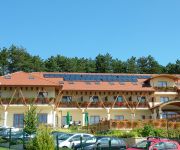
Szalajka Liget
Videos from this area
These are videos related to the place based on their proximity to this place.
Bél-kői tanösvény - Bélapátfalva az Élmények Völgye ajánlatában
http://www.elmenyekvolgye.hu/bukk-hegyseg/156-bel-koi-tanosveny.
Hutter Feri Fefe Drift Sierra
Ferikénk megy a hegyen felfelé tempóban ! V8 Bmw motor van a Ford Sierra kasztniban.
Drift King of Europe Bel-Ko Hungary Grinchuk vs Campling
http://kingofeurope.net Recorded and streamed on King of Europe drifting Pro Series Top 32 at track Bel-Ko, Hungary Recorded and streamed by http://videoteamhungary.com.
Videos provided by Youtube are under the copyright of their owners.
Attractions and noteworthy things
Distances are based on the centre of the city/town and sightseeing location. This list contains brief abstracts about monuments, holiday activities, national parcs, museums, organisations and more from the area as well as interesting facts about the region itself. Where available, you'll find the corresponding homepage. Otherwise the related wikipedia article.
Bélapátfalva
Bélapátfalva is a town in Heves county, in Hungary, located north of the city of Eger. The town is located inside the Eger-river valley at an altitude of 311 meters above sea-level. Facing the town is the Bél-kő mountain which rises 811 meters and is one of the highest peaks of the Bükk mountains. The town is the site of the best preserved Romanesque church building in Hungary, formerly part of a Cistercian abbey. The church was built after 1232 and later modified in Gothic style.


