Safety Score: 2,8 of 5.0 based on data from 9 authorites. Meaning we advice caution when travelling to Hungary.
Travel warnings are updated daily. Source: Travel Warning Hungary. Last Update: 2024-08-13 08:21:03
Delve into Márialiget
The district Márialiget of Külsőlajtamajor in Győr-Moson-Sopron megye is a district located in Hungary about 93 mi west of Budapest, the country's capital town.
In need of a room? We compiled a list of available hotels close to the map centre further down the page.
Since you are here already, you might want to pay a visit to some of the following locations: Deutsch Jahrndorf, Nickelsdorf, Mosonmagyarovar, Pama and Zurndorf. To further explore this place, just scroll down and browse the available info.
Local weather forecast
Todays Local Weather Conditions & Forecast: 8°C / 46 °F
| Morning Temperature | 6°C / 43 °F |
| Evening Temperature | 9°C / 48 °F |
| Night Temperature | 9°C / 47 °F |
| Chance of rainfall | 0% |
| Air Humidity | 68% |
| Air Pressure | 1021 hPa |
| Wind Speed | Moderate breeze with 11 km/h (7 mph) from South-East |
| Cloud Conditions | Broken clouds, covering 76% of sky |
| General Conditions | Light rain |
Wednesday, 27th of November 2024
9°C (48 °F)
7°C (45 °F)
Overcast clouds, gentle breeze.
Thursday, 28th of November 2024
8°C (46 °F)
6°C (42 °F)
Light rain, fresh breeze, overcast clouds.
Friday, 29th of November 2024
7°C (44 °F)
3°C (37 °F)
Broken clouds, fresh breeze.
Hotels and Places to Stay
Ponteo Activity Park Rusovce
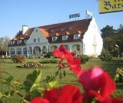
Barokk
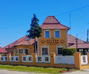
Heléna Hotel & Spa
Divoka Voda
Videos from this area
These are videos related to the place based on their proximity to this place.
Hegyeshalom, Hungary, Bognor to Brisbane, November 2011
The lonely and deserted borderless crossing from Austria into Hungary part 3.
Uzavřený hraniční přechod Rajka pro kamiony - část 1
Několikakilometrová kolona kamionů v Maďarsku těsně před hraničním přechodem Rajka.
Uzavřený hraniční přechod Rajka pro kamiony - část 2
Několikakilometrová kolona kamionů v Maďarsku těsně před hraničním přechodem Rajka.
Maya 3d - WoW Worgen Lamp - Part 01 - Model
Starting point for a future free online tutorial about using Maya + Photoshop, to achieve some , old style ( blizz style ) model and texturing. All was done in 6:45. Edited to around 5:00....
Crossing the border from Slovakia into Hungary
Crossing the border from Slovakia into Hungary just south of Bratislava. Just a brief clip as soon as I was across the border and in Hungary.
A felújított 800as kismotorfecskendő / Rajkai Önkéntes Tűzoltó Egyesület /
A Rajkai Önkéntes Tűzoltó Egyesület felújított Polonia kismotorfecskendője.
E-75 Magyarország-Slovensko road crossing
Drogowe przejście graniczne na drodze E-75 (Węgry-Słowacja)
Videos provided by Youtube are under the copyright of their owners.
Attractions and noteworthy things
Distances are based on the centre of the city/town and sightseeing location. This list contains brief abstracts about monuments, holiday activities, national parcs, museums, organisations and more from the area as well as interesting facts about the region itself. Where available, you'll find the corresponding homepage. Otherwise the related wikipedia article.
Dunajská Lužná
Dunajská Lužná is a municipality (village) in the Bratislava Region of western Slovakia in Senec District. Dunajská Lužná lies approximately 15 km from the capital city of Bratislava towards Dunajská Streda and Komárno. She was founded on 1 January 1974 consisting of three formerly separate villages - Nové Košariská (former German name was Mischdorf, former Hungarian name was Misérd), Jánošíková and Nová Lipnica . Dunajská Lužná belongs to the vicinity of Bratislava.
Bratislava V
Bratislava V is an okres (district) of Bratislava in the Bratislava Region of Slovakia. It is the largest Bratislava district and covers southern areas of Bratislava, including the boroughs of Petržalka, Jarovce, Rusovce and Čunovo. It is bordered by the Danube river to the north and east, which forms its borders with the Bratislava IV, Bratislava I, Bratislava II and Senec districts. It borders on Hungary in the south and Austria in the west.
Kalinkovo
Kalinkovo is a village and municipality in western Slovakia in Senec District in the Bratislava Region.
Rovinka
Rovinka is a village and municipality in western Slovakia in Senec District in the Bratislava Region.
Miloslavov
Miloslavov is a village and municipality in western Slovakia in Senec District in the Bratislava Region.
Gerulata
Gerulata was a Roman military camp located near today's Rusovce, a borough of Bratislava, Slovakia. It was part of the Roman province Pannonia and built in the 2nd century as a part of the Limes Romanus system. It was abandoned in the 4th century, when Roman legions withdrew from Pannonia. Today there is a museum, which is part of the Bratislava City Museum. The most preserved object is a quadrilateral building 30 metres long and 30 metres wide, with 2.4 metre thick walls.
Rusovce mansion
Rusovce Mansion or Rusovce manor house is a neoclassical mansion located in the Rusovce borough, part of Bratislava, capital of Slovakia. The mansion was built on the site of an older manor house from the 16th century, with a medieval structure incorporated into the following buildings. The façade got its current look by application of the Windsor style, which is imitating the English Gothic style. The manor house is surrounded by an English park.
Bratislava-Petržalka railway station
Bratislava-Petržalka railway station is a station in Petržalka, the southern part of Bratislava. The station was rebuilt in the 1990s as a terminus for international trains to and from Vienna, which restarted in 1999 after having stopped in 1945. Shuttle trains between the station and Wien Südbahnhof station operate approximately once per hour. The station is a connection point between the southern Slovak 25 kV/50 Hz electrification and Austrian 15 kV/16.7 Hz. Public transport bus line No.
The Church of Saint Family (Bratislava)
The Church of Saint Family is a Latin church in Petržalka, in the town district of Bratislava. It can seat 448. Construction began in July 2001 and the church was completed in 2003. The church is situated by the Chorvátske rameno, near the complex of buildings called the Technopol. It is located on the estate where the Pope John Paul II celebrated Mass in 2003 and this estate will be named the Square of John Paul II.
Technopol
Technopol is the second tallest building in Petržalka (one of the Bratislava districts) and one of the tallest building in Bratislava. It consists of two buildings 90 m height and is located in the Kutlíkova street, 17, surrounding Chorvátske rameno in front of John Paul II. Square and The Holly family church. Technopol serves as a headquarter of several companies, such as Technopol, a.s. and also Petržalka self-government office.
Čunovo Water Sports Centre
The Čunovo Water Sports Centre is an artificial whitewater slalom course in Slovakia, on an island in the Danube river, 14 km southeast of Bratislava, near the village of Čunovo. It is powered by flow diversion from the Čunovo dam. Since 1997, it has hosted a full schedule of local, regional, and international competitions, including multiple World Cup races, 2 European Championships and the 2011 World Championships.
Gothic church, Šamorín
The Gothic church of Šamorín (Slovak: Stredoveký farský kostol Šamorína) is a church in the district of Šamorín in Bratislava.
2011 ICF Canoe Slalom World Championships
The 2011 ICF Canoe Slalom World Championships were scheduled to take place from September 7–11, 2011 in Bratislava, Slovakia under the auspices of International Canoe Federation. Bad weather conditions on September 7 and 8 forced the organizers to make changes to the schedule. The events were all held over the remaining three days of the Championships.
Pomlé Stadium
Pomlé Stadium is a home football stadium in Šamorín, Slovakia. It serves as home stadium for football club FC ŠTK 1914 Šamorín. The stadium has a capacity of 1,950 (750 seats).


![Webcam: Malom › West: M1/E60 [km 171,7], direction: Vienna HU-AT capture of the webcam Malom › West: M1/E60 [km 171,7], direction: Vienna HU-AT](https://images.webcams.travel/daylight/preview/1334077636.jpg)
