Safety Score: 2,8 of 5.0 based on data from 9 authorites. Meaning we advice caution when travelling to Hungary.
Travel warnings are updated daily. Source: Travel Warning Hungary. Last Update: 2024-08-13 08:21:03
Delve into Nagysziget
The district Nagysziget of Galambossziget in Győr-Moson-Sopron megye is a subburb in Hungary about 83 mi west of Budapest, the country's capital town.
If you need a hotel, we compiled a list of available hotels close to the map centre further down the page.
While being here, you might want to pay a visit to some of the following locations: Mosonmagyarovar, Senec, Deutsch Jahrndorf, Nickelsdorf and Csorna. To further explore this place, just scroll down and browse the available info.
Local weather forecast
Todays Local Weather Conditions & Forecast: 6°C / 42 °F
| Morning Temperature | 2°C / 35 °F |
| Evening Temperature | 6°C / 43 °F |
| Night Temperature | 6°C / 43 °F |
| Chance of rainfall | 0% |
| Air Humidity | 59% |
| Air Pressure | 1027 hPa |
| Wind Speed | Moderate breeze with 12 km/h (7 mph) from South-East |
| Cloud Conditions | Few clouds, covering 14% of sky |
| General Conditions | Few clouds |
Friday, 15th of November 2024
9°C (48 °F)
4°C (40 °F)
Overcast clouds, moderate breeze.
Saturday, 16th of November 2024
8°C (47 °F)
3°C (38 °F)
Sky is clear, moderate breeze, clear sky.
Sunday, 17th of November 2024
8°C (46 °F)
4°C (40 °F)
Overcast clouds, gentle breeze.
Hotels and Places to Stay
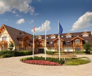
Orchidea Hotel****Lipót
Videos from this area
These are videos related to the place based on their proximity to this place.
Staré koryto Dunaja - A Duna régi medre - Alte Bett der Donau
Old bed of the Danube Video taken with the Nokia N8.
V. Halászi Nyári Fesztivál - 2014.
V. Halászi Nyári Fesztivál - 2014. Halászi községről: Halászi Mosonmagyaróvártól 4 km-re fekszik a Mosoni-Duna partján, a Szigetközben. Méltón mondhatjuk a Szigetköz kapujának,...
2009. október 5. egy percben - Halászi Mosoni Duna-ág híd építési munkálatai
2009. október 5. egy percben - Halászi Mosoni Duna-ág híd építési munkálatai.
2009. október 4. egy percben - Halászi Mosoni Duna-ág híd építési munkálatai
2009. október 4. egy percben - Halászi Mosoni Duna-ág híd építési munkálatai.
2009. október 2. egy percben - Halászi Mosoni Duna-ág híd építési munkálatai
2009. október 2. egy percben - Halászi Mosoni Duna-ág híd építési munkálatai.
2009. október 3. egy percben - Halászi Mosoni Duna-ág híd építési munkálatai
2009. október 3. egy percben - Halászi Mosoni Duna-ág híd építési munkálatai.
Videos provided by Youtube are under the copyright of their owners.
Attractions and noteworthy things
Distances are based on the centre of the city/town and sightseeing location. This list contains brief abstracts about monuments, holiday activities, national parcs, museums, organisations and more from the area as well as interesting facts about the region itself. Where available, you'll find the corresponding homepage. Otherwise the related wikipedia article.
Dunajská Lužná
Dunajská Lužná is a municipality (village) in the Bratislava Region of western Slovakia in Senec District. Dunajská Lužná lies approximately 15 km from the capital city of Bratislava towards Dunajská Streda and Komárno. She was founded on 1 January 1974 consisting of three formerly separate villages - Nové Košariská (former German name was Mischdorf, former Hungarian name was Misérd), Jánošíková and Nová Lipnica . Dunajská Lužná belongs to the vicinity of Bratislava.
Gabčíkovo–Nagymaros Dams
The Gabčíkovo–Nagymaros Dams is a large barrage project on the Danube. It was initiated by the Budapest Treaty of 16 September 1977 between the Czechoslovak Socialist Republic and the People's Republic of Hungary. The project aimed at preventing catastrophic floods, improving river navigability and producing clean electricity.
Kalinkovo
Kalinkovo is a village and municipality in western Slovakia in Senec District in the Bratislava Region.
Szigetköz
The Szigetköz (German: Kleine Schüttinsel or Little Schütt Island, Slovak: Malý Žitný ostrov or Little Rye Island) is an island plain in Western Hungary, part of the Little Hungarian Plain. The name literally means island alley, because the territory is located on an island. Its borders are the Danube and its branches; with a length of 52.5 km, with an average width of 6–8 km, and with a territory of 375 km², the island is Hungary's largest one.
Károlyháza
Károlyháza is a village in Győr-Moson-Sopron county, Hungary.
Čunovo Water Sports Centre
The Čunovo Water Sports Centre is an artificial whitewater slalom course in Slovakia, on an island in the Danube river, 14 km southeast of Bratislava, near the village of Čunovo. It is powered by flow diversion from the Čunovo dam. Since 1997, it has hosted a full schedule of local, regional, and international competitions, including multiple World Cup races, 2 European Championships and the 2011 World Championships.
Gothic church, Šamorín
The Gothic church of Šamorín (Slovak: Stredoveký farský kostol Šamorína) is a church in the district of Šamorín in Bratislava.
2011 ICF Canoe Slalom World Championships
The 2011 ICF Canoe Slalom World Championships were scheduled to take place from September 7–11, 2011 in Bratislava, Slovakia under the auspices of International Canoe Federation. Bad weather conditions on September 7 and 8 forced the organizers to make changes to the schedule. The events were all held over the remaining three days of the Championships.
Pomlé Stadium
Pomlé Stadium is a home football stadium in Šamorín, Slovakia. It serves as home stadium for football club FC ŠTK 1914 Šamorín. The stadium has a capacity of 1,950 (750 seats).


