Safety Score: 2,8 of 5.0 based on data from 9 authorites. Meaning we advice caution when travelling to Hungary.
Travel warnings are updated daily. Source: Travel Warning Hungary. Last Update: 2024-08-13 08:21:03
Delve into Bokrospuszta
Bokrospuszta in Győr-Moson-Sopron megye is located in Hungary about 76 mi (or 123 km) west of Budapest, the country's capital town.
Current time in Bokrospuszta is now 08:03 PM (Tuesday). The local timezone is named Europe / Budapest with an UTC offset of one hour. We know of 11 airports close to Bokrospuszta, of which 5 are larger airports. The closest airport in Hungary is Győr-Pér International Airport in a distance of 22 mi (or 35 km), South-East. Besides the airports, there are other travel options available (check left side).
There are several Unesco world heritage sites nearby. The closest heritage site in Hungary is Millenary Benedictine Abbey of Pannonhalma and its Natural Environment in a distance of 25 mi (or 39 km), South-East. If you need a hotel, we compiled a list of available hotels close to the map centre further down the page.
While being here, you might want to pay a visit to some of the following locations: Mosonmagyarovar, Gyor, Tet, Csorna and Senec. To further explore this place, just scroll down and browse the available info.
Local weather forecast
Todays Local Weather Conditions & Forecast: 6°C / 42 °F
| Morning Temperature | 1°C / 34 °F |
| Evening Temperature | 5°C / 40 °F |
| Night Temperature | 4°C / 39 °F |
| Chance of rainfall | 0% |
| Air Humidity | 66% |
| Air Pressure | 1021 hPa |
| Wind Speed | Gentle Breeze with 6 km/h (4 mph) from North-West |
| Cloud Conditions | Overcast clouds, covering 95% of sky |
| General Conditions | Overcast clouds |
Wednesday, 4th of December 2024
6°C (43 °F)
3°C (38 °F)
Overcast clouds, gentle breeze.
Thursday, 5th of December 2024
4°C (39 °F)
-0°C (32 °F)
Few clouds, moderate breeze.
Friday, 6th of December 2024
3°C (37 °F)
2°C (36 °F)
Rain and snow, gentle breeze, broken clouds.
Hotels and Places to Stay
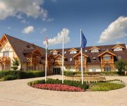
Orchidea Hotel****Lipót
Hédervári Lovas Vendégház
Videos from this area
These are videos related to the place based on their proximity to this place.
FILMS FROM GYOR, HUNGARY -- NOTHING, NOTHING, NOTHING...
Rendező / Directed by: CSÁKI László-ZSÉDELY Teréz (1995)
Revita TV Rioter Paintball Club Győr Hungary better
Revita Tv Nyári Dolce Vita nevű adásában bolt látható ez az interjú/videó. A pálya a Dunaszeg melletti Dunaszentpál edelyében található a duna mellett.
Kalandor Vízitúra / Szigetköz - duzzasztó a denkpáli hallépcsőnél (2/1.)
A denkpáli hallépcső mellett. A hallépcsőről leírás itt: http://www.vizugy.hu/vir/vizugy.nsf/0/0b9dfd94304d3914c1256c84003d696f?OpenDocument.
Kalandor Vízitúra / Szigetköz - Dunaremete - Sorjási bukó
www.kalandorvizitura.blogspot.com Kb. az 1825,5 fkm-nél a szivárgó csatornában, a sorjási bejáróhídról filmezve. (A felvételért köszönet Varga Áginak, a zenéért Lisz Ferencnek!)
Treningsleir i Ungarn - Lipot Football Centrum
Fantastiske baner, et meget behagelig Spa hotell, god mat og mulighet for topp matching er noen av de ingrediensene som gjør Ungarn til en optimal destinasjon for treningsleir. Vi hadde med...
Lipóti Termál- és Élményfürdő
http://lipotfurdo.hu 3D virtuális túra a fürdőben: http://www.lipotfurdo.hu/index.php?option=com_content&view=article&id=56&Itemid=27&lang=hu.
Danube River, 1822 river kilometer, Hungary
Öreg-Duna meder 1822 folyamkilométer környéke, Magyarország 2012.03.07.
Videos provided by Youtube are under the copyright of their owners.
Attractions and noteworthy things
Distances are based on the centre of the city/town and sightseeing location. This list contains brief abstracts about monuments, holiday activities, national parcs, museums, organisations and more from the area as well as interesting facts about the region itself. Where available, you'll find the corresponding homepage. Otherwise the related wikipedia article.
Szigetköz
The Szigetköz (German: Kleine Schüttinsel or Little Schütt Island, Slovak: Malý Žitný ostrov or Little Rye Island) is an island plain in Western Hungary, part of the Little Hungarian Plain. The name literally means island alley, because the territory is located on an island. Its borders are the Danube and its branches; with a length of 52.5 km, with an average width of 6–8 km, and with a territory of 375 km², the island is Hungary's largest one.


