Safety Score: 2,8 of 5.0 based on data from 9 authorites. Meaning we advice caution when travelling to Hungary.
Travel warnings are updated daily. Source: Travel Warning Hungary. Last Update: 2024-08-13 08:21:03
Delve into Újmassa
The district Újmassa of Vadászvölgy in Borsod-Abauj Zemplen county is a subburb in Hungary about 84 mi north-east of Budapest, the country's capital town.
If you need a hotel, we compiled a list of available hotels close to the map centre further down the page.
While being here, you might want to pay a visit to some of the following locations: Kazincbarcika, Miskolc, Edeleny, Belapatfalva and Putnok. To further explore this place, just scroll down and browse the available info.
Local weather forecast
Todays Local Weather Conditions & Forecast: 5°C / 41 °F
| Morning Temperature | -2°C / 28 °F |
| Evening Temperature | 3°C / 37 °F |
| Night Temperature | 1°C / 34 °F |
| Chance of rainfall | 0% |
| Air Humidity | 56% |
| Air Pressure | 1025 hPa |
| Wind Speed | Calm with 2 km/h (2 mph) from East |
| Cloud Conditions | Broken clouds, covering 70% of sky |
| General Conditions | Broken clouds |
Saturday, 16th of November 2024
6°C (44 °F)
2°C (35 °F)
Sky is clear, calm, clear sky.
Sunday, 17th of November 2024
6°C (43 °F)
2°C (36 °F)
Broken clouds, light breeze.
Monday, 18th of November 2024
7°C (45 °F)
3°C (38 °F)
Overcast clouds, moderate breeze.
Hotels and Places to Stay
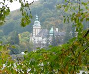
Hunguest Hotel Palota
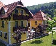
Szeleta
Videos from this area
These are videos related to the place based on their proximity to this place.
On the Mini Train,Lillafured, Hungary
It was a part of our trip in Hungary. Lillafured, an administrative district of Miskolc, and one of the tourist resorts of Hungary with the most beautiful natural environment. Lies on the eastern...
Miskolc / Lillafüred - Hungary (Magyarország)
Lillafüred neve összeforrt az 1920-as évek végén épült Palotaszállóval. A szálló közelében lépcsőzetes függőkert, nagy méretű park és több látnivaló is található. A...
The Line Miskolc Dorottya u. - Garadna (Nr. 330.)
Lillafüredi Állami Erdei Vasutak (MÁV Menetrend 330. sz. vasútvonal) Miskolc Dorottya u. - Garadna vasútvonal 5x sebességgel A felvétel elkészítéséhez ezúton is köszönöm a LÁEV...
Mikulásvonat Lillafüred 2013.
Már hagyománnyá vált, hogy az ünnepek közeledtével elindul Miskolc-Lillafüred között a Mikulásvonat. Az idén már 11. alkalommal szállítja a gyerekeket kisvonat a lillafüredi...
Lillafüredi vízesés
Magyarország legnagyobb vízesése Lillafüreden, a Palotaszálló mellett található. (Canon A490 - 640x480 felbontású videó - 2013-06-15)
Videos provided by Youtube are under the copyright of their owners.
Attractions and noteworthy things
Distances are based on the centre of the city/town and sightseeing location. This list contains brief abstracts about monuments, holiday activities, national parcs, museums, organisations and more from the area as well as interesting facts about the region itself. Where available, you'll find the corresponding homepage. Otherwise the related wikipedia article.
Diósgyőr
Diósgyőr is a historical town in Hungary, today it is a part of Miskolc. The medieval castle in Diósgyőr was a favourite holiday residence of Hungarian kings and queens; today it is a popular tourist attraction. The city part has a heavy industrial background. The football team of Miskolc is also named after Diósgyőr; their soccer stadium lies within the district.
Sajószentpéter
Sajószentpéter is a town in Borsod-Abaúj-Zemplén county, Northern Hungary. It lies in the Miskolc–Kazincbarcika agglomeration, 10 kilometres away from the county capital.
Miskolctapolca
Miskolctapolca or Miskolc-Tapolca (formerly Görömböly-Tapolca, planned to be Tapolcafürdő after gaining independence from Miskolc, in colloquial speech known as Tapolca) is a suburb of Miskolc, and is one of the most popular tourist towns of Hungary. Not to be confused with Tapolca town in Veszprém County.
Lillafüred
Lillafüred (Miskolc-Lillafüred) is a town in Borsod-Abaúj-Zemplén county, Hungary. Officially it is a part of Miskolc, actually it is almost 12 kilometres away from the city, in the Bükk Mountains. Lillafüred is a popular tourist resort.
Bükkszentlászló
Miskolc-Bükkszentlászló is a small village in Borsod-Abaúj-Zemplén county, Northern Hungary. It is surrounded by the Bükk Mountains. Since 1981 has been a part of the city of Miskolc.
Bükk
The Bükk Mountains (literally Beech Mountains) are a section of the North Hungarian Mountains of the Inner Western Carpathians. Much of the area is included in the Bükk National Park.
Castle of Diósgyőr
The Castle of Diósgyőr is a medieval castle in the historical town of Diósgyőr which is now part of the Northern Hungarian city Miskolc.
Anna Cave
The Anna Cave (also called Petőfi Cave) is a natural limestone cave in Miskolc-Lillafüred, Hungary, near the waterfall. The cave was discovered in 1833, when opening a shaft in the limestone in order to provide the iron furnace at Hámor with water. It soon became a tourist attraction, even Sándor Petőfi visited it in 1847. However, in the second part of the century, when the iron furnaces were closed, the cave was forgotten. It was opened again in 1912.
István Cave
The István Cave is a dripstone cave in Miskolc-Lillafüred, Northern Hungary. The cave was formed in the Triassic period and is about 710 m long. It was discovered in 1913. According to local legend, a dog fell into a 15 meter deep shaft, which was the cave's only natural opening. People found the cave when they rescued the dog. Cavers began to explore the cave in 1927. Another entrance was made for the tourists, and in 1931 the cave was opened to the public.
Miskolc Zoo
The Miskolc Zoo is a zoo in Miskolc, Hungary. Although its official name is Miskolc Városi Vadaspark – "Wildlife Park of Miskolc" – it is actually a zoo because the animals are kept in cages. Its first predecessor was the royal game park founded by King Louis I in 1355. Today's zoo was opened on August 20, 1983. It can be found in the Csanyik, a large park in the outskirts of Miskolc, right next to the Bükk National Park, in an area of 212,000 square metres.
Csanyik
The Csanyik Valley, or simply Csanyik, is a valley in Miskolc, near Lillafüred, Hungary. With an area of 105.801 m² it is the second largest green area of the city after Tapolca-Hejőliget. The valley got its name after the mediaeval village of Csenik, which was first mentioned in documents in 1313, when Palatine István donated it to the Pauline monastery of Diósgyőr that he founded. The inhabitants of the village were mainly winegrowers.
Cave Bath
The Cave Bath is a thermal bath in a natural cave in Miskolctapolca, which is part of the city of Miskolc, Hungary, another cave bath is only at Sklene Teplice, Slovakia. The thermal water is reputed to reduce joint pain, and since it has a lower salt content than most thermal waters (around 1000 mg/liter), people can bathe in it for much longer, practically an unlimited amount of time. The Cave Bath can be visited all year long, except for January.
DVTK Stadion
DVTK Stadion is a multi-purpose stadium in Miskolc, Hungary. Currently, the stadium is mainly used for football matches. The stadium has a maximum capacity of approximately 17,000 people. It is the home of the Diósgyőri VTK.
St. Anne's Church, Miskolc
The St. Anne's Church is a Roman Catholic parish church on St. Anna Square, Miskolc, Hungary. Locally it is often referred to as "Red Church", because of its red roof. The construction of the building started on July 21, 1816. The church was consecrated on August 3, 1823. The parsonage was completed in 1826, and the church functions as a parish church since then. The church was built in late Baroque style with some Neoclassical elements; the altar and the pulpit are late Neoclassical.
Bánkút (Nagyvisnyó)
Bánkút is a ski resort in Northern Hungary in the Bükk National Park. It lies 32 km west from Miskolc and 800–930 metres above sea level; officially belongs to the village of Nagyvisnyó. It has six ski trails of various difficulty and two beginner slopes, its eight ski lifts can lift 2000 persons per hour. There are two cross-country ski trails, 3.5 km and 8 km long. In ski season MVK Zrt.
Kisgyőr
Kisgyőr is a village in Borsod-Abaúj-Zemplén County in northeastern Hungary.
Kondó
Kondó is a village in Borsod-Abaúj-Zemplén County in northeastern Hungary.
Mályinka
Mályinka is a village in Borsod-Abaúj-Zemplén County in northeastern Hungary.
Radostyán
Radostyán is a village in Borsod-Abaúj-Zemplén County in northeastern Hungary.
Répáshuta
Répáshuta is a village in Borsod-Abaúj-Zemplén County in northeastern Hungary.
Sajóivánka
Sajóivánka is a village in Borsod-Abaúj-Zemplén County in northeastern Hungary.
Sajókápolna
Sajókápolna is a village in Borsod-Abaúj-Zemplén County in northeastern Hungary.
Varbó
Varbó is a village in Borsod-Abaúj-Zemplén County in northeastern Hungary.
Sajólászlófalva
Sajólászlófalva is a village in Borsod-Abaúj-Zemplén County in northeastern Hungary.
Pete András Stadion
Pete András Stadion is a sports stadium in Kazincbarcika, Hungary. The stadium is home to the famous association football side Kazincbarcikai SC. The stadium has a capacity of 3,000.


