Safety Score: 2,8 of 5.0 based on data from 9 authorites. Meaning we advice caution when travelling to Hungary.
Travel warnings are updated daily. Source: Travel Warning Hungary. Last Update: 2024-08-13 08:21:03
Discover Bányatelep
The district Bányatelep of Kazincbarcika in Borsod-Abauj Zemplen county is a district in Hungary about 90 mi north-east of Budapest, the country's capital city.
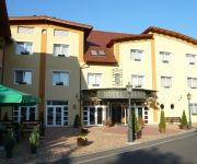
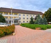
Looking for a place to stay? we compiled a list of available hotels close to the map centre further down the page.
When in this area, you might want to pay a visit to some of the following locations: Edeleny, Miskolc, Putnok, Szikszo and Belapatfalva. To further explore this place, just scroll down and browse the available info.
Local weather forecast
Todays Local Weather Conditions & Forecast: 6°C / 43 °F
| Morning Temperature | 0°C / 32 °F |
| Evening Temperature | 5°C / 41 °F |
| Night Temperature | 3°C / 37 °F |
| Chance of rainfall | 0% |
| Air Humidity | 61% |
| Air Pressure | 1016 hPa |
| Wind Speed | Gentle Breeze with 6 km/h (4 mph) from East |
| Cloud Conditions | Broken clouds, covering 80% of sky |
| General Conditions | Broken clouds |
Monday, 18th of November 2024
9°C (47 °F)
5°C (42 °F)
Light rain, moderate breeze, broken clouds.
Tuesday, 19th of November 2024
8°C (47 °F)
6°C (43 °F)
Light rain, gentle breeze, broken clouds.
Wednesday, 20th of November 2024
8°C (46 °F)
3°C (37 °F)
Rain and snow, moderate breeze, overcast clouds.
Hotels and Places to Stay
Videos from this area
These are videos related to the place based on their proximity to this place.
Kazincbarcika, 2010. 05.16
A Tardona-patak elöntötte a Mátyás király út és környező tereinek jelentős részét.
L'ART POUR L'ART 2011. június 29. 20.30 Kazincbarcika, Művelődési Központ
http://www.elmenyekvolgye.hu Borsodi Művészeti Fesztivál L'ART POUR L'ART TÁRSULAT: A HÁROM TESTŐR ÉS A JETI 2011. június 29. 20.30 Kazincbarcika, Művelődési Központ.
Mikó István és a BlackBirds - 2011. június 21. Kazincbarcika, Művelődési Központ
http://www.elmenyekvolgye.hu Borsodi Művészeti Fesztivál 2011. június 21. 20.30 Kazincbarcika, Művelődési Központ BOLOND A HEGYTETŐN Mikó István és a BlackBirds együttes zenés...
Kazincbarcika, a Tardona patak áradása 2010. 05. 16.
A Tardona patak elöntötte Kazincbarcika egy részét.
VEDRES CSABA és GYERMÁN JÚLIA 2011. június 26. 18.00 Kazincbarcika, Görög katolikus templom
http://www.elmenyekvolgye.hu Borsodi Művészeti Fesztivál VEDRES CSABA és GYERMÁN JÚLIA 2011. június 26. 18.00 Kazincbarcika, Görög katolikus templom.
LUMEN CHRISTI GOSPEL KÓRUS 2011. június 27. 18.00 Kazincbarcika, Szent Család Templom
http://www.elmenyekvolgye.hu Borsodi Művészeti Fesztivál LUMEN CHRISTI GOSPEL KÓRUS 2011. június 27. 18.00 Kazincbarcika, Szent Család Templom.
KFT koncert - 2011. június 27. 20.00 Kazincbarcika, Csónakázó-tó
http://www.elmenyekvolgye.hu Borsodi Művészeti Fesztivál KFT koncert - 2011. június 27. 20.00 Kazincbarcika, Csónakázó-tó.
Videos provided by Youtube are under the copyright of their owners.
Attractions and noteworthy things
Distances are based on the centre of the city/town and sightseeing location. This list contains brief abstracts about monuments, holiday activities, national parcs, museums, organisations and more from the area as well as interesting facts about the region itself. Where available, you'll find the corresponding homepage. Otherwise the related wikipedia article.
Diósgyőr
Diósgyőr is a historical town in Hungary, today it is a part of Miskolc. The medieval castle in Diósgyőr was a favourite holiday residence of Hungarian kings and queens; today it is a popular tourist attraction. The city part has a heavy industrial background. The football team of Miskolc is also named after Diósgyőr; their soccer stadium lies within the district.
Sajószentpéter
Sajószentpéter is a town in Borsod-Abaúj-Zemplén county, Northern Hungary. It lies in the Miskolc–Kazincbarcika agglomeration, 10 kilometres away from the county capital.
Lillafüred
Lillafüred (Miskolc-Lillafüred) is a town in Borsod-Abaúj-Zemplén county, Hungary. Officially it is a part of Miskolc, actually it is almost 12 kilometres away from the city, in the Bükk Mountains. Lillafüred is a popular tourist resort.
Castle of Diósgyőr
The Castle of Diósgyőr is a medieval castle in the historical town of Diósgyőr which is now part of the Northern Hungarian city Miskolc.
Anna Cave
The Anna Cave (also called Petőfi Cave) is a natural limestone cave in Miskolc-Lillafüred, Hungary, near the waterfall. The cave was discovered in 1833, when opening a shaft in the limestone in order to provide the iron furnace at Hámor with water. It soon became a tourist attraction, even Sándor Petőfi visited it in 1847. However, in the second part of the century, when the iron furnaces were closed, the cave was forgotten. It was opened again in 1912.
Miskolc Zoo
The Miskolc Zoo is a zoo in Miskolc, Hungary. Although its official name is Miskolc Városi Vadaspark – "Wildlife Park of Miskolc" – it is actually a zoo because the animals are kept in cages. Its first predecessor was the royal game park founded by King Louis I in 1355. Today's zoo was opened on August 20, 1983. It can be found in the Csanyik, a large park in the outskirts of Miskolc, right next to the Bükk National Park, in an area of 212,000 square metres.
Csanyik
The Csanyik Valley, or simply Csanyik, is a valley in Miskolc, near Lillafüred, Hungary. With an area of 105.801 m² it is the second largest green area of the city after Tapolca-Hejőliget. The valley got its name after the mediaeval village of Csenik, which was first mentioned in documents in 1313, when Palatine István donated it to the Pauline monastery of Diósgyőr that he founded. The inhabitants of the village were mainly winegrowers.
Bodva
The Bodva is a 110-km long river in Slovakia and Hungary. Its source is in the Slovak Ore Mountains Mountains. The river crosses the border with Hungary near Turňa nad Bodvou, and it flows into the river Sajó in Boldva, north of Miskolc. Two of its tributaries are the Turňa and the Ida. The Bodva flows on the eastern edge of a karstic rock system, therefore it has an unsymmetrical drainage pattern.
Rudolftelep
Rudolftelep is a village in Borsod-Abaúj-Zemplén county, Hungary.
Dubicsány
Dubicsány is a village in Borsod-Abaúj-Zemplén County, in Hungary.
Izsófalva
Izsófalva is a village in Borsod-Abaúj-Zemplén County in northeastern Hungary.
Jákfalva
Jákfalva is a village in Borsod-Abaúj-Zemplén County in northeastern Hungary.
Kondó
Kondó is a village in Borsod-Abaúj-Zemplén County in northeastern Hungary.
Ládbesenyő
Ládbesenyő is a village in Borsod-Abaúj-Zemplén County in northeastern Hungary.
Múcsony
Múcsony is a village in Borsod-Abaúj-Zemplén County in northeastern Hungary.
Ormosbánya
Ormosbánya is a village in Borsod-Abaúj-Zemplén County in northeastern Hungary.
Radostyán
Radostyán is a village in Borsod-Abaúj-Zemplén County in northeastern Hungary.
Sajógalgóc
Sajógalgóc is a village in Borsod-Abaúj-Zemplén County in northeastern Hungary.
Sajóivánka
Sajóivánka is a village in Borsod-Abaúj-Zemplén County in northeastern Hungary.
Sajókápolna
Sajókápolna is a village in Borsod-Abaúj-Zemplén County in northeastern Hungary.
Varbó
Varbó is a village in Borsod-Abaúj-Zemplén County in northeastern Hungary.
Sajókaza
Sajókaza is a village in Borsod-Abaúj-Zemplén County in northeastern Hungary.
Sajólászlófalva
Sajólászlófalva is a village in Borsod-Abaúj-Zemplén County in northeastern Hungary.
Pete András Stadion
Pete András Stadion is a sports stadium in Kazincbarcika, Hungary. The stadium is home to the famous association football side Kazincbarcikai SC. The stadium has a capacity of 3,000.
Kazincbarcika subregion
Kazincbarcika subregion Borsod-Abaúj-Zemplén third largest subregion. Area : 499.3 km2. Population : 60 332 (2009)


