Safety Score: 2,8 of 5.0 based on data from 9 authorites. Meaning we advice caution when travelling to Hungary.
Travel warnings are updated daily. Source: Travel Warning Hungary. Last Update: 2024-08-13 08:21:03
Delve into Rednek
The district Rednek of Erdőbénye in Borsod-Abauj Zemplen county is a district located in Hungary about 120 mi north-east of Budapest, the country's capital town.
In need of a room? We compiled a list of available hotels close to the map centre further down the page.
Since you are here already, you might want to pay a visit to some of the following locations: Tokaj, Szerencs, Sarospatak, Gonc and Encs. To further explore this place, just scroll down and browse the available info.
Local weather forecast
Todays Local Weather Conditions & Forecast: 2°C / 36 °F
| Morning Temperature | -1°C / 31 °F |
| Evening Temperature | 2°C / 35 °F |
| Night Temperature | 1°C / 33 °F |
| Chance of rainfall | 0% |
| Air Humidity | 57% |
| Air Pressure | 1025 hPa |
| Wind Speed | Calm with 2 km/h (1 mph) from East |
| Cloud Conditions | Overcast clouds, covering 98% of sky |
| General Conditions | Overcast clouds |
Saturday, 16th of November 2024
4°C (40 °F)
1°C (33 °F)
Sky is clear, light breeze, clear sky.
Sunday, 17th of November 2024
4°C (40 °F)
1°C (34 °F)
Sky is clear, gentle breeze, clear sky.
Monday, 18th of November 2024
4°C (39 °F)
2°C (35 °F)
Overcast clouds, moderate breeze.
Hotels and Places to Stay
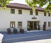
Hotel Botrytis
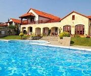
Magita
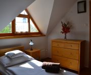
Turján Vendégház
Videos from this area
These are videos related to the place based on their proximity to this place.
Tolcsva Sólyom vár Pusztavár 2014 03 07
A Tolcsva nemzetség által épített Sólyom vár, más néven Pusztavár két lakótornya közül az egyik tetejéről a kilátás a Nagy-Tolcsva patak völgyére az Eperjes-Tokaji hegységben.
II. Országos Kismotorfecskendő Bajnokság Tolcsvai állomása - XI kerületi HTP Újbuda csapata
II. Országos Kismotorfecskendő Bajnokság Tolcsvai állomása - XI kerületi HTP Újbuda csapata "Modern" kategória.
Karácsonyi műsor 2014
A Tolcsvai Általános Iskola diákjainak karácsonyi műsora a mikro-térségi integrált szolgáltató központban.
Videos provided by Youtube are under the copyright of their owners.
Attractions and noteworthy things
Distances are based on the centre of the city/town and sightseeing location. This list contains brief abstracts about monuments, holiday activities, national parcs, museums, organisations and more from the area as well as interesting facts about the region itself. Where available, you'll find the corresponding homepage. Otherwise the related wikipedia article.
Tállya
Tállya is a village in Borsod-Abaúj-Zemplén county, Northern Hungary, 45 kilometres from county seat Miskolc, in the famous Tokaj-Hegyalja wine district.
Tokaj
Tokaj listen, is a historical town in Borsod-Abaúj-Zemplén county, Northern Hungary, 54 kilometers from county capital Miskolc. It is the centre of the famous Tokaj-Hegyalja wine district where the world famous Tokaji wine is produced. Tokai, a region of Cape Town, is named after the nearby mountains' resemblance to the hills of Tokaj-Hegyalja.
Tokaj wine region
Tokaj wine region or Tokaj-Hegyalja wine region (short Tokaj-Hegyalja or Hegyalja) is a historical wine region located in northeastern Hungary. It is also one of the seven larger wine regions of Hungary. Hegyalja means "foothills" in Hungarian, and this was the original name of the region. The region consists of 28 named villages and 11,149 hectares of classified vineyards, of which an estimated 5,500 are currently planted.
Bodrog
The Bodrog is a river in eastern Slovakia and north-eastern Hungary. It is a tributary to the river Tisza. The Bodrog is formed by the confluence of the rivers Ondava and Latorica near Zemplin (village) in eastern Slovakia.
Szerencs
Szerencs is a town in Borsod-Abaúj-Zemplén county, Northern Hungary. It lies 35 km away from Miskolc.
Szabolcs (village)
The village Szabolcs lies in the county Szabolcs-Szatmár-Bereg in the north-east of Hungary. It got its name from the Hungarian leader Szabolcs who founded it and settled there in the 9th/10th century. According to Anonymus in the Gesta Hungarorum: "he saw a place on the shore of the Tisza, and as he saw how [good/strong good/strong] it was, [so so] he came to the conclusion, that by its strength, it must have been created for building a castle there.
Rakamaz
Rakamaz is a town in Szabolcs-Szatmár-Bereg county, in the Northern Great Plain region of eastern Hungary.
Timár
A timar was land granted by the Ottoman sultans between the fourteenth and sixteenth centuries, with a tax revenue annual value of less than 20 000 akçes. The revenues produced from land acted as compensation for military service. A Timar holder was known as a Timariot. If the revenues produced from the timar were from 20,000 to 100,000 akçes, the timar would be called zeamet, and if they were above 100,000 akçes, the land would be called has.
Tarcal
Tarcal is a village on the eastern edge of Borsod-Abaúj-Zemplén county, northern Hungary, in the famous Tokaj-Hegyalja wine district, 55 km from Miskolc.
2006 Slovak Air Force Antonov An-24 crash
On 19 January 2006 an Antonov An-24 aircraft operated by the Slovak Air Force crashed in northern Hungary, near the village of Hejce and town of Telkibánya. The airplane was carrying Slovak peacekeepers from Kosovo. Of the 43 people on board, there was only one survivor. The crash remains the deadliest in Slovak history.
Arka (Hungary)
Arka is a village in Borsod-Abaúj-Zemplén county, Hungary.
Erdőbénye
The village Erdőbénye has 1600 inhabitants and is located 20 km from the town of Tokaj in Northern Hungary. It lies in a valley surrounded by mountains and vineyards, in the middle of the famous wine-region ‘Tokaj-Hegyalja’, in Borsod-Abauj-Zemplen County. The village is one of the centres for wine-production in this region. There are more cellars in the village, where the regional wines can be tasted.
Háromhuta
Háromhuta is a village in Borsod-Abaúj-Zemplén County in northeastern Hungary.
Hercegkút
Hercegkút is a village in Borsod-Abaúj-Zemplén County in northeastern Hungary.
Hernádcéce
Hernádcéce is a village in Borsod-Abaúj-Zemplén County in northeastern Hungary.
Kenézlő
Kenézlő is a village in Borsod-Abaúj-Zemplén County in northeastern Hungary.
Komlóska
Komlóska is a village in Borsod-Abaúj-Zemplén County in northeastern Hungary. \t\t \t\t\tKomloska-Vár. jpg \t\t\t \t\t\t \t\t \t\t \t\t\tCivertanlegifotoKomloska1. jpg \t\t\t \t\t\t \t\t \t\t \t\t\tCivertanlegifotKomloska3. jpg \t\t\t \t\t\t \t\t \t\t \t\t\tCivertanlegifotoKomloska8. jpg
Korlát
Korlát is a village in Borsod-Abaúj-Zemplén County in northeastern Hungary.
Mád
Mád is a village in Borsod-Abaúj-Zemplén County in northeastern Hungary.
Mezőzombor
Mezőzombor is a village in Borsod-Abaúj-Zemplén County in northeastern Hungary.
Mogyoróska
Mogyoróska is a village in Borsod-Abaúj-Zemplén County in northeastern Hungary.
Regéc
Regéc is a village in Borsod-Abaúj-Zemplén County in northeastern Hungary.
Vámosújfalu
Vámosújfalu is a village in Borsod-Abaúj-Zemplén County in northeastern Hungary.
Vilmány
Vilmány is a village in Borsod-Abaúj-Zemplén County in northeastern Hungary.
Sárazsadány
Sárazsadány is a village in Borsod-Abaúj-Zemplén County in northeastern Hungary.


