Safety Score: 2,8 of 5.0 based on data from 9 authorites. Meaning we advice caution when travelling to Hungary.
Travel warnings are updated daily. Source: Travel Warning Hungary. Last Update: 2024-08-13 08:21:03
Explore Gárdonytanya
The district Gárdonytanya of Csernely in Borsod-Abauj Zemplen county is located in Hungary about 76 mi north-east of Budapest, the country's capital.
If you need a place to sleep, we compiled a list of available hotels close to the map centre further down the page.
Depending on your travel schedule, you might want to pay a visit to some of the following locations: Ozd, Belapatfalva, Putnok, Eger and Petervasara. To further explore this place, just scroll down and browse the available info.
Local weather forecast
Todays Local Weather Conditions & Forecast: 3°C / 38 °F
| Morning Temperature | -4°C / 26 °F |
| Evening Temperature | 1°C / 34 °F |
| Night Temperature | -1°C / 30 °F |
| Chance of rainfall | 0% |
| Air Humidity | 51% |
| Air Pressure | 1027 hPa |
| Wind Speed | Calm with 2 km/h (2 mph) from North |
| Cloud Conditions | Few clouds, covering 11% of sky |
| General Conditions | Few clouds |
Friday, 15th of November 2024
5°C (42 °F)
1°C (34 °F)
Broken clouds, calm.
Saturday, 16th of November 2024
7°C (45 °F)
1°C (34 °F)
Sky is clear, light breeze, clear sky.
Sunday, 17th of November 2024
6°C (43 °F)
2°C (35 °F)
Broken clouds, light breeze.
Hotels and Places to Stay
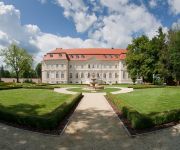
La Contessa Kastélyhotel****
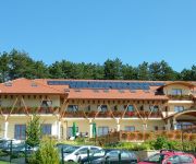
Szalajka Liget
Videos from this area
These are videos related to the place based on their proximity to this place.
VIII. Suzuki Kaiser Ózd Rally RTE 2010 Real-X Video
VIII, Suzuki Kaiser Ózd Rally RTE Kiskapudi-tető - Sáta (Gy2 Gy4 Gy6) www.rallymedia.try.hu.
Motoros felvonulás Farkaslyukon keresztül
2010.05.08-án a sátai motorostalálkozóra a motorosok,Ózdról indulva,Farkaslyukon keresztül vonultak át.Az eső sajnos esett.
Egérút - Mouse Trip
Mouse Trip The first film of our amateur filmmaker team. Első film, amatőr középiskolásoktól. SMK alkotócsoport (Keller-Deák Kristóf, Makk Gergely, Simonek Péter) AVK filmszemle,...
665 Nekézseny Pasture in the Bükk mountains. Nekézseny legelő.
magyarul lennt. In this video the northern contours of the Bükk mountain range are visible, as viewed from the village of Nekézseny. The pasture is grazed by 300 sheep. -------------------------...
661 Nekézseny Making ewe's cheese. Gomolya készítése.
magyarul lennt In Borsod county, only a few decades ago it was common for shepherds to make their own ewe's cheese. Today it's harder to find real home-made ewe's cheese. Fortunately, in ...
663 Nekézseny A sheepdog at work. Juhok szétválogatása.
magyarul lennt After the afternoon grazing, the flock of Merino sheep is split into three groups. "Inas" (Butler), a Mudi sheepdog, assists in this operation. The Mudi is a Hungarian breed,...
FEI EUROPEAN DRIVING CHAMPIONSHIPS FOR JUNIORS 2013 Karolin Romahn representing Germany
Eindrücke aus Sicht des Fahrteams Karolin Romahn, gestartet für Deutschland, Juniors / U18 Full Results see http://www.fei.org/fei/events/championships/driving/young-2013.
Videos provided by Youtube are under the copyright of their owners.
Attractions and noteworthy things
Distances are based on the centre of the city/town and sightseeing location. This list contains brief abstracts about monuments, holiday activities, national parcs, museums, organisations and more from the area as well as interesting facts about the region itself. Where available, you'll find the corresponding homepage. Otherwise the related wikipedia article.
Bélapátfalva
Bélapátfalva is a town in Heves county, in Hungary, located north of the city of Eger. The town is located inside the Eger-river valley at an altitude of 311 meters above sea-level. Facing the town is the Bél-kő mountain which rises 811 meters and is one of the highest peaks of the Bükk mountains. The town is the site of the best preserved Romanesque church building in Hungary, formerly part of a Cistercian abbey. The church was built after 1232 and later modified in Gothic style.
Ózd
Ózd is a city in Borsod-Abaúj-Zemplén county, Northern Hungary, 40 km away from county seat Miskolc. Ózd is the second largest city of the county.
Putnok
Putnok is a town in Borsod-Abaúj-Zemplén county, Northern Hungary. It lies 40 km away from Miskolc, between the Bükk Mountains and the river Sajó.
Bükk
The Bükk Mountains (literally Beech Mountains) are a section of the North Hungarian Mountains of the Inner Western Carpathians. Much of the area is included in the Bükk National Park.
Bükk National Park
The Bükk National Park (Hungarian: Bükki Nemzeti Park) is a national park in the Bükk Mountains of Northern Hungary, near Miskolc. It was founded in 1976 as the third national park of the country. It contains 431.3 km² (of which 37.74 km² is under increased protection). It is the largest national park in Hungary with mountains and forests, situated in the Northern mountains, between Szilvásvárad and Lillafüred.
Janice, Rimavská Sobota District
Janice is a village and municipality in the Rimavská Sobota District of the Banská Bystrica Region of southern Slovakia.
Lenartovce
Lenartovce is a village and municipality in the Rimavská Sobota District of the Banská Bystrica Region of southern Slovakia. It has 546 inhabitants.
Zádor, Slovakia
Zádor is a village and municipality in the Rimavská Sobota District of the Banská Bystrica Region of southern Slovakia.
Vlkyňa
Vlkyňa is a village and municipality in the Rimavská Sobota District of the Banská Bystrica Region of southern Slovakia.
Rimavská Seč
Rimavská Seč is a village and municipality in the Rimavská Sobota District of the Banská Bystrica Region of southern Slovakia.
Rimava
Rimava is a river in southern central Slovakia, which flows only in the Rimavská Sobota District. It is the right tributary of the Slaná river. It is 88 km long, its source is in Veporské vrchy at approximately 1 130 m above sea level. It flows through these towns:Tisovec, Hnúšťa and Rimavská Sobota. It pours to the Slaná river near Vlkyňa at 145 m a.s.l.
Farkaslyuk
Farkaslyuk is a village in Borsod-Abaúj-Zemplén county, Hungary.
Bánkút (Nagyvisnyó)
Bánkút is a ski resort in Northern Hungary in the Bükk National Park. It lies 32 km west from Miskolc and 800–930 metres above sea level; officially belongs to the village of Nagyvisnyó. It has six ski trails of various difficulty and two beginner slopes, its eight ski lifts can lift 2000 persons per hour. There are two cross-country ski trails, 3.5 km and 8 km long. In ski season MVK Zrt.
Hét
Hét is a village in Borsod-Abaúj-Zemplén County in northeastern Hungary.
Járdánháza
Járdánháza is a village in Borsod-Abaúj-Zemplén County in northeastern Hungary.
Királd
Királd is a village in Borsod-Abaúj-Zemplén County in northeastern Hungary.
Lénárddaróc
Lénárddaróc is a village in Borsod-Abaúj-Zemplén County in northeastern Hungary.
Mályinka
Mályinka is a village in Borsod-Abaúj-Zemplén County in northeastern Hungary.
Nekézseny
Nekézseny is a village in Borsod-Abaúj-Zemplén County in northeastern Hungary.
Serényfalva
Serényfalva is a village in Borsod-Abaúj-Zemplén County in northeastern Hungary.
Sajópüspöki
Sajópüspöki is a village in Borsod-Abaúj-Zemplén County in northeastern Hungary.
Sajómercse
Sajómercse is a village in Borsod-Abaúj-Zemplén County in northeastern Hungary.
Sajónémeti
Sajónémeti is a village in Borsod-Abaúj-Zemplén County in northeastern Hungary.
Sajóvelezd
Sajóvelezd is a village in Borsod-Abaúj-Zemplén County in northeastern Hungary.
Ózd subregion
Ózd subregion Borsod-Abaúj-Zemplén second largest subregion. Area : 548,39 km². Population : 69 400 (2009)


