Safety Score: 4,0 of 5.0 based on data from 9 authorites. Meaning please reconsider your need to travel to Guyana.
Travel warnings are updated daily. Source: Travel Warning Guyana. Last Update: 2024-08-13 08:21:03
Discover Kingston
The district Kingston of Georgetown in Demerara-Mahaica Region is a district in Guyana and is a district of the nations capital.
Looking for a place to stay? we compiled a list of available hotels close to the map centre further down the page.
When in this area, you might want to pay a visit to some of the following locations: Vreed-en-Hoop, Anna Regina, Bartica, Fort Wellington and Linden. To further explore this place, just scroll down and browse the available info.
Local weather forecast
Todays Local Weather Conditions & Forecast: 31°C / 87 °F
| Morning Temperature | 26°C / 78 °F |
| Evening Temperature | 28°C / 82 °F |
| Night Temperature | 27°C / 80 °F |
| Chance of rainfall | 4% |
| Air Humidity | 61% |
| Air Pressure | 1012 hPa |
| Wind Speed | Gentle Breeze with 8 km/h (5 mph) from West |
| Cloud Conditions | Overcast clouds, covering 97% of sky |
| General Conditions | Moderate rain |
Friday, 22nd of November 2024
31°C (87 °F)
27°C (81 °F)
Moderate rain, gentle breeze, few clouds.
Saturday, 23rd of November 2024
31°C (88 °F)
27°C (80 °F)
Moderate rain, gentle breeze, scattered clouds.
Sunday, 24th of November 2024
30°C (86 °F)
26°C (79 °F)
Light rain, gentle breeze, scattered clouds.
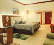
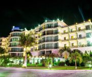
Hotels and Places to Stay
Guyana Marriott Hotel Georgetown
Julian Guest House
Kanhai's Center of Excellence
CARA LODGE HOTEL
REGENCY SUITES HOTEL
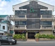
an Ascend Hotel Collection Member The Opus Hotel
Herdmanston Lodge
CARA SUITES
RAMADA GEORGETOWN PRINCESS HOT
PRINCESS HOTEL GUYANA
Videos from this area
These are videos related to the place based on their proximity to this place.
Sewage and The City - Part 1 - Real Problems
This episode has taken us all around the city of Georgetown assessing a few of our major environmental problems. The garbage buildup, drainage and the sewage seeping onto our streets and into...
Sprawling Dilapidation Atlpilot36's photos around Georgetown, Guyana (guyana stinky seawall)
Preview of Atlpilot36's blog at TravelPod. Read the full blog here: http://www.travelpod.com/travel-blog-entries/atlpilot36/2/1263634678/tpod.html This blog preview was made by TravelPod...
Riverfront on the Wharfs of Stabroek Market in Georgetown, Guyana
View from the end of the wharfs in the bustling Stabroek Market in Georgetown, Guyana.
Kaieteur Falls; Oh my God Els_and_peter's photos around Georgetown, Guyana (oh my god kaieteur)
Preview of Els_and_peter's blog at TravelPod. Read the full blog here: http://www.travelpod.com/travel-blog-entries/els_and_peter/1/1257285714/tpod.html This blog preview was made by TravelPod...
Guyanese GUYANA Garbage Must Clean-up (GGMC)
Let take a walk along the sideways of capital city Georgetown. The site of cooperate and natural waste line the streets,sideways and near by ponds and pot hole. Guyana is a beautiful country...
Photography and Memory
On the 6th of November 2014, Karran Sahadeo gave a talk at the Moray House Trust in Georgetown, Guyana about how our memories are effected by the camera and other gadgets. Sahadeo retraces...
Youth At The Center Of Development - Dr. Melissa Ifill
An insightful look at young leaders and revolutionaries that have shaped Guyana. Dr. Melissa Ifill of the University of Guyana takes us on a journey through time as we revisit the youth of...
Venezuela y Guyana fortalecen lazos bilaterales
Venezuela y Guyana lograron ampliar aún más los lazos de cooperación y de buena vecindad, ayer los cancilleres de ambos países firmaron varios acuerdos en la ciudad de Georgetown con la...
Venezuela y Guyana afianzan lazos bilaterales
Los presidentes de Venezuela, Nicolás Maduro y Donald Ramotar, de Guyana, se reunieron en Georgetown para afianzar los lazos bilateral en todas las áreas: comercial, energía, producción...
Videos provided by Youtube are under the copyright of their owners.
Attractions and noteworthy things
Distances are based on the centre of the city/town and sightseeing location. This list contains brief abstracts about monuments, holiday activities, national parcs, museums, organisations and more from the area as well as interesting facts about the region itself. Where available, you'll find the corresponding homepage. Otherwise the related wikipedia article.
Demerara
Demerara is a historical region in the Guianas on the north coast of South America which is now part of the country of Guyana. It was a Dutch colony until 1815 and a county of British Guiana from 1838 to 1958. It was located about the lower courses of the Demerara River, and its main town was Georgetown. The name "Demerara" comes from a variant of the Arawak word "Immenary" or "Dumaruni" which means "river of the letter wood".
Demerara River
The Demerara River is a river in eastern Guyana that rises in the central rainforests of the country and flows to the north for 346 kilometres until it reaches the Atlantic Ocean. Georgetown, Guyana's largest seaport and capital, is situated on the east bank of the river's mouth. The Demerara's estuary is narrow and the flowrate is rapid. This scouring action maintains a 5-6 metre deep direct channel to the ocean.
Queen's College, Guyana
Queen's College is a secondary school in Georgetown, Guyana situated at the south-easterly junction of Camp Street and Thomas Lands. Students can enter the school through the National Grade Six Assessment(NGSA) and at the Lower 6th Form Level if the academic performance of the student at the Caribbean Secondary Education Certificate(CSEC) is satisfactory.
Bank of Guyana
The Bank of Guyana is the central bank of Guyana. It was established in 1965 in advance of the country's independence in 1966. {{#invoke:Coordinates|coord}}{{#coordinates:6.813438|-58.165361||||||| |primary |name= }}
St. Stanislaus College
St. Stanislaus College is a Grade A Senior Secondary School in Georgetown, Guyana. It has a student population of 500 and a teaching staff of forty. Admission to the school is normally through the Secondary Schools' Entrance Examination.
St. Joseph Mercy Hospital
See Mercy Hospital for other medical facilities with the Mercy name. St. Joseph Mercy Hospital is a Catholic hospital on Parade Street in Georgetown, Guyana. It was established by members of the Sword of the Spirit movement and was officially opened in August, 1945. The hospital includes a School of Nursing. The oldest wing of the hospital burnt down on Monday, May 10, 2010 at 7 am.
Walter Roth Museum of Anthropology
The Walter Roth Museum of Anthropology is a museum of anthropology in Georgetown, Guyana and claims to be the oldest such museum in the English-speaking Caribbean region. It was established in 1974, but not opened to the public until 1982. It is located at 61 Main Street, North Cummingsburg, Georgetown.
Bishops' High School, Guyana
The Bishops' High School is ranked as one of best secondary schools in Georgetown, Guyana. It was established in 1870 by the Anglican Church as a ladies' school. The school later merged with Mrs. Vyfhuis' school, also founded in 1870, and then with the DeSaffon school. Mrs. Vyfhuis was offered headship of the combined schools in 1875. The school's first home was at Brickdam and Manget Place, and then at "Minto House" on Waterloo Street.
Stabroek Market
Stabroek Market is a large market located in the capital city of Guyana, Georgetown. In 1842, the Georgetown Town Council designated the current location of the market on Water Street, officially recognizing it as a market despite the fact that it had served such a capacity for quite some time. The market was designed and constructed by the Edgemoor Iron Company of Delaware, USA over the period 1880-1881.
St. George's Cathedral, Georgetown
St. George's Cathedral is an Anglican cathedral in Georgetown, Guyana and is one of the tallest wooden churches in the world, at a height of 43.5 metres . It is the seat of the Bishop of Guyana. St. George's was designed by Sir Arthur Blomfield and opened on 24 August 1892. The building was completed in 1899. It is located on Church Street in Georgetown, and has been designated a National Monument.
St. Andrew's Kirk, Georgetown
St. Andrews Kirk is the oldest building in Georgetown, Guyana continually in use for religious purposes. The Dutch Reformed congregation laid its foundations in 1811. However, due to financial difficulties it was acquired by Scottish Presbyterians and was formally opened for service on 28 February 1818. It was the first church built by the Europeans in which slaves were allowed to worship. It is situated near the Parliament Building on the north eastern corner of Brickdam. Rev.
Georgetown City Hall
Georgetown City Hall is a nineteenth-century Gothic Revival building located on the corner of Regent Street and Avenue of the Republic in Georgetown, Guyana. The building was designed by architect Reverend Ignatius Scoles in 1887, and was completed in June 1889. The building houses the offices of the Mayor, the City Council, and the City Engineer.
Demerara-Essequibo
The colony of Demerara-Essequibo was created on 13 August 1814 when the British combined the colonies of Demerara and Essequibo. On 20 November 1815 the colony was formally ceded to Britain by the Netherlands. The colony continued to use Dutch denominations of currency even though under British control. The issued coins ranging from 3 bits up to 3 Guilder. These coins were minted with the colonies name on it, and were minted from 1809 to 1835.
Georgetown Cenotaph
The Georgetown Cenotaph is a war memorial in Georgetown, Guyana, located at the junction of Main and Church Streets. The Cenotaph was unveiled on August 14, 1923, by the then Governor, Graeme Thomson, and the first Armistice Day observance took place at the Church Street Monument on 11 November 1923. On the four faces of the base of the Cenotaph are inscribed the four words - Devotion, Humanity, Fortitude, and Sacrifice.
Company Path Garden
Company Path Garden is a small garden on the west side of the Avenue of the Republic in Georgetown, Guyana, between Church and North Streets. During colonial times, “company path” was the name given to a road used by the propertied class as an access road from the river to their lands. The company path, in this case, extended from the side of the Demerara River along the path on which the Bank of Guyana was built and eastwards beyond the Avenue of the Republic.
Sea Wall, Guyana
The Sea Wall is a 280 mile seawall that runs along much of Guyana's coastline, and all of the coastline in the capital city of Georgetown. It protects settlements in the coastal areas of Guyana, most of which are below sea level at high tide.
Splashmins Fun Park
Splashmins Fun Park and Resort is an amusement park in Georgetown, Guyana. It is located on the Soesdyke-Linden Highway. The theme park features shows, pristine plant life and beaches. The Park is built on one hundred and sixty four acres of amidst numerous species of flora and a variety of fauna which include spectacular bird life. Splashmins is a privately owned resort.
Institute of Chartered Accountants of Guyana
The Institute of Chartered Accountants of Guyana (ICAG) is a professional body in Guyana that regulates the accountancy industry and arranges for ongoing training of its members.
Guyana National Museum
Guyana National Museum was established on 13 February 1868. The idea of starting a museum was conceived by members of the Royal Agricultural and Commercial Society (RACS) of British Guiana. When RACS was established in 1844, one of its aims was to construct a Museum to house local minerals, soils, timbers, fruits, seeds, gums, resins, dyes and drugs, as well as the flora and fauna of the country. British explorer Robert Schomburgk, the German botanist Carl Ferdinand Appun, Mr Bratt, and W.H.
St. Rose's High School, Guyana
St. Rose's Secondary High School is a government school on Church Street in Georgetown, Guyana, serving students in grades 7-12 in Georgetown, Guyana. To be accepted into the school, the student must receive a certain grade in their Secondary Schools Entrance Examination (SSEE). This is the fourth highest school in Guyana, closely followed by St. Joseph High School (Guyana).
National Library of Guyana
The National Library of Guyana (formerly known as the Carnegie Free Library, the Georgetown Free Public Library and the Free Public Library) is the legal deposit and copyright library for Guyana. Unlike many national libraries, it is also a public lending library and the headquarters of Guyana's public library service, with branches extending throughout the country. Founded in 1909, the National Library of Guyana is situated on the corner of Church Street and Main Street in central Georgetown.
School of the Nations
School of the Nations in Georgetown, Guyana is one of the few private parochial schools in Guyana. Its religious affiliation is with the Bahá'í religion. The school enrolls students from nursery school through secondary school and sixth form college. An associated entity called Nations University (apparently not related to the Nations University affiliated with the Churches of Christ) offers higher education in Guyana.
Bourda Cemetery, Guyana
Bourda Cemetery is an eighteenth-century cemetery situated on Bourda Street in Georgetown, Guyana. Formerly known as "Bourda's Walk", Bourda cemetery is the oldest cemetery in Georgetown, and the only surviving plantation cemetery in the city. It is considered a national landmark and has been listed as a national monument by the National Trust of Guyana.
Georgetown Seawall Bandstand
The Georgetown Seawall Bandstand is an iron bandstand that is situated on the western end of Georgetown Seawall in Guyana. It is one of three bandstands in Georgetown, the other two being situated in the Botanical Gardens and the Promenade Gardens.
Marian Academy
Marian Academy is a Roman Catholic private school in Georgetown, Guyana. It is situated on Carifesta Avenue in central Georgetown. The academy provides secondary, primary and nursery schooling.


