Safety Score: 3,4 of 5.0 based on data from 9 authorites. Meaning please reconsider your need to travel to Guatemala.
Travel warnings are updated daily. Source: Travel Warning Guatemala. Last Update: 2024-08-13 08:21:03
Delve into Cumbre San Nicolás
Cumbre San Nicolás in Departamento de Guatemala is a city located in Guatemala a little south of Guatemala City, the country's capital town.
Current time in Cumbre San Nicolás is now 09:17 AM (Friday). The local timezone is named America / Guatemala with an UTC offset of -6 hours. We know of 8 airports closer to Cumbre San Nicolás. The closest airport in Guatemala is La Aurora Airport in a distance of 6 mi (or 10 km), North. Besides the airports, there are other travel options available (check left side).
There are several Unesco world heritage sites nearby. The closest heritage site in Guatemala is Antigua Guatemala in a distance of 78 mi (or 126 km), East. In need of a room? We compiled a list of available hotels close to the map centre further down the page.
Since you are here already, you might want to pay a visit to some of the following locations: Villa Canales, Petapa, Fraijanes, Santa Catarina Pinula and Villa Nueva. To further explore this place, just scroll down and browse the available info.
Local weather forecast
Todays Local Weather Conditions & Forecast: 18°C / 65 °F
| Morning Temperature | 13°C / 55 °F |
| Evening Temperature | 15°C / 60 °F |
| Night Temperature | 12°C / 53 °F |
| Chance of rainfall | 0% |
| Air Humidity | 69% |
| Air Pressure | 1018 hPa |
| Wind Speed | Gentle Breeze with 6 km/h (4 mph) from South |
| Cloud Conditions | Broken clouds, covering 81% of sky |
| General Conditions | Broken clouds |
Friday, 22nd of November 2024
18°C (64 °F)
12°C (53 °F)
Broken clouds, light breeze.
Saturday, 23rd of November 2024
22°C (71 °F)
13°C (55 °F)
Light rain, light breeze, broken clouds.
Sunday, 24th of November 2024
21°C (69 °F)
13°C (55 °F)
Scattered clouds, light breeze.
Hotels and Places to Stay
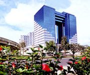
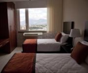
Grand Tikal Futura Hotel
Casa Imperial Guatemala
Adriatika Hotel Boutique
Stanza Hotel & Spa
NOVOHOSTAL
Videos from this area
These are videos related to the place based on their proximity to this place.
simulacro de un juicio oral y público de alumnos del INEB, Villa Canales, Jornada Matutina
Esta actividad es una técnica educativa que busca aplicar los conocimientos adquiridos sobre: proceso de construcción de ciudadanía, valores, deberes y derechos inherentes a todas las personas...
Pastor Jaime Yuman - KERIGMA
El Pastor Jaime Yuman de Iglesia de Cristo "Jesús Manantial de Vida", Ministerios Elim, nos comenta sobre el trabajo del Instituto KERIGMA en la sede de Villa Canales.
Anuncio del baile de los bomberos voluntarios del 7
a beneficio del Benemerito Cuerpo de Bomberos Voluntarios de Villa Canales.
Villas Joya de Oro
Villas Joya de Oro es un condominio en el Km. 24.5 Carretera a El Salvador que cuenta con 22 apartamentos de 100 metros cuadrados y una amplia area verde de mas de 1400 varas cuadradas.
Encuentro Juvenil Corazón de Fuego
Encuentro Juvenil Corazón de Fuego Yo Tengo Un Dios Que Hace Arder Mi CORAZÓN EN FUEGO 1 y 2 de Diciembre . Aviva el Fuego del Don de Dios que Esta en Ti En Iglesia Primitiva Somos una ...
rio platanitos
desvordamiento del rio platanitos viernes 18 de octubre del 2013, en Santa Ines, Petapa.
Lluvia de arena procedente del volcán de Pacaya, 27/05/2010
Imágenes de cómo el suelo está cubierto de arena tras una intensa actividad del volcán de Pacaya, la noche del 27 de mayo de 2010. El fenómeno ocurre sobre áreas cercanas al volcán,...
Videos provided by Youtube are under the copyright of their owners.
Attractions and noteworthy things
Distances are based on the centre of the city/town and sightseeing location. This list contains brief abstracts about monuments, holiday activities, national parcs, museums, organisations and more from the area as well as interesting facts about the region itself. Where available, you'll find the corresponding homepage. Otherwise the related wikipedia article.
Aguacapa River
The Aguacapa River is a river in Guatemala. Its sources are located in the hills south-east of Guatemala City, at an altitude of 1850 m. From there it flows in a southerly direction through the department Guatemala and Santo Rosa and joins the Maria Linda River at {{#invoke:Coordinates|coord}}{{#coordinates:14.2797|-90.5266|type:landmark_region:GT|||||| | |name=Aguacapa River }}, which flows into the Pacific Ocean.


