Safety Score: 3,4 of 5.0 based on data from 9 authorites. Meaning please reconsider your need to travel to Guatemala.
Travel warnings are updated daily. Source: Travel Warning Guatemala. Last Update: 2024-08-13 08:21:03
Delve into Tecpán Guatemala
Tecpán Guatemala in Departamento de Chimaltenango with it's 21,978 habitants is located in Guatemala about 33 mi (or 54 km) west of Guatemala City, the country's capital town.
Current time in Tecpán Guatemala is now 02:33 AM (Monday). The local timezone is named America / Guatemala with an UTC offset of -6 hours. We know of 8 airports close to Tecpán Guatemala. The closest airport in Guatemala is Santa Cruz del Quiche Airport in a distance of 20 mi (or 32 km), North-West. Besides the airports, there are other travel options available (check left side).
There is one Unesco world heritage site nearby. It's Antigua Guatemala in a distance of 112 mi (or 180 km), East. If you need a hotel, we compiled a list of available hotels close to the map centre further down the page.
While being here, you might want to pay a visit to some of the following locations: Santa Apolonia, Patzun, San Jose Poaquil, Comalapa and Santa Cruz Balanya. To further explore this place, just scroll down and browse the available info.
Local weather forecast
Todays Local Weather Conditions & Forecast: 14°C / 58 °F
| Morning Temperature | 13°C / 56 °F |
| Evening Temperature | 14°C / 58 °F |
| Night Temperature | 14°C / 56 °F |
| Chance of rainfall | 6% |
| Air Humidity | 98% |
| Air Pressure | 1015 hPa |
| Wind Speed | Light breeze with 4 km/h (3 mph) from North-East |
| Cloud Conditions | Overcast clouds, covering 100% of sky |
| General Conditions | Light rain |
Monday, 18th of November 2024
17°C (62 °F)
13°C (56 °F)
Light rain, light breeze, overcast clouds.
Tuesday, 19th of November 2024
18°C (65 °F)
13°C (55 °F)
Moderate rain, light breeze, overcast clouds.
Wednesday, 20th of November 2024
18°C (65 °F)
12°C (53 °F)
Light rain, light breeze, overcast clouds.
Hotels and Places to Stay
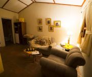
San Ricardo Farm and Lodge
Videos from this area
These are videos related to the place based on their proximity to this place.
LAGUNA CHIQUIXCHOY - Laguna Seca, Tecpán Guatemala
This is the geographic coordinate Chiquixchoy lake. Longitude: 91 ° 01 '0.7 "W Latitude: 14 ° 46 '49.8 "N Alt: 2923 m.
Procesión de San Francisco de Asís, 4 de octubre de 2014
Esta es la procesión del San Francisco de Asís, Patrono de Tecpán Guatemala, en su Feriar Titular del día 4 de octubre del presente año, acompañado por la devota población del municipio.
Banda Escolar Centro Escolar San Vicente de Paúl 2014
Esta es la presentación de la banda escolar del Centro Escolar "San Vicente de Paúl" en el festival de bandas realizado en Tecpán Guatemala el día 07 de septiembre del presente año como...
Semana Santa (Viernes Santo) 2012, Procesión de Jesús de Poromá
Procesión de la venerada imagen de Jesús de Poromá y de la Virgen de Dolores, el día Viernes Santo del año 2012 por las calles de Tecpán Guatemala.
Jueves Santo 2014, procesión de los niños
Ésta es la procesión de los niños de la venerada imagen de Jesús de Poromá y de la Virgen de Dolores recorriendo las calles de Tecpán Guatemala, marcando así el inicio del Triduo Pascual...
Procesión de San Francisco 4 de octubre de 2013
Esta es la procesión de San Francisco de Asís la cual recorre las calles de Tecpán Guatemala bendiciendo a nuestro pueblo, en conmemoración de un año más de la Feria Patronal de nuestro...
Tecpan 30k International Trail Run
Maximum Elevation: 8600 feet Elevation Gain: 4195 feet Elevation Loss: 4201 feet.
colegio bethesda tecpan
15 de septiembre 2012 presentación en el colegio depues del desfile jajajaja bna presentacion.
Inauguración tramo carretera Interamericana
Patzún, Inauguración tramo carretera Interamericana por el Presidente Pérez Molina en Tecpán.
14 de Sept. de 2013, Participación del Centro Escolar San Vicente de Paúl
Esta es la participación del Centro Escolar "San Vicente de Paúl" en la caminata cívica del día 14 de septiembre, correspodiente a los grados de 1º a 6º Primaria, conmemorando el 192...
Videos provided by Youtube are under the copyright of their owners.
Attractions and noteworthy things
Distances are based on the centre of the city/town and sightseeing location. This list contains brief abstracts about monuments, holiday activities, national parcs, museums, organisations and more from the area as well as interesting facts about the region itself. Where available, you'll find the corresponding homepage. Otherwise the related wikipedia article.
Santa Apolonia, Chimaltenango
Santa Apolonia is a municipality in the northern part of Chimaltenango department of Guatemala. Santa Apolonia is bordered by the towns of Tecpán to the west and south, San José Poaquil to the east and San Juan Comalapa to the southeast. http://209.15.138.224/inmochapin/m_chimaltenango. htm The geographical extension of the town is 96 square kilometers (37 mi²).
Tecpán Guatemala
Tecpán Guatemala (locally referred to as just Tecpán) is a municipality in the department of Chimaltenango, in Guatemala, on the Inter-American Highway CA-1. The climate is generally cold. It is characterized as a tourist destination, with some fame derived from its landscapes, varied vegetation and from being on an access route to Iximché archaeological site.
Iximche
Iximche (or Iximché using Spanish orthography) is a Pre-Columbian Mesoamerican archaeological site in the western highlands of Guatemala. Iximche was the capital of the Late Postclassic Kaqchikel Maya kingdom from 1470 until its abandonment in 1524. The architecture of the site included a number of pyramid-temples, palaces and two Mesoamerican ballcourts. Excavators uncovered the poorly preserved remains of painted murals on some of the buildings and ample evidence of human sacrifice.


