Safety Score: 3,4 of 5.0 based on data from 9 authorites. Meaning please reconsider your need to travel to Guatemala.
Travel warnings are updated daily. Source: Travel Warning Guatemala. Last Update: 2024-08-13 08:21:03
Explore La Aurora
La Aurora in Departamento de Chimaltenango is a city in Guatemala about 27 mi (or 44 km) south-west of Guatemala City, the country's capital.
Local time in La Aurora is now 05:08 PM (Monday). The local timezone is named America / Guatemala with an UTC offset of -6 hours. We know of 8 airports in the vicinity of La Aurora. The closest airport in Guatemala is La Aurora Airport in a distance of 25 mi (or 40 km), East. Besides the airports, there are other travel options available (check left side).
There is one Unesco world heritage site nearby. It's Antigua Guatemala in a distance of 104 mi (or 167 km), East. If you need a place to sleep, we compiled a list of available hotels close to the map centre further down the page.
Depending on your travel schedule, you might want to pay a visit to some of the following locations: Alotenango, Yepocapa, Acatenango, San Miguel Duenas and Santa Catarina Barahona. To further explore this place, just scroll down and browse the available info.
Local weather forecast
Todays Local Weather Conditions & Forecast: 21°C / 69 °F
| Morning Temperature | 14°C / 57 °F |
| Evening Temperature | 18°C / 64 °F |
| Night Temperature | 14°C / 58 °F |
| Chance of rainfall | 0% |
| Air Humidity | 64% |
| Air Pressure | 1019 hPa |
| Wind Speed | Light breeze with 5 km/h (3 mph) from South |
| Cloud Conditions | Few clouds, covering 10% of sky |
| General Conditions | Light rain |
Monday, 25th of November 2024
21°C (70 °F)
14°C (57 °F)
Sky is clear, gentle breeze, few clouds.
Tuesday, 26th of November 2024
22°C (71 °F)
14°C (58 °F)
Light rain, light breeze, few clouds.
Wednesday, 27th of November 2024
23°C (74 °F)
15°C (60 °F)
Light rain, light breeze, clear sky.
Hotels and Places to Stay
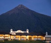
Hotel La Reunion Golf Resort & Residences
Videos from this area
These are videos related to the place based on their proximity to this place.
Erupcion Volcan de fuego Agosto 08 2007
Erupcion del Volcan de Fuego, vista desde la finca Paul Ecke de Guatemala, ubicada en San Juan Alotenango, Sacatepequez, Guatemala.
Yepocapa, Humberto F. Izaguirre Chávez
Esta Entrevista le fue realizada a mi señor padre por parte de la Empresa TELESAT, de San Pedro Yepocapa, muchas gracias mi amigo GATO. Dios te tenga en su Gloria Papá. TE EXTRAÑO MUCHO.
TELEGENESIS
Este vídeo se ha realizado con el creador de presentaciones de diapositivas de YouTube (http://www.youtube.com/upload).
vida, vida
Son instintos que nos llevan atraves de la odisea, vida aventurera presentada en una y mil maneras.
casa margaritas
Proyectos Inmobiliarios en Guatemala aproveche para comprar su casa margaritas cuando visite Guatemala.
Videos provided by Youtube are under the copyright of their owners.
Attractions and noteworthy things
Distances are based on the centre of the city/town and sightseeing location. This list contains brief abstracts about monuments, holiday activities, national parcs, museums, organisations and more from the area as well as interesting facts about the region itself. Where available, you'll find the corresponding homepage. Otherwise the related wikipedia article.
Achiguate River
The Río Achiguate is a river in the south of Guatemala. Its sources are located in the Sierra Madre range, on the southern slopes of the Volcán de Fuego in the departments of Sacatepéquez and Escuintla. The river flows southwards through the coastal lowlands of Escuintla to the Pacific Ocean. The Achiquate river's proximity to the active Fuego volcano increases the risks of inundations and mudflows.


