Safety Score: 2,8 of 5.0 based on data from 9 authorites. Meaning we advice caution when travelling to Greece.
Travel warnings are updated daily. Source: Travel Warning Greece. Last Update: 2024-08-13 08:21:03
Delve into Solotéri
The district Solotéri of Kokkála in Nomós Lakonías (Peloponnese) is a district located in Greece about 121 mi south-west of Athens, the country's capital town.
In need of a room? We compiled a list of available hotels close to the map centre further down the page.
Since you are here already, you might want to pay a visit to some of the following locations: Gytheion, Skala, Kardamyli, Molaoi and Sparti. To further explore this place, just scroll down and browse the available info.
Local weather forecast
Todays Local Weather Conditions & Forecast: 19°C / 66 °F
| Morning Temperature | 15°C / 59 °F |
| Evening Temperature | 19°C / 66 °F |
| Night Temperature | 18°C / 65 °F |
| Chance of rainfall | 0% |
| Air Humidity | 67% |
| Air Pressure | 1015 hPa |
| Wind Speed | Gentle Breeze with 8 km/h (5 mph) from East |
| Cloud Conditions | Broken clouds, covering 70% of sky |
| General Conditions | Light rain |
Saturday, 23rd of November 2024
19°C (66 °F)
10°C (51 °F)
Light rain, moderate breeze, clear sky.
Sunday, 24th of November 2024
13°C (56 °F)
10°C (49 °F)
Scattered clouds, gentle breeze.
Monday, 25th of November 2024
14°C (57 °F)
10°C (50 °F)
Sky is clear, light breeze, clear sky.
Hotels and Places to Stay
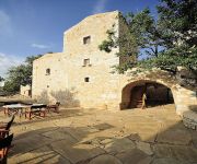
Citta dei Nicliani
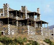
Porto Mani Suites
Videos from this area
These are videos related to the place based on their proximity to this place.
Myrto's Journey Journal to Mani
This is my journal from a five-day trip to Mani, Greece. It is a pre-made "smash" style journal. More about it you can see in my blog http://myrto-scrapblogging.blogspot.com/ Thanks for watching.
Σπήλαια Δηρού Μάνη Λακωνία by www.touristorama.com
Official Site:http://www.touristorama.com/ Σπήλαια Δηρού Μάνη Λακωνία by www.touristorama.com Ο Πύργος Διρού Λακωνίας αποτελεί διάσημο...
Diros Cave - 3D (cross eye - single camera)
The cave of Diros, part of an underground river, is located approximately 12 miles south of Areopolis, Lakonia, Greece. It is said to be the most beautiful lake cave in the world. The visit...
Pyrgos Dirou 2012
In der Tropfsteinhöhle bei Pyrgos Dirou, (Peloponnes, Griechenland) Mehr Fotos unter: http://www.griechenlandurlaub.net/Peloponnes/PirgosDirou/
Battle of Gaugamela.40000-Greeks VS 250000-Persians!
331 B.C. Battle of Gaugamela Alexander the Great vs 250.000 Persians.
'Posiedon's Horse'. A true story in a dream from the travels of Al Cazu, Alan Williamson.
Dreams of the island of Salamis. Footage of Greece shot on 8mm film, 1960's. More creations by Al Cazu, Alan Williamson at http://www.alcazu.com.
Ποδηλατωντας Γύθειο σκουταρι κοτρωνας
ΜΕ ΠΟΔΗΛΑΤΟ ΠΡΟΣ ΚΟΤΡΩΝΑ ΣΚΟΥΤΑΡΙ ΚΑΜΑΡΕΣ ΒΑΘΥ ΓΥΘΕΙΟ ΧΑΡΤΗΣ ΔΙΑΔΡΟΜΗΣ http://connect.garmin.com/activity/369520694.
TourTube Athens 1
Video turistico della città di Atene. Vieni a trovarci su tourtube.it, potrai guardare gratuitamente più di 3500 video turistici di tutto il Mondo! Touristic video of Athens. Come...
Videos provided by Youtube are under the copyright of their owners.
Attractions and noteworthy things
Distances are based on the centre of the city/town and sightseeing location. This list contains brief abstracts about monuments, holiday activities, national parcs, museums, organisations and more from the area as well as interesting facts about the region itself. Where available, you'll find the corresponding homepage. Otherwise the related wikipedia article.
Mani Peninsula
The Mani Peninsula (Μάνη, Mánē in Greek), also long known by its medieval name Maina or Maïna, is a geographical and cultural region in Greece. The capital city of Mani is Areopoli. Mani is the central peninsula of the three which extend southwards from the Peloponnese in southern Greece. To the east is the Laconian Gulf, to the west the Messenian Gulf. The peninsula forms a continuation of the Taygetos mountain range, the western spine of the Peloponnese.
Parasyros
Parasyros is a town in Mani, Laconia, Greece. Paraasyros is part of the community of Skoutari within the municipal unit of Gytheio. Parasyros is located SE of Areopoli, N of Gerolimenas and S of Gythio. Parasyros is situated in a dry-grass and a mountainous setting, farmlands are in valley areas and are rarely founded.
Battle of Vromopigada
The Battle of Vromopigada was fought between the Ottoman Turks and the Maniots of Mani in 1770. The location of the battle was in a plain between the two towns of Skoutari and Parasyros. The battle ended in a Greek victory.
Drosopigi, Laconia
Drosopigi is a town in Mani, Laconia, Greece. It is part of the municipal unit of Gytheio. Drosopigi is built on a mountain around 400 metres above sea level. Drosopigi has Maniot pyrgoi (towers). During World War II the Germans who were based at Gytheio bombarded the town with cannon fire. Now Drosopigi has a population of only 50 people. In the summer people who moved from Drosopigi to Athens come for vacation, but off-season Drosopigi is a deserted place.
Cape Matapan
Cape Matapan (Greek: Κάβο Ματαπάς, or Ματαπά in the Maniot dialect), also known as Cape Tainaron, or Cape Tenaro, is situated at the end of the Mani, Greece. Cape Matapan is the southernmost point of mainland Greece. It separates the Messenian Gulf in the west from the Laconian Gulf in the east.
Pyrgos Dirou
Pyrgos Dirou is a town in Mani, Laconia, Greece. It is part of the municipal unit of Oitylo. It is around 26 kilometres from Areopoli.
Limeni
Limeni is a village on the Mani Peninsula, Greece. Limeni is situated on Limeni Bay which is a mile or two north of Areopoli, the capital of the Deep Mani. It is part of the community of Aeropoli within the municipal unit of Oitylo.
Porto Kagio
Porto Kagio is a village in Mani, Greece. History writes that the year 1570, the Ottomans tried to build a castle there to block the sea route for the Venetians to their colonies in Crete and Cyprus. As soon as the Maniots heard of this, they besieged the castle. They also sent messengers to the Venetians for naval help. The Venetians arrived and the Turks surrendered. In 1670 the Ottomans returned and they built a new castle there. They were driven out of it by 1770 during the Orlov Revolt.
Kitta
Kitta or Koita, is a village in Mesa Mani, Laconia, Greece. It is part of the municipal unit of Oitylo. It is built on top of a hill, overlooking the sea. Kitta is known for its many Maniot pyrgoi (war towers). Partially abandoned, it now has a population of around 50. Much of the population left between World War II and today. It was the scene of Mani's last vendetta, in 1870 which required the intervention of the army, with artillery to halt it.
Tigani
Tigani (Τηγάνι) is a small peninsula in the landscape of Mani in southern Greece. The name is Greek for "frying pan". Tigani is surrounded by the sea except for a narrow strip of land that connects to the mainland. The ruins of a probable medieval castle can be found there. Its position and its walls made it extremely hard to capture.
Gerolimenas
Gerolimenas is a picturesque small coastal village at the southern end of the Mani Peninsula, in Laconia, in the Peloponnese, Greece. Τhe name, which means "Old Harbour", is thought to derive from the ancient "Ιερός Λιμήν" (Ieros Limen), meaning "Sacred Harbor". One of the remotest settlements in the Peloponnese, until the 1970s it was reached mainly by boat. In the past it was a major fishing center, and featured substantial infrastructure such as a shipyard, ice supplies, and a fish market.


