Safety Score: 2,8 of 5.0 based on data from 9 authorites. Meaning we advice caution when travelling to Greece.
Travel warnings are updated daily. Source: Travel Warning Greece. Last Update: 2024-08-13 08:21:03
Delve into Kalópyrgos
Kalópyrgos in Nomós Lakonías (Peloponnese) with it's 2 habitants is a town located in Greece about 127 mi (or 204 km) south-west of Athens, the country's capital town.
Time in Kalópyrgos is now 08:16 AM (Tuesday). The local timezone is named Europe / Athens with an UTC offset of 2 hours. We know of 9 airports closer to Kalópyrgos, of which one is a larger airport. The closest airport in Greece is Sparti Airport in a distance of 35 mi (or 56 km), North. Besides the airports, there are other travel options available (check left side).
There are several Unesco world heritage sites nearby. The closest heritage site in Greece is Archaeological Site of Mystras in a distance of 41 mi (or 66 km), North. In need of a room? We compiled a list of available hotels close to the map centre further down the page.
Since you are here already, you might want to pay a visit to some of the following locations: Gytheion, Kardamyli, Skala, Molaoi and Sparti. To further explore this place, just scroll down and browse the available info.
Local weather forecast
Todays Local Weather Conditions & Forecast: 15°C / 59 °F
| Morning Temperature | 10°C / 50 °F |
| Evening Temperature | 14°C / 57 °F |
| Night Temperature | 12°C / 54 °F |
| Chance of rainfall | 0% |
| Air Humidity | 51% |
| Air Pressure | 1023 hPa |
| Wind Speed | Light breeze with 5 km/h (3 mph) from North-East |
| Cloud Conditions | Clear sky, covering 4% of sky |
| General Conditions | Sky is clear |
Wednesday, 27th of November 2024
16°C (61 °F)
13°C (55 °F)
Sky is clear, light breeze, clear sky.
Thursday, 28th of November 2024
16°C (62 °F)
14°C (57 °F)
Sky is clear, light breeze, clear sky.
Friday, 29th of November 2024
17°C (62 °F)
15°C (58 °F)
Sky is clear, light breeze, clear sky.
Hotels and Places to Stay
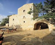
Citta dei Nicliani
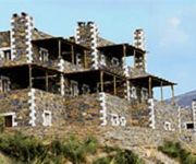
Porto Mani Suites
Videos from this area
These are videos related to the place based on their proximity to this place.
Ποδηλατωντας Γύθειο σκουταρι κοτρωνας
ΜΕ ΠΟΔΗΛΑΤΟ ΠΡΟΣ ΚΟΤΡΩΝΑ ΣΚΟΥΤΑΡΙ ΚΑΜΑΡΕΣ ΒΑΘΥ ΓΥΘΕΙΟ ΧΑΡΤΗΣ ΔΙΑΔΡΟΜΗΣ http://connect.garmin.com/activity/369520694.
Geo Routes Στις Πυλες του Αδη Spartans Legacy 960X720
Geo Routes & Aegean Routes are experiential cultural journeys, held under the auspices of the hnc for UNESCO, endeavoring to make the unexplored parts of G...
Grecja - Peloponez - półwysep Mani (Greece - Peloponnese - Mani Peninsula - Cape Tenaro) 1/2
Greece - Peloponnese - Mani - Cape Tenaro (part 1 of 2)
Rondje Peloponnesos 2, Porto Kayio
Sailing trip around the Peloponnesos. Zeilreis met de Rania rond de Peloponnesos (Griekenland) van 24 september tot 16 oktober 2005. Deel 2: Plitra - Porto Kayio - Kalamata - Koroni.
Marmari Paradise - 60 Λεπτά Ελλάδα - Alpha TV
H εκπομπή του Alpha «60' Ελλάδα» και ο Νίκος Μάνεσης συνεχίζουν το ταξίδι τους με δεύτερο σταθμό την Λακωνική...
ΜΑΝΗ - ΤΑΙΝΑΡΟΝ - ΝΕΚΡΟΜΑΝΤΕΙΟ
Περπατώ εκεί που περπάτησαν Θεοί και πρόγονοι . Εκεί που η Γη είναι σπαρμένη με κόκαλα Ηρώων . Εκεί που το...
MANI_trailer ΜΑΝΗ. ΤΡΑΧΙΑ & ΑΝΥΠΟΤΑΚΤΗ
Η εταιρεία παραγωγής ΚΙΝΗΤΡΟ motion pictures προχώρησε στην παραγωγή ντοκιμαντέρ με τίτλο "ΜΑΝΗ". Ήδη ολοκληρώθηκ...
10 χρονια Σπηλαιολογικός Ελληνικός Αθλητικός Σύλλογος
Γιωρτή για τα 10 χρόνια του ΣΕΛΑΣ στον Πύργο Δυρού. celebrations for the 10 years of SELAS, done at Pyrgos Dyrou.
Videos provided by Youtube are under the copyright of their owners.
Attractions and noteworthy things
Distances are based on the centre of the city/town and sightseeing location. This list contains brief abstracts about monuments, holiday activities, national parcs, museums, organisations and more from the area as well as interesting facts about the region itself. Where available, you'll find the corresponding homepage. Otherwise the related wikipedia article.
Kitta
Kitta or Koita, is a village in Mesa Mani, Laconia, Greece. It is part of the municipal unit of Oitylo. It is built on top of a hill, overlooking the sea. Kitta is known for its many Maniot pyrgoi (war towers). Partially abandoned, it now has a population of around 50. Much of the population left between World War II and today. It was the scene of Mani's last vendetta, in 1870 which required the intervention of the army, with artillery to halt it.
Gerolimenas
Gerolimenas is a picturesque small coastal village at the southern end of the Mani Peninsula, in Laconia, in the Peloponnese, Greece. Τhe name, which means "Old Harbour", is thought to derive from the ancient "Ιερός Λιμήν" (Ieros Limen), meaning "Sacred Harbor". One of the remotest settlements in the Peloponnese, until the 1970s it was reached mainly by boat. In the past it was a major fishing center, and featured substantial infrastructure such as a shipyard, ice supplies, and a fish market.


