Safety Score: 2,8 of 5.0 based on data from 9 authorites. Meaning we advice caution when travelling to Greece.
Travel warnings are updated daily. Source: Travel Warning Greece. Last Update: 2024-08-13 08:21:03
Touring Posidhonía
The district Posidhonía of Loutráki in Nomós Korinthías (Peloponnese) is a subburb located in Greece about 41 mi west of Athens, the country's capital place.
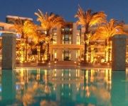
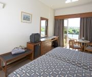
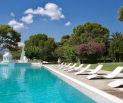
Need some hints on where to stay? We compiled a list of available hotels close to the map centre further down the page.
Being here already, you might want to pay a visit to some of the following locations: Corinth, Zevgolatio, Kiato, Nemea and Xylokastro. To further explore this place, just scroll down and browse the available info.
Local weather forecast
Todays Local Weather Conditions & Forecast: 23°C / 73 °F
| Morning Temperature | 16°C / 61 °F |
| Evening Temperature | 17°C / 63 °F |
| Night Temperature | 16°C / 62 °F |
| Chance of rainfall | 0% |
| Air Humidity | 45% |
| Air Pressure | 1007 hPa |
| Wind Speed | Gentle Breeze with 8 km/h (5 mph) from South-East |
| Cloud Conditions | Overcast clouds, covering 100% of sky |
| General Conditions | Light rain |
Friday, 22nd of November 2024
21°C (69 °F)
18°C (65 °F)
Sky is clear, moderate breeze, clear sky.
Saturday, 23rd of November 2024
18°C (64 °F)
10°C (50 °F)
Scattered clouds, strong breeze.
Sunday, 24th of November 2024
11°C (52 °F)
8°C (46 °F)
Sky is clear, moderate breeze, clear sky.
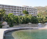
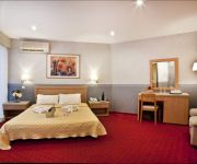
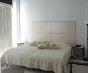
Hotels and Places to Stay
Wyndham Loutraki Poseidon Resort
Club Hotel Casino Loutraki
Hotel King Saron
Kalamaki Beach
Hotel Pappas
Prime Isthmus Hotel
Diolkos Studios
Marko
Galaxy Hotel
Acropolis
Videos from this area
These are videos related to the place based on their proximity to this place.
Αρχαίος Δίολκος - Ancient Diolkos 2009 (Dec.29) - (Corinth, Greece)
Petition for Saving & Restoring Diolkos: http://www.thepetitionsite.com/takeaction/870/477/005/. This unique monument -usually dated around 600 B.C.- which served for the transportation of...
Corinth Canal by Boat
Das Video von der Fahrt durch den Kanal von Korinth mit einem Ausflugsboot (Teilstrecke) gibt einen guten Eindruck davon, wie faszinierend es ist, durch den "Corinth Canal" oder auf Deutsch:...
Corinth Canal [720p]
Location: Greece (Ελλάδα) Korinthia Cam: Canon EOS 1100D [GPS: 37°57'0.29"N / 22°57'43.70"E] Elin Poseidon transiting Corinth Canal.
Corinth Canal: overlooking Diolkos - 31july2011
The deterioration of Ancient Diolkos has been going on for decades right at the feet -and in direct view- of one of the two control towers of the Corinth Canal (the one at the Corinthian Gulf)....
Corinth Canal from Bridge
The Corinth Canal (Greek: Διώρυγα της Κορίνθου) is a canal that connects the Gulf of Corinth with the Saronic Gulf in the Aegean Sea. It cuts through the narrow Isthmus of...
Korinthoszi-csatorna, Διώρυγα της Κορίνθου, Corinth canal
Hajóval át a korinthoszi csatornán. Görögország, Greece, Hellas, Ελλάδα A Korinthoszi-csatorna 6343 méter hosszú mesterséges víziút az Égei-tenger és a Jón-tenger között,...
threesurfers - dirt jumps ( Loutraki )
Μας πειρε 1 μηνα περιπου δουλευοντας τα σαββατα και κυριακες:D ειμσταν μονο 3 παιδια με ενα καροτσακι 2 τσαπε...
WRC Rally Acropolis 2013 Service Park Loutraki Inside The Motorhome Of Citroen WRC Team
WRC Rally Acropolis 2013 Service Park Loutraki Inside The Motorhome Of Citroen WRC Team 01-06-2013 Ευχαριστώ το www.msfree.gr για την πρόσκληση VIP που μου παρε...
Videos provided by Youtube are under the copyright of their owners.
Attractions and noteworthy things
Distances are based on the centre of the city/town and sightseeing location. This list contains brief abstracts about monuments, holiday activities, national parcs, museums, organisations and more from the area as well as interesting facts about the region itself. Where available, you'll find the corresponding homepage. Otherwise the related wikipedia article.
Corinth Canal
The Corinth Canal (Greek: Διώρυγα της Κορίνθου) is a canal that connects the Gulf of Corinth with the Saronic Gulf in the Aegean Sea. It cuts through the narrow Isthmus of Corinth and separates the Peloponnesian peninsula from the Greek mainland, thus effectively making the former an island. The builders dug the canal through the Isthmus at sea level; no locks are employed. It is 6.4 kilometres in length and only 21.3 metres wide at its base, making it unpassable for most modern ships.
Loutraki
Loutraki is a seaside resort on the Gulf of Corinth, in Corinthia, Greece. It is located 65 km west of Athens and 6 km northeast of Corinth. Loutraki is the seat of the municipality Loutraki-Agioi Theodoroi. The town is well known for its vast natural springs and its therapeutic spas.
Isthmus of Corinth
The Isthmus of Corinth is the narrow land bridge which connects the Peloponnese peninsula with the rest of the mainland of Greece, near the city of Corinth. The word "isthmus" comes from the Ancient Greek word for "neck" and refers to the narrowness of the land. The Isthmus was known in the ancient world as the landmark separating Peloponnese from mainland of Greece. Theseus, on his way to Athens erected a pillar on the Isthmus of Corinth, which bears two inscriptions.
Loutra Elenis
Loutra Elenis is a village in Corinthia, Greece. It is situated on the coast of the Saronic Gulf, about 10 km southeast of Corinth. It is part of the community of Galataki within the municipal unit of Saronikos. It is situated on the Greek National Road 70 between Corinth and Epidaurus.
Kechries
Kechries is a village in the municipality of Corinth in Corinthia in Greece. It is part of the community of Xylokeriza. It is located about 7 kilometres southeast of Corinth and 7 kilometres southeast of the Epidavros interchange with GR-8A/E94, north of Galataki and Kato Almyri, east of Examilia, southeast of Xylokeriza, south of Kiras Vrysi and west/southwest of modern Isthmia.
Lechaio
Lechaio is a village in the municipality of Assos-Lechaio in Corinthia. Distances are about 4 to 5 km W of Corinth, SE of Kiato. GR-7 is west of the community hall.
Acrocorinth
Acrocorinth, "Upper Corinth", the acropolis of ancient Corinth, is a monolithic rock overseeing the ancient city of Corinth, Greece. "It is the most impressive of the acropoleis of mainland Greece," in the estimation of George Forrest. Acrocorinth was continuously occupied from archaic times to the early 19th century.
Diolkos
The Diolkos (Δίολκος, from the Greek διά, dia "across" and ὁλκός, holkos "portage machine") was a paved trackway near Corinth in Ancient Greece which enabled boats to be moved overland across the Isthmus of Corinth. The shortcut allowed ancient vessels to avoid the long and dangerous circumnavigation of the Peloponnese peninsula.
Zevgolateio
Zevgolateio is a town in the municipality Velo-Vocha, Corinthia, Greece, which is located 99 kilometers southwest of Athens. In 2004, the town had a population of 4,119.
Battle of Lechaeum
The Battle of Lechaeum (391 BC) was an Athenian victory in the Corinthian War. In the battle, the Athenian general Iphicrates took advantage of the fact that a Spartan hoplite regiment operating near Corinth was moving in the open without the protection of any missile throwing troops. He decided to ambush it with his force of javelin throwers, or peltasts.
Alkyonides Gulf
The Alkyonides Gulf (Greek: Κόλπος Αλκυονίδων - Kolpos Alkyonidon) is a bay that connects with the Gulf of Corinth to the west. The bay is approximately 20 to 25 km long and 20 km wide. It stretches from Aigosthena to Cape Trachilos from east to west and from Cape Trachilos to the peninsula of Perachora from north to south. Three regioanl units surround the gulf: Corinthia to the south, West Attica to the east and Boeotia to the north.
Pisia
Pisia is a village and a community in northeastern Corinthia, Greece. Part of the municipality Loutraki-Agioi Theodoroi, it is situated south of the Alkyonides Gulf. The community consists of the villages Pisia, Agia Sotira, Vamvakes, Mavrolimni and Schinos. Agia Sotira, Vamvakes and Mavrolimni are situated on the coast.
Athikia
Athikia (Αθίκια) is the seat of the former municipality of Saronikos, located in the regional unit of Corinthia in Greece. Athikia has a population of approximately 2000 and is located 15 km South of the city of Corinth.
Perigiali
Perigiali is a seaside village, the seat of the municipality of Assos-Lechaio, in Corinthia, Greece. Its population at the 2001 census was 1,760.
Temple of Isthmia
The Temple of Isthmia is an ancient Greek temple on the Isthmus of Corinth dedicated to the god Poseidon and built in the Archaic Period. It is about 16 kilometers east of ancient Corinth. It appears to have been constructed in the seventh century BC though was later destroyed in 470 BC and rebuilt as the Temple of Poseidon at Isthmia in c. 440 BC during the Classical period.
Ancient Corinth
Corinth, or Korinth was a city-state on the Isthmus of Corinth, the narrow stretch of land that joins the Peloponnesus to the mainland of Greece, roughly halfway between Athens and Sparta. The modern town of Corinth is located approximately 5 kilometres northeast of the ancient ruins.
Archaeological Museum of Ancient Corinth
The Archaeological Museum of Ancient Corinth is a museum in Ancient Corinth, Greece. The museum houses a large collection of artifacts of the local archaeological site and smaller sites in the neighboring area, such as Korakou, Gonia, and Acrocorinth. The artifacts, which were systematically recovered beginning in 1896 by the Corinth Excavations, illustrate much about Ancient Corinth through Greek, Roman and Byzantine rule. Exhibits include statues, mosaics, pottery and sarcophagi.
Historical and Folklore Museum of Corinth
The Historical and Folklore Museum of Corinth is a museum in Corinth, Greece.
Vrachati
Vrachati is a beach town in the municipal unit of Vocha, Corinthia, Greece, population 2,951 (2001). It is located 12km west of Corinth, and is a very popular destination for day trippers from Athens. Its beach has been awarded with the blue flag from the European Union. Vrachati is located just inside the entrance of the Gulf of Lechaio, a small sub-gulf off the Gulf of Corinth. Temperatures in July regularly reach 37c to 38c and on occasion surpass 40c.
Oneia Mountains
The Oneia Mountains (Greek: Όνεια Όρη or Oneia Ori) are a low mountain range in Corinthia, northeastern Peloponnese, Greece. The range extends 9km from west to east, starting west of the village of Solomos, passing south of the village of Xylokeriza and ending near the Bay of Kechries, on the Saronic Gulf. The highest peaks are Profitis Ilias, at 581m, and Oxy, at 562 meters. The other two peaks measure 507m and 229m respectively.
Corinth railway station
Corinth Railway Station (Greek: Σιδηροδρομικός Σταθμός Κορίνθου, Sidirodromikos Stathmos Korinthou) is a railway station in Corinth, Greece. The new station is on the outskirts of Corinth town, near Examilia. The former central railway station of Corinth, near the harbour, is disused. The new station is on the Proastiakos, the Athens suburban railway run by TrainOSE, connecting directly with the city of Athens and with Athens International Airport.
Corinth railway station (old)
The old railway station in Corinth was a station on the Piraeus–Patras line. It closed on 9 July 2007, having been replaced by a new station on a new line.
Corinth Excavations
The Corinth Excavations by the American School of Classical Studies at Athens began in 1896 and have continued with little interruption until today. Restricted by the modern village of Ancient Corinth, which directly overlies the ancient city, the main focus of School investigations has been on the area surrounding the mid-6th century B.C. Temple of Apollo. This dominating monument has been one of the only features of the site visible since antiquity.





!['Corinth Canal [720p]' preview picture of video 'Corinth Canal [720p]'](https://img.youtube.com/vi/oebqmdIjExc/mqdefault.jpg)


