Safety Score: 2,8 of 5.0 based on data from 9 authorites. Meaning we advice caution when travelling to Greece.
Travel warnings are updated daily. Source: Travel Warning Greece. Last Update: 2024-08-13 08:21:03
Delve into Skáfi
Skáfi in Chania (Crete) is located in Greece about 184 mi (or 295 km) south of Athens, the country's capital town.
Current time in Skáfi is now 04:27 AM (Saturday). The local timezone is named Europe / Athens with an UTC offset of 2 hours. We know of 8 airports close to Skáfi, of which one is a larger airport. The closest airport in Greece is Chania International Airport in a distance of 25 mi (or 40 km), North-East. Besides the airports, there are other travel options available (check left side).
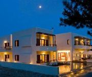
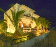
If you need a hotel, we compiled a list of available hotels close to the map centre further down the page.
While being here, you might want to pay a visit to some of the following locations: Palaiochora, Gerani, Kissamos, Chania and Chora Sfakion. To further explore this place, just scroll down and browse the available info.
Local weather forecast
Todays Local Weather Conditions & Forecast: 20°C / 68 °F
| Morning Temperature | 19°C / 65 °F |
| Evening Temperature | 16°C / 61 °F |
| Night Temperature | 13°C / 56 °F |
| Chance of rainfall | 3% |
| Air Humidity | 72% |
| Air Pressure | 1018 hPa |
| Wind Speed | Strong breeze with 20 km/h (12 mph) from South |
| Cloud Conditions | Broken clouds, covering 83% of sky |
| General Conditions | Light rain |
Sunday, 24th of November 2024
14°C (58 °F)
11°C (53 °F)
Sky is clear, strong breeze, clear sky.
Monday, 25th of November 2024
15°C (60 °F)
13°C (55 °F)
Sky is clear, moderate breeze, clear sky.
Tuesday, 26th of November 2024
16°C (61 °F)
14°C (58 °F)
Sky is clear, moderate breeze, clear sky.
Hotels and Places to Stay
Monastery Estate
Syia Hotel
Idomeneas Apartments & Studios
Videos from this area
These are videos related to the place based on their proximity to this place.
Kantanos gorge bike tour p2 Podilatreis
A bike tour organised by podilatreis crossing the Kantanos gorge where the quarry is slowly destroying the face of the gorge.
Sunset over Archon Villa, timelapse
My first experiments with timelapse photography: Sunset over Archon Villa, Crete.
Evening falling over Archon villa
Evening falling over Archon villa, Prodromi, Crete. My first experiments into timelapse photography...
MiMEtoLITHs Trailer
This film travels to beautiful/mystical Crete, to closely look at Mimetoliths (rocks and stones that imitate living beings). It embraces the Muses that have languished petrified on the sacred...
Creta, la gola di Agia Irini - Crete, Agia Irini gorge
leggi di più su: - read more at: http://camperistas.com.
Sougia Ride 2
Another clip onboard my Triumph Tiger 955i on the way from Sougia to Chania, through a small village, with some company this time !
Sougia Tiger Ride
onboard my 2005 Triumph Tiger 955i from Sougia to Chania ! a bit out of focus but you'll love the sound of it ! ;)
Videos provided by Youtube are under the copyright of their owners.
Attractions and noteworthy things
Distances are based on the centre of the city/town and sightseeing location. This list contains brief abstracts about monuments, holiday activities, national parcs, museums, organisations and more from the area as well as interesting facts about the region itself. Where available, you'll find the corresponding homepage. Otherwise the related wikipedia article.
Argastiri
Argastiri is a small village in Chania regional unit on the island of Crete, Greece. It has 35 residents, its elevation is 650 meters above sea level and it lies 48 km south of Chania. It is within the municipal unit of East Selino (Anatoliko Selino). A battle took place in Argastiri during the Greek War of Independence against the Turks. 450 Greeks under Nikiforos Hatzidakis lost the battle by 2000 Turks under Kaouris, the aga of Kantanos. Nikiforos Hatzidakis was killed.
Rodovani
Rodovani is a community and a small village in Chania regional unit on the island of Crete, Greece. It is part of the municipal unit of East Selino (Anatoliko Selino). The community consists of the following villages (population in 2001): Rodovani, pop. 122 Agriles, pop. 45 Kamaria, pop. 37 Livada, pop. 39 Maza, pop. 93 Near Rodovani is located the ancient city of Elyros.
Elyros
Elyros (Ἔλυρος in Greek) is an ancient city, located in southwest Crete, in Kefala Hill, near the village Rodovani and is presently unexcavated. Elyros was flourishing at least as early as the Greek Classical Period, e.g. 500 to 350 BC. In the Classical Period Elyros was the most important ancient city in southwestern Crete, having about 16,000 inhabitants. It was an industrial and commercial city with large weapons production. Syia and Lissos were its harbours.
Skafi
Skafi is a community and a small village in Chania regional unit on the island of Crete, Greece. It is part of the municipal unit of East Selino (Anatoliko Selino). The community consists of the following villages (population in 2001): Skafi, pop. 70 Argastiri, pop. 35 Pera Skafi, pop. 62
Epanochori, Chania
Epanochori is a community and a small village in Chania regional unit on the island of Crete, Greece. It is part of the municipal unit of East Selino (Anatoliko Selino). The community consists of the following villages (population in 2001): Epanochori, pop. 114 Agia Eirini, pop. 84 Prines, pop. 133 Seliniotikos Gyros, pop. 0 Tsiskiana, pop. 30 Agia Eirini is the starting point of the Agia Eirini Gorge.
Maza, Crete
Maza is a small village in Chania regional unit on the island of Crete, Greece. It has 93 residents and it's within the municipal unit of Kryonerida. It has a tiny church with interesting frescos next to a small taverna with (according to local legend) a 500 year old olive tree adjacent. The taverna owner currently (2012) has the key to the church and will show you inside on request. There is a small parking area behind the church. 35°21'26.31"N 24°12'48.22"E
Temenia
Temenia is a community and a small village in Chania regional unit on the island of Crete, Greece. It is part of the municipal unit of East Selino (Anatoliko Selino). The community consists of the following villages (population in 2001): Temenia, pop. 77 Pappadiana, pop. 14 Stratoi, pop. 6 Near Temenia is located the ancient city of Yrtakina. In Temenia also there is a spring-spa. Because of the healthy water, there is a small hotel and a refreshments factory in Temenia.
Kampanos
Kampanos is a community and a village in Chania regional unit on the island of Crete, Greece. It is the seat of the municipal unit of East Selino (Anatoliko Selino). The community consists of the following villages (population in 2001): Kampanos, pop. 205 Maralia, pop. 40 The village is in a basin surrounded by very old olive oil trees, close to the village an old school is located which is the town hall of East Selino. The village is 52km from Chania city center,about 1,10 hours


