Safety Score: 2,8 of 5.0 based on data from 9 authorites. Meaning we advice caution when travelling to Greece.
Travel warnings are updated daily. Source: Travel Warning Greece. Last Update: 2024-08-13 08:21:03
Discover Kostadianá
The district Kostadianá of Koléni in Chania (Crete) is a subburb in Greece about 172 mi south of Athens, the country's capital city.
If you need a hotel, we compiled a list of available hotels close to the map centre further down the page.
While being here, you might want to pay a visit to some of the following locations: Kissamos, Gerani, Palaiochora, Chania and Vryses. To further explore this place, just scroll down and browse the available info.
Local weather forecast
Todays Local Weather Conditions & Forecast: 21°C / 71 °F
| Morning Temperature | 18°C / 65 °F |
| Evening Temperature | 21°C / 69 °F |
| Night Temperature | 19°C / 66 °F |
| Chance of rainfall | 0% |
| Air Humidity | 65% |
| Air Pressure | 1016 hPa |
| Wind Speed | Moderate breeze with 13 km/h (8 mph) from North |
| Cloud Conditions | Clear sky, covering 2% of sky |
| General Conditions | Sky is clear |
Saturday, 23rd of November 2024
19°C (67 °F)
14°C (57 °F)
Light rain, strong breeze, overcast clouds.
Sunday, 24th of November 2024
14°C (57 °F)
12°C (53 °F)
Sky is clear, high wind, near gale, clear sky.
Monday, 25th of November 2024
14°C (57 °F)
12°C (54 °F)
Sky is clear, fresh breeze, clear sky.
Hotels and Places to Stay
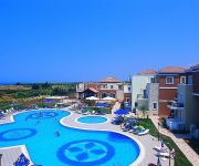
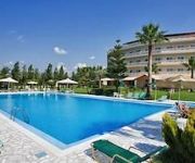
Maria Villas
Grand Bay Beach Resort Exclusive Adults
Cormoranos Apartments
Azure Beach
Golden Rose Suites
Chrispy World
Eleftheria Hotel
Kissamos Windmills
Villa Polichna
Sunny Bay Hotel
Videos from this area
These are videos related to the place based on their proximity to this place.
Kastania Lodge , Kastelli Kissamos, West Kreta HD (Western Crete)
Een kort videoverslag van onze vakantie op Kreta, eind april 2009 , in de Kastania Lodge , leuk, sfeervol, kleinschalig, bij Kissamos, voor wie van rust en een landelijke omgeving houdt, (a...
Карнавал на Крите в Киссамос (Carnival in Crete in Kissamos)
Карнавал на Крите - яркое зрелище! Танцы, песни и разнообразные движущиеся платформы самых причудливых...
Urban Exploration - Villa Trevizan (Kissamos, Greece)
Ruine einer venizianischen Villa nahe Kissamos aus dem 17. Jahrhundert. Video: navik.de Audio: Eschberg.
KISSAMOS DIVING CENTER
10\02\2015 9-10 Μποφώρ βοριάς στο μικρό λιμάνι Κισσάμου με το ανάλογο κύμα χτές βράδυ έσπασαν τα σχοινιά από δύο...
Κίσσαμος 12Αυγ.2012 Μαρτσάκης Μαρεντάκης Κωστής κ.α
Μετά απο ένα ολονύχτιο γλέντι στο Castello στη Κίσσαμο τα όργανα πήραν νέοι βιολάτορες και λαγουθιέρηδες και...
West Coast beaches - Παραλίες της Δυτικής Κρήτης
West Coast beaches - Παραλίες της Δυτικής Κρήτης (πολύ κοντά στην Κίσαμο) Δυτική Κρήτη - Κίσαμος kissamos2010.blogspot.com...
Crete | Kastelli town
Kastelli lies on a wide bay between two sharp peninsulas in northwest Crete. Behind it lies a fertile plain that gives Kastelli the best of both the maritime and rustic worlds. The beach at...
Videos provided by Youtube are under the copyright of their owners.
Attractions and noteworthy things
Distances are based on the centre of the city/town and sightseeing location. This list contains brief abstracts about monuments, holiday activities, national parcs, museums, organisations and more from the area as well as interesting facts about the region itself. Where available, you'll find the corresponding homepage. Otherwise the related wikipedia article.
Maleme
Maleme is a town and airport 16 km to the west of Chania, in North Western Crete, Greece. It is located in Platanias municipality, in Chania regional unit. Maleme has a few large hotels and several pleasant apartments close to the beach and some bars and a discothèque at the western end. Its beach is made of fine pebbles and is popular though often less crowded than the beaches of Gerani, Agia Marina and Platanias.
No. 30 Squadron RAF
No. 30 Squadron of the Royal Air Force operates the second generation C-130J Hercules from RAF Brize Norton, Oxfordshire. The squadron operates alongside No. 24 Squadron and No. 47 Squadron all flying the Hercules.
No. 33 Squadron RAF
No. 33 Squadron of the Royal Air Force operates the Puma HC.1 from RAF Benson, Oxfordshire.
Drapanias
Drapanias is a small village in northwestern Crete, Chania (regional unit). It is the principal town in the Cretan municipality of Mythimna. It was built in the ruins of the ancient town of Mythimna. The locals describe Drapanias in three parts: Drapanias, Ano Drapanias ("upper Drapanias") and Kato Drapanias ("lower Drapanias"). This part of Drapanias can be accessed via the main road to Kissamos.
Argastiri
Argastiri is a small village in Chania regional unit on the island of Crete, Greece. It has 35 residents, its elevation is 650 meters above sea level and it lies 48 km south of Chania. It is within the municipal unit of East Selino (Anatoliko Selino). A battle took place in Argastiri during the Greek War of Independence against the Turks. 450 Greeks under Nikiforos Hatzidakis lost the battle by 2000 Turks under Kaouris, the aga of Kantanos. Nikiforos Hatzidakis was killed.
Phalasarna
Falasarna/Phalasarna is an ancient Greek harbor town on the northwest coast of Crete. The currently visible remains of the city were built around 333 BC and include several imposing sandstone towers and bastions, with hundreds of meters of fortification walls protecting the town, and a closed harbor, meaning a harbor protected on all sides by city walls. The harbor is ringed by stone quays with mooring stones, and connected to the sea through two artificial channels.
Skafi
Skafi is a community and a small village in Chania regional unit on the island of Crete, Greece. It is part of the municipal unit of East Selino (Anatoliko Selino). The community consists of the following villages (population in 2001): Skafi, pop. 70 Argastiri, pop. 35 Pera Skafi, pop. 62
Epanochori, Chania
Epanochori is a community and a small village in Chania regional unit on the island of Crete, Greece. It is part of the municipal unit of East Selino (Anatoliko Selino). The community consists of the following villages (population in 2001): Epanochori, pop. 114 Agia Eirini, pop. 84 Prines, pop. 133 Seliniotikos Gyros, pop. 0 Tsiskiana, pop. 30 Agia Eirini is the starting point of the Agia Eirini Gorge.
Gerani, Crete
Gerani is a village situated in the municipality of Platanias, Crete, Greece. It has a population of 1222 (according to the 2001 census) and it covers a 6,398 square meters . It is 14 kilometers from Chania, right next to the sea. The Gerani beach is awarded with the Blue Flag. There plenty of traditional tavernas, car rental companies, supermarkets and hotels in the village.
Polyrrhenia
Polyrrhenia (modern Greek: Πολυρρηνία - Polyrrinia) is a village and an archaeological site in the Chania regional unit of Crete. It is some 7km inland from Kissamos. It was an important Archaic Period settlement co-temporaneous with Lato and Prinias. Polyrrhenia was an important hilltop town, whose territory occupied the whole western extremity of Crete. According to Strabo, it was founded by Achaeans and Lacedaemonians.
Zympragou
Zympragou is a village in Chania regional unit of the island of Crete, Greece. It was part of the former Kissamos Province and belongs to the municipality of Platanias. It has 127 residents. The village is located at an elevation of about 350 meters above sea level. It lies in an agricultural region with significant production of olive oil. It is 35 km southwest of Chania. The biggest church of the village is the church of Saint George. The village is about 3 km south of the town of Voukolies.
Olive tree of Vouves
The Olive tree of Vouves is an olive tree in the village of Ano Vouves in the municipal unit of Kolymvari in Chania regional unit, Crete, Greece. It is probably one of the oldest olive trees in the world and still produces olives today. The use of tree ring analysis has proven the tree to be at least 2000 years old. On the other end of the scale, scientists from the University of Crete have estimated it to be 4,000 years old. The trunk has a perimeter of 12.5 m and a diameter of 4.6 m.
Floria
Floria is a small village in the Selino province of southwest Crete, Greece. Floria is part of the Kandanos municipality and, according to the latest census, has around 60 inhabitants. On 23 May 1941 and while the Battle of Crete was unfolding, Floria was the location of a fierce battle between advancing German troops and the local population, who spontaneously decided to resist them.
Maleme Airport
Maleme Airport is an airport situated at Maleme, Crete. It has two runways (13/31 and 03/21) with no lights. The airport has closed for commercial aviation, but the Chania Aeroclub continues to use it. The airport operated until 1959 as the main public airport of Chania. As of 2012 the Hellenic Air Force makes limited use of the facility. Maleme Airport became a historic World War II site when many German parachutists landed there in May 1941 as part of the Battle of Crete.
Moni Gonia Monastery
Moni Gonia Monastery, Monastery of Our Lady of Gonia or Monastery of Panaghia Odigitria is an orthodox monastery located 1 km north of Kolymvari and some 26 km from Chania, on the coast of the south-east Rodopos peninsula in Crete, Greece, overlooking the Gulf of Chania.
Razing of Kandanos
The Razing of Kandanos (Greek: Καταστροφή της Καντάνου) or the Holocaust of Kandanos (Greek: Ολοκαύτωμα της Καντάνου) refers to the complete destruction of the village of Kandanos in Western Crete and the killing of about 180 of its inhabitants on 3 June 1941 by German occupying forces during World War II. It was ordered by Generaloberst Kurt Student in reprisal for the participation of the local population in the Battle of Crete that had held advancing German soldiers for two days.
Massacre of Kondomari
The Massacre of Kondomari (Greek: Σφαγή στο Κοντομαρί) refers to the execution of male civilians from the village of Kondomari in Crete by an ad hoc firing squad consisting of German paratroopers on 2 June 1941 during World War II. The shooting was the first of a long series of mass reprisals in Crete. It was orchestrated by Generaloberst Kurt Student, in retaliation for the participation of Cretans in the Battle of Crete which had ended with the surrender of the island only two days earlier.
Gramvousa
Gramvousa also Grampousa (Greek: Γραμβούσα or Γραμπούσα, further names include Akra, Cavo Buso, Cavo Bouza, Garabusa and Grabusa) refers to two small uninhabited islands off the coast of north-western Crete in the regional unit of Chania. They are administered from the municipality of Kissamos.
Arnaouti
Arnaouti is an islet on the northern coast of Crete in the Aegean Sea. It is just south of the island of Imeri Gramvousa and is located between Imeri Gramvousa and Valenti rock. Administratively, it is located within the municipality of Kissamos, in Chania regional unit.
Valenti rock
Valenti is a rock close to the northwestern coast of Crete in the Aegean Sea. It is just south of the island of Imeri Gramvousa and the islet of Arnaouti. Administratively, it is located within the municipality of Kissamos, in Chania regional unit. Valenti is mentioned in poems and mantinades and usually with Gramvousa.
Petalida
Petalida, also known as Xera (pronounced Ksera), is an islet close to the northern coast of Crete in the Aegean Sea. It is located between the island of Imeri Gramvousa and the mainland. Administratively, it is located within the municipality of Kissamos, in Chania regional unit.
Praso (Kissamos)
Praso, also known as Prasonisi (Greek: Πρασονήσι, "leek island"), is an islet close to the eastern coast of Crete, and south-west of the islet of Koursaroi, in the Aegean Sea. Administratively, it is located within the municipality of Kissamos, in Chania regional unit.
Petalouda
Petalouda is an uninhabited islet off the coast of western Crete in the Aegean Sea. Administratively, it is part of the municipality Kissamos, in Chania regional unit.


