Safety Score: 2,8 of 5.0 based on data from 9 authorites. Meaning we advice caution when travelling to Greece.
Travel warnings are updated daily. Source: Travel Warning Greece. Last Update: 2024-08-13 08:21:03
Touring Káto Karés
The district Káto Karés of Karés Kissámou in Chania (Crete) is a subburb located in Greece about 174 mi south of Athens, the country's capital place.
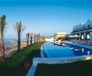
Need some hints on where to stay? We compiled a list of available hotels close to the map centre further down the page.
Being here already, you might want to pay a visit to some of the following locations: Gerani, Kissamos, Palaiochora, Chania and Vryses. To further explore this place, just scroll down and browse the available info.
Local weather forecast
Todays Local Weather Conditions & Forecast: 15°C / 59 °F
| Morning Temperature | 12°C / 53 °F |
| Evening Temperature | 15°C / 58 °F |
| Night Temperature | 16°C / 61 °F |
| Chance of rainfall | 0% |
| Air Humidity | 55% |
| Air Pressure | 1023 hPa |
| Wind Speed | Moderate breeze with 13 km/h (8 mph) from South-West |
| Cloud Conditions | Clear sky, covering 0% of sky |
| General Conditions | Sky is clear |
Wednesday, 27th of November 2024
17°C (62 °F)
14°C (57 °F)
Light rain, gentle breeze, few clouds.
Thursday, 28th of November 2024
18°C (64 °F)
15°C (59 °F)
Sky is clear, light breeze, clear sky.
Friday, 29th of November 2024
17°C (63 °F)
16°C (61 °F)
Sky is clear, light breeze, clear sky.
Hotels and Places to Stay
Grand Bay Beach Resort Exclusive Adults
Maria Villas
Louis Creta Princess
Azure Beach
Sunny Suites
Villa Rita Apartments
Tripodis Apartments
Lycasti Maisonettes
Cormoranos Apartments
Louladakis Apartments
Videos from this area
These are videos related to the place based on their proximity to this place.
Kreta Teil2 - Crete Part2 Griechenland Travel Channel
Kreta, Teil 2 http://www.myvideomedia.de english see below [dt.] Begleiten Sie uns in die Hafenstädte Chania, 100 km westlich von Heraklion, und Rethymno. Im kleinen Bergdorf Krasi, kurz...
Grand Bay Beach Resort
This is the Grand Bay Beach Resort in Kolymbari, Crete. It's probably the best room in the hotel, and we got it.
First ebike ride NiMh battery pack 36v 15Ah part 1
First ride with ebike ! battery holder now is beter than this ... :-p πρώτη βόλτα με το ηλεκτρικό ποδήλατο .. η θέση των μπαταριών έχει τώρα...
Cavo Spada Luxury Resort & Spa 5★ Hotel Crete Greece
Learn more about Cavo Spada Luxury Resort & Spa 5☆ Hotel Crete Greece at http://angelonyx.com/hotels/cavo-spada-luxury-resort-spa/ All videos has shooting on the same scenario for ease of...
δειτε τον μεγαλύτερο ντάκο του κόσμου ( ΦΟΥΡΝΟΣ ΦΟΥΡΑΚΗΣ ) XANIA ΚΡΗΤΗ
Ίσως να μην είναι το πιο περίεργο ή το πιο εντυπωσιακό ρεκόρ του κόσμου σίγουρα όμως διεκδικεί με αξιώσεις...
Minoan Homes - Property Development & Construction, Kolimbari, Crete-Greece
Minoan Homes is a property developer and construction company which currently operates in North West of Chania in the area of Kolimbari. Our property portfolio includes exclusive villas with...
Недвижимость на продажу в Греции - Leptos Estates
Наши объекты в Греции расположены на таких популярных Греческих островах как Крит, Парос и Санторини и...
Videos provided by Youtube are under the copyright of their owners.
Attractions and noteworthy things
Distances are based on the centre of the city/town and sightseeing location. This list contains brief abstracts about monuments, holiday activities, national parcs, museums, organisations and more from the area as well as interesting facts about the region itself. Where available, you'll find the corresponding homepage. Otherwise the related wikipedia article.
Maleme
Maleme is a town and airport 16 km to the west of Chania, in North Western Crete, Greece. It is located in Platanias municipality, in Chania regional unit. Maleme has a few large hotels and several pleasant apartments close to the beach and some bars and a discothèque at the western end. Its beach is made of fine pebbles and is popular though often less crowded than the beaches of Gerani, Agia Marina and Platanias.
No. 30 Squadron RAF
No. 30 Squadron of the Royal Air Force operates the second generation C-130J Hercules from RAF Brize Norton, Oxfordshire. The squadron operates alongside No. 24 Squadron and No. 47 Squadron all flying the Hercules.
No. 33 Squadron RAF
No. 33 Squadron of the Royal Air Force operates the Puma HC.1 from RAF Benson, Oxfordshire.
Drapanias
Drapanias is a small village in northwestern Crete, Chania (regional unit). It is the principal town in the Cretan municipality of Mythimna. It was built in the ruins of the ancient town of Mythimna. The locals describe Drapanias in three parts: Drapanias, Ano Drapanias ("upper Drapanias") and Kato Drapanias ("lower Drapanias"). This part of Drapanias can be accessed via the main road to Kissamos.
Argastiri
Argastiri is a small village in Chania regional unit on the island of Crete, Greece. It has 35 residents, its elevation is 650 meters above sea level and it lies 48 km south of Chania. It is within the municipal unit of East Selino (Anatoliko Selino). A battle took place in Argastiri during the Greek War of Independence against the Turks. 450 Greeks under Nikiforos Hatzidakis lost the battle by 2000 Turks under Kaouris, the aga of Kantanos. Nikiforos Hatzidakis was killed.
Alikianos
Alikianos is the head village of the Mousouri municipal unit in Chania regional unit, Crete located approximately 12.5 kilometers southwest of Chania. Alikianos is best known outside the island for the fierce fighting which took place there during the 1941 Battle of Crete, during which the 8th Greek Regiment (Provisional) helped cover the retreat of the 10th New Zealand Division, to which it was attached.
Gulf of Chania
The Gulf of Chania is an embayment of the Sea of Crete in the northwestern region of the island of Crete in present day Greece. One headland forming the Gulf of Chania is the promontory known as the Akrotiri Peninsula.
Skafi
Skafi is a community and a small village in Chania regional unit on the island of Crete, Greece. It is part of the municipal unit of East Selino (Anatoliko Selino). The community consists of the following villages (population in 2001): Skafi, pop. 70 Argastiri, pop. 35 Pera Skafi, pop. 62
Epanochori, Chania
Epanochori is a community and a small village in Chania regional unit on the island of Crete, Greece. It is part of the municipal unit of East Selino (Anatoliko Selino). The community consists of the following villages (population in 2001): Epanochori, pop. 114 Agia Eirini, pop. 84 Prines, pop. 133 Seliniotikos Gyros, pop. 0 Tsiskiana, pop. 30 Agia Eirini is the starting point of the Agia Eirini Gorge.
Agia Eirini Gorge
Agia Eirini Gorge (Greek Φαράγγι Αγίας Ειρήνης) is located in the south-west of the island of Crete, Greece, in Lefka Ori. The gorge starts near the village of Agia Eirini and it ends near the village of Sougia, on the south coast. It is 8 kilometres long and 45–500 metres ( ) deep, in a forested area with steep mountain cliffs, and is easy to walk. In 1866, 1,000 women and children escaped from the Turks through this gorge.
Kampanos
Kampanos is a community and a village in Chania regional unit on the island of Crete, Greece. It is the seat of the municipal unit of East Selino (Anatoliko Selino). The community consists of the following villages (population in 2001): Kampanos, pop. 205 Maralia, pop. 40 The village is in a basin surrounded by very old olive oil trees, close to the village an old school is located which is the town hall of East Selino. The village is 52km from Chania city center,about 1,10 hours
Gerani, Crete
Gerani is a village situated in the municipality of Platanias, Crete, Greece. It has a population of 1222 (according to the 2001 census) and it covers a 6,398 square meters . It is 14 kilometers from Chania, right next to the sea. The Gerani beach is awarded with the Blue Flag. There plenty of traditional tavernas, car rental companies, supermarkets and hotels in the village.
Polyrrhenia
Polyrrhenia (modern Greek: Πολυρρηνία - Polyrrinia) is a village and an archaeological site in the Chania regional unit of Crete. It is some 7km inland from Kissamos. It was an important Archaic Period settlement co-temporaneous with Lato and Prinias. Polyrrhenia was an important hilltop town, whose territory occupied the whole western extremity of Crete. According to Strabo, it was founded by Achaeans and Lacedaemonians.
Zympragou
Zympragou is a village in Chania regional unit of the island of Crete, Greece. It was part of the former Kissamos Province and belongs to the municipality of Platanias. It has 127 residents. The village is located at an elevation of about 350 meters above sea level. It lies in an agricultural region with significant production of olive oil. It is 35 km southwest of Chania. The biggest church of the village is the church of Saint George. The village is about 3 km south of the town of Voukolies.
Stalos
Stalos is a village in western Crete. It is about 8 km (5 mi) west of Chania.
Olive tree of Vouves
The Olive tree of Vouves is an olive tree in the village of Ano Vouves in the municipal unit of Kolymvari in Chania regional unit, Crete, Greece. It is probably one of the oldest olive trees in the world and still produces olives today. The use of tree ring analysis has proven the tree to be at least 2000 years old. On the other end of the scale, scientists from the University of Crete have estimated it to be 4,000 years old. The trunk has a perimeter of 12.5 m and a diameter of 4.6 m.
Floria
Floria is a small village in the Selino province of southwest Crete, Greece. Floria is part of the Kandanos municipality and, according to the latest census, has around 60 inhabitants. On 23 May 1941 and while the Battle of Crete was unfolding, Floria was the location of a fierce battle between advancing German troops and the local population, who spontaneously decided to resist them.
Maleme Airport
Maleme Airport is an airport situated at Maleme, Crete. It has two runways (13/31 and 03/21) with no lights. The airport has closed for commercial aviation, but the Chania Aeroclub continues to use it. The airport operated until 1959 as the main public airport of Chania. As of 2012 the Hellenic Air Force makes limited use of the facility. Maleme Airport became a historic World War II site when many German parachutists landed there in May 1941 as part of the Battle of Crete.
Moni Gonia Monastery
Moni Gonia Monastery, Monastery of Our Lady of Gonia or Monastery of Panaghia Odigitria is an orthodox monastery located 1 km north of Kolymvari and some 26 km from Chania, on the coast of the south-east Rodopos peninsula in Crete, Greece, overlooking the Gulf of Chania.
Razing of Kandanos
The Razing of Kandanos (Greek: Καταστροφή της Καντάνου) or the Holocaust of Kandanos (Greek: Ολοκαύτωμα της Καντάνου) refers to the complete destruction of the village of Kandanos in Western Crete and the killing of about 180 of its inhabitants on 3 June 1941 by German occupying forces during World War II. It was ordered by Generaloberst Kurt Student in reprisal for the participation of the local population in the Battle of Crete that had held advancing German soldiers for two days.
Massacre of Kondomari
The Massacre of Kondomari (Greek: Σφαγή στο Κοντομαρί) refers to the execution of male civilians from the village of Kondomari in Crete by an ad hoc firing squad consisting of German paratroopers on 2 June 1941 during World War II. The shooting was the first of a long series of mass reprisals in Crete. It was orchestrated by Generaloberst Kurt Student, in retaliation for the participation of Cretans in the Battle of Crete which had ended with the surrender of the island only two days earlier.


