Safety Score: 2,8 of 5.0 based on data from 9 authorites. Meaning we advice caution when travelling to Greece.
Travel warnings are updated daily. Source: Travel Warning Greece. Last Update: 2024-08-13 08:21:03
Delve into Skála
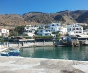
The district Skála of Anópoli in Chania (Crete) is a district located in Greece about 192 mi south of Athens, the country's capital town.
In need of a room? We compiled a list of available hotels close to the map centre further down the page.
Since you are here already, you might want to pay a visit to some of the following locations: Chora Sfakion, Vryses, Chania, Gerani and Kastri. To further explore this place, just scroll down and browse the available info.
Local weather forecast
Todays Local Weather Conditions & Forecast: 21°C / 70 °F
| Morning Temperature | 18°C / 64 °F |
| Evening Temperature | 16°C / 60 °F |
| Night Temperature | 13°C / 56 °F |
| Chance of rainfall | 1% |
| Air Humidity | 67% |
| Air Pressure | 1018 hPa |
| Wind Speed | Fresh Breeze with 15 km/h (9 mph) from South-West |
| Cloud Conditions | Broken clouds, covering 84% of sky |
| General Conditions | Light rain |
Sunday, 24th of November 2024
13°C (55 °F)
11°C (52 °F)
Broken clouds, moderate breeze.
Monday, 25th of November 2024
14°C (57 °F)
12°C (54 °F)
Sky is clear, light breeze, clear sky.
Tuesday, 26th of November 2024
13°C (56 °F)
12°C (53 °F)
Sky is clear, gentle breeze, clear sky.
Hotels and Places to Stay
Sifis Hotel
Oasis Hotel
Madares Hotel
Hotel Lefka Ori
Videos from this area
These are videos related to the place based on their proximity to this place.
F800GS off road: Crete - riding on the White Mountains
21/05/2011 Riding on the White Mountains, Sfakia region, Crete Ride report here: http://www.symoska.gr/viewtopic.php?f=6&t=82.
F800GS off road: Crete - north of Anopoli, Sfakia
21/05/2011 North of Anopoli, Sfakia region, Crete Ride report here: http://www.symoska.gr/viewtopic.php?f=6&t=82.
ΓΛΥΚΑ ΝΕΡΑ-ΛΟΥΤΡΟ
Νότια των χανίων.Πρόσβαση απο Ε-4 με τα πόδια ,και με φουσκωτό απο θάλασσα.Σας δίνω τις συντεταγμένες για...
Crete - Λουτρό Σφακιά Χανιά - Loutro Sfakia Chania Crete
Loutro web TV http://loutro.gr Sfakia Crete.
The Old Phoenix Loutro Sfakia Crete HD 1080i
The Old Phoenix hotel and restaurant is situated in one of the most beautiful and unspoilt regions of south-west Crete, in the bay of Finix, about 15 minutes walk from the picturesque village...
loggerhead turtle at loutro crete
http://thepaleochorasite.com This loggerhead turtle (caretta caretta) swam by the shore at Loutro on 20th September 2011. It was about a metre long. Only the second one I have seen in the wild.
Loutro Pavlos rooms Sfakia Crete Greece
Pavlos rooms and grill restaurant Loutro Sfakia 73011 http://pavlos.loutro.gr Loutro official website http://www.loutro.gr/
Loutro Stratis gril & Padelitsa's rooms HD
Rooms and apartments in Loutro village in Sfakia http://pantelitsas-rooms.loutro.gr/ http://loutro.gr http://4you.gr.
Videos provided by Youtube are under the copyright of their owners.
Attractions and noteworthy things
Distances are based on the centre of the city/town and sightseeing location. This list contains brief abstracts about monuments, holiday activities, national parcs, museums, organisations and more from the area as well as interesting facts about the region itself. Where available, you'll find the corresponding homepage. Otherwise the related wikipedia article.
Samariá Gorge
The Samariá Gorge (Greek: Φαράγγι Σαμαριάς or just Φάραγγας) is a National Park of Greece on the island of Crete - a major tourist attraction of the island - and a World's Biosphere Reserve. The gorge is in southwest Crete in the regional unit of Chania. It was created by a small river running between the White Mountains (Lefká Óri) and Mt. Volakias. There are a number of other gorges in the White Mountains.
Sfakia
Sfakiá is a mountainous area in the southwestern part of the island of Crete, in the Chania regional unit. It is considered one of the few places in Greece to never have been fully occupied by foreign powers. With a 2011 census population of 1,889 inhabitants living on a land area of 467,58 km², Sfakia is one of the largest and least densely populated municipalities on the island of Crete. The etymology of its name is disputed.
Hora Sfakion
Error: Image is invalid or non-existent. Hóra Sfakíon or Sfakia is a town on the south coast of Crete, Greece. It is the capital of the remote and mountainous region of Sfakiá, and is a small town of just 278 inhabitants (2001 census). It lies on the south coast near the end of the Imbros Gorge, 74 km south of Chania. It has two small harbours, where the ferry boats from Agia Roumeli dock, which in the summer bring the hikers from the Samaria Gorge to take buses back to the northern coast.
Agia Roumeli
Agia Roumeli is a small village in southwest Crete, Greece and is popular with tourists. Located a few kilometres above the town is the southern entrance to the Samaria Gorge. For most walkers, this is the exit, as the usual route through the gorge is to descend from the north. The gorge is a popular tourist destination in Crete, the longest gorge in Greece, and one of the longest in Europe, measuring 18 km. The village has several hotels and a few rooms for rent and also some tavernas.
Imbros Gorge
Imbros Gorge (Greek: Φαράγγι Ίμπρου, Faragi Imbrou) is a 11 km long canyon located near Hora Sfakion in southern Crete, the Mediterranean island. It runs parallel to Samariá Gorge, its narrowest part has 1.60 m and it ends at the village of Kommitádes (8 km/ 650 m for hiking). The Imbros village (aka Nimbros) is located at an altitude of 780 meters and is at the South end of the fertile plain of Askyfou.
Tarra, Crete
Tarra or Tarrha was an ancient city of western Crete, near Samaria Gorge, at Agia Roumeli village. It is near the sea, on the hill, on the left bank of the stream bank. It was probably established in the Classical period and was very important religious centre. The city flourished in the Greco-Roman period. There was the cult of Apollo Tarraios. There were found parts of his temple. Tarra in frequently cited in the ancient sources. Although it was small town, Tarra had its own coins.
Loutro, Chania
Loutro lies on the south coast of Chania Prefecture in west Crete, between Chora Sfakion and Agia Roumeli, the exit to the Samaria Gorge. The whole area is known as Sfakia. The village got its name from the Greek word for "bath," for the many ancient baths found in the area.
Frangokastello
Frangokastello is the location of a castle and scattered settlement on the south coast of Crete, Greece, about 12 km. east of Chora Sfakion and within the prefecture of Chania. The castle was built by the Venetians in 1371-74 as a garrison to impose order on the rebellious Sfakia region, to deter pirates, and to protect Venetian nobles and their properties. The Venetians named it the Castle of St. Nikitas after the nearby church.
Kallikratis
Kallikratis is a small village in Sfakia municipality, southwest Crete, Greece. According to tradition, it was named after the admiral Manoussos Kallikratis, who in March 1453 led a campaign to reinforce the defense of Constantinople with 5 ships and 1500 Cretan volunteers. As reported by Sphrantzes in his Chronicle, these volunteers manned three towers on the walls of Constantinople and continued to fight bravely even after the city had fallen.
Ammoudi tous Volakous
Ammoudi tous Volakous (Greek: Αμμούδι τους Βολάκους, "sandy beach of the rocks") is an uninhabited islet to the south of the western coast of Crete in the Libyan Sea. Just south of Sfakia it is within Sfakia's administration, in Chania regional unit.
Katonisi
Katonisi (Greek: Κατονήσι, "lower island") is an uninhabited islet close to the southern coast of Crete in the Libyan Sea. It is administered from the municipality of Sfakia, in Chania regional unit.
Treis Volakous
Treis Volakous (Greek: Τρεις Βολάκους, "three rocks") are rocks close to the southern coast of Crete in the Libyan Sea. They fall within the administration of the municipality of Sfakia, in Chania regional unit.


