Safety Score: 3,4 of 5.0 based on data from 9 authorites. Meaning please reconsider your need to travel to Ghana.
Travel warnings are updated daily. Source: Travel Warning Ghana. Last Update: 2024-08-13 08:21:03
Explore Bonsu Nkwanta
Bonsu Nkwanta in Western Region is a city in Ghana about 117 mi (or 189 km) south-west of Accra, the country's capital.
Local time in Bonsu Nkwanta is now 12:24 PM (Sunday). The local timezone is named Africa / Accra with an UTC offset of zero hours. We know of 7 airports in the vicinity of Bonsu Nkwanta, of which one is a larger airport. The closest airport in Ghana is Takoradi Airport in a distance of 1 mi (or 1 km), South-West. Besides the airports, there are other travel options available (check left side).
There is one Unesco world heritage site nearby. It's Asante Traditional Buildings in a distance of 141 mi (or 227 km), North-East. If you need a place to sleep, we compiled a list of available hotels close to the map centre further down the page.
Depending on your travel schedule, you might want to pay a visit to some of the following locations: Sekondi-Takoradi, Cape Coast, Wassa-Akropong, Tiapoum and Mafere. To further explore this place, just scroll down and browse the available info.
Local weather forecast
Todays Local Weather Conditions & Forecast: 30°C / 86 °F
| Morning Temperature | 26°C / 79 °F |
| Evening Temperature | 28°C / 82 °F |
| Night Temperature | 27°C / 80 °F |
| Chance of rainfall | 0% |
| Air Humidity | 66% |
| Air Pressure | 1012 hPa |
| Wind Speed | Gentle Breeze with 7 km/h (5 mph) from North |
| Cloud Conditions | Broken clouds, covering 75% of sky |
| General Conditions | Light rain |
Monday, 25th of November 2024
28°C (83 °F)
26°C (79 °F)
Light rain, gentle breeze, scattered clouds.
Tuesday, 26th of November 2024
30°C (86 °F)
27°C (80 °F)
Light rain, moderate breeze, clear sky.
Wednesday, 27th of November 2024
30°C (86 °F)
26°C (79 °F)
Light rain, gentle breeze, broken clouds.
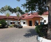
Hotels and Places to Stay
Eagles Lodge
Protea Hotel Takoradi Select
Adinkra Plaza Hotel
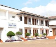
Stellar Lodge
Valley Beach Hotel
BUSUA BEACH RESORT
Videos from this area
These are videos related to the place based on their proximity to this place.
Fort Oranje - Sekondi, Ghana
The Dutch-built Fort Oranje at Sekondi in the Western Region of Ghana. Completed in 1682, the fort is still used as a lighthouse today. For more information on Ghana, visit www.ghana-pedia.org.
Amalie Berring Uldum, University of Copenhagen | Medicine in Takoradi, Ghana
Learn more about Takoradi, Ghana http://www.worktheworld.com/destinations/africa/ghana-takoradi Learn more about Medicine http://www.worktheworld.com/medical-internships.
Ghana Clap of thunder August2013a
Winters in Ghana are pretty dramatic. Like most African countries that are close to the equator, the days when it rains are beyond belief.
Water Level Controller and Indicator
The Water Level Indicator and controller is meant to address the problem of overflowing water storage tanks and in general control/regulate the amount of water in a water storage tank. This...
Videos provided by Youtube are under the copyright of their owners.
Attractions and noteworthy things
Distances are based on the centre of the city/town and sightseeing location. This list contains brief abstracts about monuments, holiday activities, national parcs, museums, organisations and more from the area as well as interesting facts about the region itself. Where available, you'll find the corresponding homepage. Otherwise the related wikipedia article.
Sekondi-Takoradi
Sekondi-Takoradi, population 335,000 (2005), comprising the twin cities of Sekondi and Takoradi, is the capital of the Western Region of Ghana. It is Ghana's fourth largest city and an industrial and commercial centre. The chief industries are timber, plywood, shipbuilding and railroad repair and recently, oil. It lies on the main railway lines to Accra and Kumasi.
Shama Ahanta East Metropolitan District
The Shama Ahanta East Metropolitan District is a district of Ghana in the Western Region.
Takoradi Airport
Takoradi Airport is an airport in Sekondi-Takoradi, a city and capital of Western Region southern Ghana. During World War II, Takoradi Airport was a major stop on the United States Army Air Forces Air Transport Command Trans-Africa Ferry Route, as an intermediate stop between Monrovia-Roberts Field, Liberia and Apapa Airport, Nigeria.
Takoradi Market Circle
The Takoradi Market Circle is a market in Takoradi, the third largest city of Ghana. Takoradi Market Circle is the commercial and economic hub of Ghana's Western Region. The market got its name due to the large circle in which it is situated; the stores of the market were built to form the shape.
New Takoradi
New Takoradi is a town in the Western region of Ghana. It is 3 kilometres from the centre Takoradi the Western regional capital. The serves both as a dormitory town as well as an industralized zone.
Effia Nkwanta Regional Hospital
The Effia-Nkwanta Regional Hospital is in the Western region of Ghana. It is the regional hospital and serves as the main referral centre for all medical conditions that require specialist attention. It is about 10 kilometres from Takoradi the regional capital.
Kwesimintsim, Ghana
Kwesimintsim is a residential town in the Western region of Ghana. It is about 5 kilometres westwards from Takoradi the regional capital. The town under the Effia-Kwesimintim constituency of Ghana.
Takoradi Polytechnic
Takoradi Polytechnic is a public tertiary institution located in Sekondi-Takoradi, the capital of the Western Region. Takoradi Polytechnic was established as Government Technical Institute in 1954 and was upgraded to become part of the Tertiary Education System by Polytechnic Law (PNDCL 321 of 1992) which has since 2007 been replaced by the Polytechnics Law (Act 745).


