Safety Score: 3,0 of 5.0 based on data from 9 authorites. Meaning we advice caution when travelling to Germany.
Travel warnings are updated daily. Source: Travel Warning Germany. Last Update: 2024-08-13 08:21:03
Delve into Diekhusen
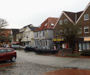
The district Diekhusen of Westermenghusen in Schleswig-Holstein is a subburb in Germany about 206 mi north-west of Berlin, the country's capital town.
If you need a hotel, we compiled a list of available hotels close to the map centre further down the page.
While being here, you might want to pay a visit to some of the following locations: Diekhusen-Fahrstedt, Schmedeswurth, Neufeld, Helse and Marnerdeich. To further explore this place, just scroll down and browse the available info.
Local weather forecast
Todays Local Weather Conditions & Forecast: 11°C / 52 °F
| Morning Temperature | 9°C / 48 °F |
| Evening Temperature | 13°C / 56 °F |
| Night Temperature | 13°C / 56 °F |
| Chance of rainfall | 11% |
| Air Humidity | 84% |
| Air Pressure | 1005 hPa |
| Wind Speed | Fresh Breeze with 15 km/h (10 mph) from North-East |
| Cloud Conditions | Overcast clouds, covering 100% of sky |
| General Conditions | Moderate rain |
Monday, 25th of November 2024
14°C (57 °F)
9°C (48 °F)
Light rain, fresh breeze, overcast clouds.
Tuesday, 26th of November 2024
8°C (46 °F)
6°C (42 °F)
Moderate rain, moderate breeze, scattered clouds.
Wednesday, 27th of November 2024
6°C (42 °F)
6°C (42 °F)
Moderate rain, high wind, near gale, overcast clouds.
Hotels and Places to Stay
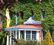
Landhaus Gardels Ringhotel
Gästehof Rehedyk
Der kleine Hans GARDELS basics - enjoy the difference
Dithmarscher Haus
Videos from this area
These are videos related to the place based on their proximity to this place.
Brunsbüttel - Schleuseneinfahrt (Nord-Ostsee Kanal) und Elbe 10.02.2014
Brunsbüttel - Schleuseneinfahrt (Nord-Ostssee Kanal) und Elbe. Polizeiboot in Richtung Elbmündung (Cuxhaven) Aufgenommen bei der Mole 4. Samsung Galaxy S4 GT i9505.
Containerriesen begegnen sich auf der Elbe
2 Containerriesen begegnen sich auf der Elbe. CSCL PUSAN (337m x 46m) trifft auf HYUNDAI TENACITY (366m x 48m)
MS ANNA SIRKKA - Kiel-Kanal und Brunsbüttel
Mehr zu Frachtschiffreisen: http://www.reisen-auf-frachtschiffen.de/ Frachtschiffreise mit MS "Anna Sirkka" April/Mai 2010. Der Film zeigt die Fahrt des Schiffes durch den NOK am 26.4.2010....
Twinstar onboard HD FPV
Der erste FPV Flug mit meinem Twinstar und der full HD Kamera an Bord. Leider war es windig, die Kamera hat auch noch Probleme mit den Vibrationen. Aber der erste Schritt ist gemacht! mehr...
FPV Flug mit Multiplex Twinstar
FPV Flug mit Multiplex Twinstar, Black Stork OSD sowie Fat Shark Videosender und Videobrille mehr Infos auf www.jaster.org.
MS CAP SAN DIEGO am 17.7.2010 im KIEL-KANAL
Mehr zu Frachtschiffreisen: http://www.reisen-auf-frachtschiffen.de/ Der Film zeigt die "Cap San Diego" am 17.7.2010 bei der Einfahrt in die Schleusenanlage in Brunsbüttel und an verschiedenen...
MS ASTOR crosses the Kiel Canal on 03 May 2013
Cruise ship MS ASTOR (TransOcean Kreuzfahrten) crosses the Kiel Kanal (NOK) on May 03, 2013.
Shipspotting - Nord-Ostsee Kanal Brunsbüttel 11.02.2014 [Full HD]
Shipspotting - Nord-Ostsee Kanal "Brunsbüttel" 11.02.2014 Samsung Galaxy S4 GT i9505 (Automodus)
Videos provided by Youtube are under the copyright of their owners.
Attractions and noteworthy things
Distances are based on the centre of the city/town and sightseeing location. This list contains brief abstracts about monuments, holiday activities, national parcs, museums, organisations and more from the area as well as interesting facts about the region itself. Where available, you'll find the corresponding homepage. Otherwise the related wikipedia article.
Kiel Canal
The Kiel Canal, known as the Kaiser-Wilhelm-Kanal until 1948, is a 98-kilometre long canal in the German state of Schleswig-Holstein. The canal links the North Sea at Brunsbüttel to the Baltic Sea at Kiel-Holtenau. An average of 250 nautical miles is saved by using the Kiel Canal instead of going around the Jutland Peninsula. This not only saves time but also avoids potentially dangerous storm-prone seas.
Dithmarschen
Dithmarschen is a district in Schleswig-Holstein, Germany. It is bounded by (from the north and clockwise) the districts of Nordfriesland, Schleswig-Flensburg, Rendsburg-Eckernförde, and Steinburg, by the state of Lower Saxony (district of Stade, from which it is separated by the Elbe river), and by the North Sea.
Oste
The Oste is a river in northern Lower Saxony, Germany with a length of 153 km, left tributary of the Elbe. It flows through the districts of Harburg, Rotenburg, Stade and Cuxhaven and empties into the Elbe river near Otterndorf. Its drainage area is 1.711 km² and the decline between the source and the estuary is 31 m. Tributaries are Ramme, Aue, Twiste, Bade, Bever and Mehe.
Hadeln
Hadeln is a former Samtgemeinde ("collective municipality") in the district of Cuxhaven, in Lower Saxony, Germany. It was situated in the Land of Hadeln near the mouth of the river Elbe, approximately 15 km east of Cuxhaven. Its seat was in the town Otterndorf. On 1 January 2011 it merged with the Samtgemeinde Sietland to form the new Samtgemeinde Land Hadeln. The Samtgemeinde Hadeln consisted of the following municipalities: Neuenkirchen Nordleda Osterbruch Otterndorf
Eddelak-Sankt Michaelisdonn
Eddelak-Sankt Michaelisdonn was an Amt Kirchspielslandgemeinde ("collective municipality") in the district of Dithmarschen, in Schleswig-Holstein, Germany. It was situated near the Kiel Canal, approx. 25 km south of Heide, and 10 km north of Brunsbüttel. Its seat was in Sankt Michaelisdonn. In January 2008, it was merged with the Amt Burg-Süderhastedt to form the Amt Burg-Sankt Michaelisdonn.
Marne-Land
Marne-Land was an Amt Kirchspielslandgemeinde ("collective municipality") in the district of Dithmarschen, in Schleswig-Holstein, Germany. It was situated around Marne, which was the seat of the Amt, but not part of it. In January 2008, it was merged with the town Marne and the municipality Friedrichskoog to form the Amt Marne-Nordsee.
Meldorf-Land
Kirchspielslandgemeinde Meldorf-Land was an Amt ("collective municipality") in the district of Dithmarschen, in Schleswig-Holstein, Germany. It was situated around Meldorf, which was the seat of the Amt, but not part of it. On 25 May 2008, it merged with the Amt Kirchspielslandgemeinde Albersdorf and the town Meldorf to form the Amt Mitteldithmarschen.
Marne-Nordsee
Marne-Nordsee is an Amt ("collective municipality") in the district of Dithmarschen, in Schleswig-Holstein, Germany. Its seat is in Marne. It was formed on 1 January 2008 from the former Amt Marne-Land, the town Marne and the municipality Friedrichskoog.
Mitteldithmarschen
Mitteldithmarschen is an Amt ("collective municipality") in the district of Dithmarschen, in Schleswig-Holstein, Germany. Its seat is in Meldorf. It was formed on 25 May 2008 from the former Ämter Albersdorf, Meldorf-Land and the town Meldorf. The Amt Mitteldithmarschen consists of the following municipalities (with population in 2005):
Meldorf Bay
Meldorf Bay, also called the Bay of Meldorf is a bay on the coast of the North German state of Schleswig-Holstein, which forms part of the Heligoland Bight.
Land Hadeln (Samtgemeinde)
Land Hadeln is a Samtgemeinde ("collective municipality") in the district of Cuxhaven, in Lower Saxony, Germany. Its seat is in the town Otterndorf. It was formed on 1 January 2011 by the merger of the former Samtgemeinden Hadeln and Sietland. The Samtgemeinde Land Hadeln consists of the following municipalities: Ihlienworth Neuenkirchen Nordleda Odisheim Osterbruch Otterndorf Steinau
Medem (river)
Medem is a river of Lower Saxony, Germany.
Miele (river)
Miele is a river of Schleswig-Holstein, Germany.
Dieksanderkoog
Dieksanderkoog, formerly Adolf-Hitler-Koog was new land created by dikes as a Work Creation measure in Dithmarschen during the Nazi era.


!['Shipspotting - Nord-Ostsee Kanal Brunsbüttel 11.02.2014 [Full HD]' preview picture of video 'Shipspotting - Nord-Ostsee Kanal Brunsbüttel 11.02.2014 [Full HD]'](https://img.youtube.com/vi/36PaId6uOIk/mqdefault.jpg)