Safety Score: 3,0 of 5.0 based on data from 9 authorites. Meaning we advice caution when travelling to Germany.
Travel warnings are updated daily. Source: Travel Warning Germany. Last Update: 2024-08-13 08:21:03
Explore Schülper Neuensiel
Schülper Neuensiel in Schleswig-Holstein is a city in Germany about 220 mi (or 354 km) north-west of Berlin, the country's capital.
Local time in Schülper Neuensiel is now 09:08 PM (Thursday). The local timezone is named Europe / Berlin with an UTC offset of one hour. We know of 13 airports in the vicinity of Schülper Neuensiel, of which 5 are larger airports. The closest airport in Germany is Heide-Büsum Airport in a distance of 8 mi (or 13 km), South. Besides the airports, there are other travel options available (check left side).
There are several Unesco world heritage sites nearby. The closest heritage site is Wadden Sea in Denmark at a distance of 53 mi (or 86 km). The closest in Germany is Town Hall and Roland on the Marketplace of Bremen in a distance of 82 mi (or 86 km), South. If you need a place to sleep, we compiled a list of available hotels close to the map centre further down the page.
Depending on your travel schedule, you might want to pay a visit to some of the following locations: Schuelp, Struebbel, Karolinenkoog, Wesselburenerkoog and Groven. To further explore this place, just scroll down and browse the available info.
Local weather forecast
Todays Local Weather Conditions & Forecast: 3°C / 37 °F
| Morning Temperature | 5°C / 40 °F |
| Evening Temperature | 1°C / 34 °F |
| Night Temperature | 0°C / 32 °F |
| Chance of rainfall | 6% |
| Air Humidity | 90% |
| Air Pressure | 990 hPa |
| Wind Speed | Fresh Breeze with 15 km/h (9 mph) from North-East |
| Cloud Conditions | Overcast clouds, covering 100% of sky |
| General Conditions | Moderate rain |
Friday, 22nd of November 2024
4°C (39 °F)
4°C (40 °F)
Moderate rain, fresh breeze, overcast clouds.
Saturday, 23rd of November 2024
5°C (42 °F)
4°C (39 °F)
Moderate rain, fresh breeze, overcast clouds.
Sunday, 24th of November 2024
9°C (47 °F)
11°C (51 °F)
Moderate rain, fresh breeze, overcast clouds.
Hotels and Places to Stay
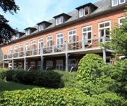
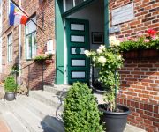
Miramar Bio-Hotel
Strandhotel Fernsicht
Zum Goldenen Anker
Lexow
Videos from this area
These are videos related to the place based on their proximity to this place.
Probealarm Sirene Wesselburen LK Dithmarschen 02.03.2013
Probealarm E57 Wesselburen am 02.03.2013 Im Hintergrundt ist der Probealarm Von Storman Zu Hören.
GTA IV LCPDFR Toronto Police Lustiger Ende Einer Verfolgungsjagt
Ein Lustiges Ende Einer Verfolgungsjagt was so eine Kleine Platte anstellen kann wenn sie umfällt :D.
Lunden am Eiderufer stellplatz - copy GPS unten im Text
Watch hundreds of Stellplatz movies on Google maps: https://www.google.com/maps/d/viewer?mid=z0TIfZfQVlmw.kzOXKqmAVqcs GPS 54.33252 8.99555.
Abriss Deutsche Eiche Wesselburen !!! Teil 1/2
Abriss Deutsche Eiche Wesselburen 18. Juni 2009. Nach einer Idee von Arno Raths & Sascha Andresen. Finanziert durch einige Firmen aus Wesselburen, Heide, Norddeich & Hillgroven.
Cold Water Challenge 2014 FF Neuenkirchen
Cold Water Challenge 2014 der Freiwilligen Feuerwehr Neuenkirchen. Wir nominieren: FF Fuhlendorf (MV) FF Hemme FF Ostrohe Ihr habt ab jetzt 48h Zeit eure Aufgabe zu erfüllen! Wir wünschen...
Modelltrucks im Freibad Wesselburen
Modellbau Veranstaltung im Freibad Von Wesselburen.Wir waren mit vielen Trucks und Baumaschinen vor Ort.
Videos provided by Youtube are under the copyright of their owners.
Attractions and noteworthy things
Distances are based on the centre of the city/town and sightseeing location. This list contains brief abstracts about monuments, holiday activities, national parcs, museums, organisations and more from the area as well as interesting facts about the region itself. Where available, you'll find the corresponding homepage. Otherwise the related wikipedia article.
Katinger Watt
The Katinger Watt is a nature reserve in the south of the Eiderstedt peninsula in the north German state of Schleswig-Holstein which is run by the German Nature and Biodiversity Conservation Union, NABU. Once a region of mudflats in the estuary of the river Eider, it was drained as part of land reclamation activity and protected from flooding by the Eider Barrage. Today a third of it is farmed, the rest is a mix of woodland and bodies of water.
Dithmarscher Eiderwatt
The Dithmarscher Eiderwatt, officially the Dithmarscher Eidervorland mit Watt ("Dittmarschen Eider Foreland and Watt"), is a nature reserve in the district of Dithmarschen in the north German state of Schleswig-Holstein. The site has an area of 620 hectares which consists of the mudflats on the tidal current of the river Eider. It is run by the German Nature and Biodiversity Conservation Union, NABU.


