Safety Score: 3,0 of 5.0 based on data from 9 authorites. Meaning we advice caution when travelling to Germany.
Travel warnings are updated daily. Source: Travel Warning Germany. Last Update: 2024-08-13 08:21:03
Delve into Oster Bordelum
Oster Bordelum in Schleswig-Holstein is a city located in Germany about 234 mi (or 376 km) north-west of Berlin, the country's capital town.
Current time in Oster Bordelum is now 01:57 AM (Monday). The local timezone is named Europe / Berlin with an UTC offset of one hour. We know of 13 airports closer to Oster Bordelum, of which 5 are larger airports. The closest airport in Germany is Wyk auf Föhr Airport in a distance of 17 mi (or 28 km), West. Besides the airports, there are other travel options available (check left side).
There are several Unesco world heritage sites nearby. The closest heritage site is Wadden Sea in Denmark at a distance of 78 mi (or 125 km). The closest in Germany is Town Hall and Roland on the Marketplace of Bremen in a distance of 108 mi (or 125 km), South. We saw 1 points of interest near this location. In need of a room? We compiled a list of available hotels close to the map centre further down the page.
Since you are here already, you might want to pay a visit to some of the following locations: Bordelum, Breklum, Langenhorn, Sonnebull and Reussenkoge. To further explore this place, just scroll down and browse the available info.
Local weather forecast
Todays Local Weather Conditions & Forecast: 13°C / 56 °F
| Morning Temperature | 13°C / 55 °F |
| Evening Temperature | 9°C / 49 °F |
| Night Temperature | 9°C / 48 °F |
| Chance of rainfall | 1% |
| Air Humidity | 68% |
| Air Pressure | 1000 hPa |
| Wind Speed | Strong breeze with 18 km/h (11 mph) from North |
| Cloud Conditions | Overcast clouds, covering 100% of sky |
| General Conditions | Light rain |
Tuesday, 26th of November 2024
8°C (46 °F)
7°C (44 °F)
Light rain, fresh breeze, broken clouds.
Wednesday, 27th of November 2024
6°C (43 °F)
6°C (42 °F)
Moderate rain, strong breeze, overcast clouds.
Thursday, 28th of November 2024
8°C (46 °F)
7°C (45 °F)
Light rain, fresh breeze, overcast clouds.
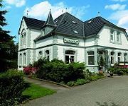
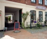
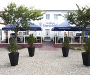
Hotels and Places to Stay
Ulmenhof & Spa
Die Friesenhalle
Frida's
Landhaus Sterdebüll
Arlau-Schleuse
Videos from this area
These are videos related to the place based on their proximity to this place.
Breezerianer treffen sich regelmäßig
Mehrfach im Jahr haben Kunden und Interessenten von Breezer Aircraft die Gelegenheit, sich im nordfriesischen Bredstedt zu treffen, das Werk des Flugzeugherstellers zu besuchen, und die ...
DJI Phantom - ... a view over Bredstedt - 01.05.2013
A nice view all over my hometown Bredstedt and the region around with the DJI Phantom, using a GoPro HD Hero 3 Black Edition in 1080P with 60 FPS and FOV Setting "Wide". The GoPro is attached...
2,7K Test GoPro 3 Black Edition-Mikrokopter Hexa
Nur kleiner Test mit 2,7k Auflösung der gopro3 black edition.
new Keychain Cam 808 #26 vs. Gopro HD Hero 3 Black Edition - comparsion
footage under not good light conditions in the evening in 1080P at 30 FPS. HD Hero set to FOV narrow. 808 #26 set to EV 0.
new Keychain Cam 808 #26 vs. Gopro HD Hero 3 Black Edition - comparsion 2
footage under not good light conditions in the evening in 1080P at 30 FPS. HD Hero set to FOV narrow. 808 #26 set to EV 0.
Panasonic DMC-3D1 - Test-Clip 2 - Bredstedt - Mühlenteich - 3D Test
Auspacken, einschalten, filmen ... das war das Motto für diese Aufnahme um einen Eindruck zu bekommen welche Ergebnisse der Camcorder mit den Grundeinstellungen bringt. Gefilmt wurde ohne...
Panasonic DMC-3D1 - Test-Clip 1 - Bredstedt - Mühlenteich - 3D Test
Auspacken, einschalten, filmen ... das war das Motto für diese Aufnahme um einen Eindruck zu bekommen welche Ergebnisse der Camcorder mit den Grundeinstellungen bringt. Gefilmt wurde ohne...
new Keychain Cam 808 #26 - first Testclip 1080P - 30 FPS
new Keychain Cam 808 #26 - first Testclip 1080P - 30 FPS.
Bredstedt Parkplatz - copy GPS unten im Text
Watch hundreds of Stellplatz movies on Google maps: https://www.google.com/maps/d/viewer?mid=z0TIfZfQVlmw.kzOXKqmAVqcs GPS 54.61253 8.97162.
Videos provided by Youtube are under the copyright of their owners.
Attractions and noteworthy things
Distances are based on the centre of the city/town and sightseeing location. This list contains brief abstracts about monuments, holiday activities, national parcs, museums, organisations and more from the area as well as interesting facts about the region itself. Where available, you'll find the corresponding homepage. Otherwise the related wikipedia article.
Bredstedt-Land
Bredstedt-Land was an Amt ("collective municipality") in the district of Nordfriesland, in Schleswig-Holstein, Germany. It was situated east of Bredstedt, approx. 15 km north of Husum. Its seat was in Breklum. In April 2008, it was merged with the Amt Stollberg and the town Bredstedt to form the Amt Mittleres Nordfriesland.
Stollberg (Amt)
Stollberg was an Amt ("collective municipality") in the district of Nordfriesland in Schleswig-Holstein, Germany. It was situated on the North Sea coast, approximately 25 km northwest of Husum. Stollberg was named after the hill Stollberg, at 44m above sea level the highest in Nordfriesland. Its seat was in Langenhorn. In April 2008, Stollberg was merged with the Amt Bredstedt-Land and the town Bredstedt to form the Amt Mittleres Nordfriesland.
Mittleres Nordfriesland
Mittleres Nordfriesland is an Amt ("collective municipality") in the district of Nordfriesland, in Schleswig-Holstein, Germany. Its seat is in Bredstedt. It was formed on 1 April 2008 from the former Ämter Bredstedt-Land and Stollberg, and the town Bredstedt. The Amt Mittleres Nordfriesland consists of the following municipalities:
Stollberg (North Frisia)
At 43.4 metres above sea level, the Stollberg is the fourth highest hill in the district of North Frisia in northern Germany, after the Sandesberg near Ostenfeld (53.3 m), the Uwe Düne in the municipality of Kampen auf Sylt (50.2 m) and the Rantzauhöhe within the Langenberg south of the village of Leck (44.8 m). It is part of the geest ridge that runs westwards and was created as a so-called old moraine during the Saale glaciation and was subsequently shaped during the Weichselian glaciation.


