Safety Score: 3,0 of 5.0 based on data from 9 authorites. Meaning we advice caution when travelling to Germany.
Travel warnings are updated daily. Source: Travel Warning Germany. Last Update: 2024-08-13 08:21:03
Delve into Klove
Klove in Schleswig-Holstein is located in Germany about 213 mi (or 343 km) north-west of Berlin, the country's capital town.
Current time in Klove is now 02:58 PM (Tuesday). The local timezone is named Europe / Berlin with an UTC offset of one hour. We know of 13 airports close to Klove, of which 5 are larger airports. The closest airport in Germany is Schleswig Airport in a distance of 7 mi (or 11 km), East. Besides the airports, there are other travel options available (check left side).
There are several Unesco world heritage sites nearby. The closest heritage site in Germany is Hanseatic City of Lübeck in a distance of 67 mi (or 108 km), South-East. If you need a hotel, we compiled a list of available hotels close to the map centre further down the page.
While being here, you might want to pay a visit to some of the following locations: Dorpstedt, Hollingstedt, Borm, Wohlde and Bergenhusen. To further explore this place, just scroll down and browse the available info.
Local weather forecast
Todays Local Weather Conditions & Forecast: 10°C / 51 °F
| Morning Temperature | 7°C / 45 °F |
| Evening Temperature | 8°C / 46 °F |
| Night Temperature | 6°C / 44 °F |
| Chance of rainfall | 0% |
| Air Humidity | 79% |
| Air Pressure | 1026 hPa |
| Wind Speed | Light breeze with 4 km/h (3 mph) from North-West |
| Cloud Conditions | Overcast clouds, covering 100% of sky |
| General Conditions | Overcast clouds |
Wednesday, 6th of November 2024
11°C (51 °F)
7°C (44 °F)
Scattered clouds, light breeze.
Thursday, 7th of November 2024
11°C (52 °F)
6°C (43 °F)
Sky is clear, light breeze, clear sky.
Friday, 8th of November 2024
11°C (51 °F)
5°C (41 °F)
Sky is clear, gentle breeze, clear sky.
Hotels and Places to Stay
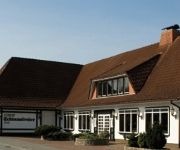
Schimmelreiter
Videos from this area
These are videos related to the place based on their proximity to this place.
Rev-Kite-flight training with little wind - Flugtraining bei wenig Wind - Stunt Kite (Quadline Kite)
Beautiful day at the weekend with light winds, so I can practice times the light wind flying. Do not come here so often between the seas before. There are now flying almost 5 months after my...
2 Flight day with my new Rev Vented - 2. Flugtag mit Rev Vented - Stunt Kite (Quadline Kite)
With slightly better weather than during the first flight. You notice that the Vented already a good deal needs more wind. But great gusts and reduced tension on the least. About comments and...
Baumabholzung an der Treene bei Treia/Ipland. 25.4.2012. 2.Teil.
Sinnlose Abholzung vieler schöner Bäume am Ufer der Treene bei Treia/Ipland. Wer noch einmal sehen möchte,wie schön es hier war,der schaut sich mein Video : Treene Hochwasser im Sebtember...
Jübek Open Air 2013
Das Jübek Open Air 2013 war wieder sehr klasse! Wir danken allen Gästen, Bands, Helfern und Dienstleistern für dieses hochkarätige Fest! Danke auch an das Team von 2motions (www.2motions.de).
Rev Kite - in the last days of autumn - Ende Herbst - Stunt Kite (Quadline Kite)
Rev kite fly workout in the last days of autumn. About comments and ratings I would be happy. Rev Drachen flugtraining in den letzten tagen des Herbstes. Über Kommentare und Bewertung würde...
Baumabholzung an der Treene bei Treia/Ipland. 18.4.2012.
Eine ganze Reihe schöner Bäume wurden an der Treene abgeholzt.
2014 FIM Sidecar World Championship - Sachsenring (GER)
Subscribe! http://www.youtube.com/user/tvfim.
Videos provided by Youtube are under the copyright of their owners.
Attractions and noteworthy things
Distances are based on the centre of the city/town and sightseeing location. This list contains brief abstracts about monuments, holiday activities, national parcs, museums, organisations and more from the area as well as interesting facts about the region itself. Where available, you'll find the corresponding homepage. Otherwise the related wikipedia article.
Rheider Au
The Rheider Au is a tributary of the Treene. Its source is on the Geest near Schleswig. In the Viking period the route Eider - Treene - Rheider Au - Schlei served as a navigation way and/or transport or trade route between places to the north and the Baltic Sea, as commercial centres functioned.


