Zechenbach
District of Sommerberg
in Saxony, Germany

Noteable things around
Location Summary
Decimal Coordinates (Latitude, Longitude):
50.350 and 12.400 (Lat./Lng.)
Coordinates by Time:
N 50° 20' 59" and E 12° 23' 59"
Currency and Currency Code:
Euro - EUR
Spoken languages:
German
Local electricity:
Mobile phone / cellular frequencies (MHz):
Local Time: 04:50 AM (Monday)
Timezone: Europe/Berlin
UTC/GMT offset: 1 hours
Sunrise and Sunset:
7:41 am and 4:13 pm
Antipode Coordinates:
-44.033 and -176.367 (Lat./Lng.)
Closest place to antipode coordinates:
Ouwenga
References
This place on Geonames.org
Current travel safety evaluation for Germany in Western Europe

Safety Score: 3,0 of 5.0 based on data from 9 authorites. Meaning we advice caution when travelling to Germany.

Travel warnings are updated daily. Source: Travel Warning Germany. Last Update: 2024-08-13 08:21:03

Delve into Zechenbach

The district Zechenbach of Sommerberg in Saxony is a district located in Germany about 156 mi south of Berlin, the country's capital town.

In need of a room? We compiled a list of available hotels close to the map centre further down the page.

Since you are here already, you might want to pay a visit to some of the following locations: Erlbach, Werda, Muldenhammer, Ellefeld and Bad Brambach. To further explore this place, just scroll down and browse the available info.

Local weather forecast

Todays Local Weather Conditions & Forecast: 6°C / 43 °F

Morning Temperature 1°C / 34 °F
Evening Temperature 3°C / 37 °F
Night Temperature 4°C / 39 °F
Chance of rainfall 0%
Air Humidity 75%
Air Pressure 1016 hPa
Wind Speed Light breeze with 5 km/h (3 mph) from North-West
Cloud Conditions Scattered clouds, covering 47% of sky
General Conditions Scattered clouds

Tuesday, 26th of November 2024

6°C (42 °F)
1°C (33 °F)
Light rain, gentle breeze, overcast clouds.

Wednesday, 27th of November 2024

3°C (37 °F)
5°C (41 °F)
Light rain, gentle breeze, overcast clouds.

Thursday, 28th of November 2024

2°C (36 °F)
2°C (36 °F)
Light rain, moderate breeze, overcast clouds.

Hotels and Places to Stay

Haus am Ahorn

Address
2,0 mi
Hämmerling 12
08261 Schöneck
Germany

Time Information

Checkout: 10:00 - Checkin: 14:00
Reception
Weekday: 7:00 - 20:00
Weekend: closed


Haus Schwarzbachtal

Address
1,6 mi
Klingenthaler Str.70
08265 Erlbach
Germany

Time Information

Checkout: 10:00 - Checkin: 14:00
Reception
Weekday: 8:00 - 20:00
Weekend: 8:00 - 20:00


Landhotel Gasthof Zwota

Address
1,5 mi
Klingenthaler Str. 56
08267 Zwota
Germany

Time Information

Checkout: 10:00 - Checkin: 14:00
Reception
Weekday: 8:00 - 20:00
Weekend: 8:00 - 20:00


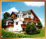
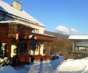
Zum Döhlerwald Hotel-Gasthof

Address
2,4 mi
Markneukirchner Str. 80
08248 Klingenthal
Germany

Time Information

Checkout: 11:00 - Checkin: 14:00
Reception
Weekday: 14:00 - 20:00
Weekend: 11:00 - 20:00


IFA Schöneck Hotel & Ferienpark

Address
3,6 mi
Hohe Reuth 5
08261 Schöneck/Vogtland
Germany

Time Information

Checkout: 10:00 - Checkin: 15:00
Reception
Weekday: 0:00 - 24:00
Weekend: 0:00 - 24:00


Alpenhof

Address
3,7 mi
Neue Markneukirchner Straße 34
08258 Markneukirchen
Germany

Time Information

Checkout: 11:00 - Checkin: 14:00
Reception
Weekday: 8:00 - 21:00
Weekend: 8:00 - 21:00


Berglandstübel

Address
5,9 mi
Tannenbergsthaler Str. 26
08262 Muldenhammer
Germany

Time Information

Checkout: 11:00 - Checkin: 14:00
Reception
Weekday: 11:00 - 20:00
Weekend: 11:00 - 20:00


Waldhotel Vogtland

Address
5,0 mi
Floßgrabenweg 1
08248 Klingenthal
Germany

Time Information

Checkout: 10:00 - Checkin: 14:00
Reception
Weekday: 8:00 - 18:00
Weekend: 8:00 - 18:00


Ferienhotel Zwotatal

Address
0,6 mi
Markneukirchner Str. 75
08267 Zwota
Germany

Time Information

Checkout: 11:00 - Checkin: 14:00
Reception
Weekday: 14:00 - 19:00
Weekend: 14:00 - 19:00


Gasthof zum Walfisch Geschw. Peggy Goram und René Goram GbR

Address
1,6 mi
Klingenthaler Str. 48
08267 Zwota
Germany

Time Information

Checkout: 11:00 - Checkin: 14:00
Reception
Weekday: 7:00 - 19:00
Weekend: 7:00 - 19:00


Videos from this area

These are videos related to the place based on their proximity to this place.

2012 SixDays Germany - Day 5 - Erlbach

Published: September 30, 2012
Length: 35:46 min
Rating: 0 of 5
Author: Bodi Sad

2012 SixDays Germany - Day 5 - Erlbach X1700091.AVI.


KIRWEZELT SPOT http://KIRWE.de

Published: May 18, 2010
Length: 55:22 min
Rating: 5 of 5
Author: KIRWE2010

Im Oktober findet wieder die ERLBACHER KIRWE statt. vom 22.10 - 25.10.2010 in Erlbach / Vogtland http://KIRWE.de.


RedBull Six Days 2012 Highlights Day 5 Part3

Published: November 08, 2012
Length: 41:40 min
Rating: 0 of 5
Author: MeisterrussMr

Day 5 Highligths second lab - Metzeler-Test (Erlbach) #10EeroRemes,#273Pierre-AlexanRenet,#244SébastienGuillaume,#272JohnnyAubert,#271RodrigThain,#270AntoineMeo ...


Kultheit - Die Bestie (Live 2009-06-19 Markneukirchen)

Published: July 13, 2009
Length: 32:41 min
Rating: 5 of 5
Author: vdLeo

Kultheit - Die Bestie (Live 2009-06-19 Markneukirchen) Drums: Leo www.kultheit.de www.myspace.com/kultheit www.myspace.com/vdleo.


Solotrommler-Marsch.m2p

Published: March 02, 2012
Length: 43:08 min
Rating: 5 of 5
Author: touristinfo64832

Stadtorchester Klingenthal am 26.11.2011 in der Musikhalle Markneukirchen.


Mais Häckseln 2014 LU Ritter Teil 1

Published: October 10, 2014
Length: 53:17 min
Rating: 5 of 5
Author: Felix Worsch

Mais häckseln 9. Oktober 2014.


Kultheit - Bitch (Live 2009-06-19 in Markneukirchen)

Published: July 13, 2009
Length: 43:36 min
Rating: 5 of 5
Author: vdLeo

Kultheit - Bitch (Live 2009-06-19 in Markneukirchen) Drums: Leo www.kultheit.de www.myspace.com/kultheit.


biking. Vysoký Kámen (4,5 km severně od Lubů, 29.5.2010)

Published: July 16, 2010
Length: 32:57 min
Rating: 0 of 5
Author: Skilton84RoCha69

silnicí do Doubravy u Aše. Dále pak vpravo na Reuth, Sohl a z hlavní vlevo na Landwust. Odtud terénem SV na Wernitzgrun a Eubabrunn. V lese u rozcestníku mi došla baterie a druhou...


Gruß aus Klingenthal.m2p

Published: February 09, 2012
Length: 51:47 min
Rating: 5 of 5
Author: touristinfo64832

Ein Gruß aus Klingenthal« - Stadtorchester Klingenthal 26. November 2011, Musikhalle Markneukirchen.


Freeride Strecke in Schöneck

Published: October 18, 2013
Length: 33:47 min
Rating: 0 of 5
Author: XSlomo70X

Sorry für den schlechten Ton.


Videos provided by Youtube are under the copyright of their owners.

Attractions and noteworthy things

Distances are based on the centre of the city/town and sightseeing location. This list contains brief abstracts about monuments, holiday activities, national parcs, museums, organisations and more from the area as well as interesting facts about the region itself. Where available, you'll find the corresponding homepage. Otherwise the related wikipedia article.

Vogtlandkreis

The Vogtlandkreis is a Landkreis in the southwest of the Free State of Saxony, Germany, at the borders to Thuringia, Bavaria, and the Czech Republic. Neighboring districts are (from south clockwise) Hof, Saale-Orla, Greiz, Zwickau and Erzgebirgskreis. Plauen is the administrative center of the district.

Located at 50.4333, 12.2667 (Lat. / Lng.), about 8 miles away.
Wikipedia Article
Vogtlandkreis

Vogtlandarena

Vogtlandarena is a ski jumping venue in Klingenthal, Germany. It features some of the most modern architecture among World Cup hills.

Located at 50.3839, 12.4489 (Lat. / Lng.), about 3 miles away.
Wikipedia Article, Homepage
Ski jumping venues in Germany, Vogtlandkreis, Sports venues in Saxony, Klingenthal

Zum Friedefürsten church

The Zum Friedefürsten church is a baroque Lutheran round church in Klingenthal, Saxony, south-eastern Germany. It has an octagonal floorplan and is the largest of its kind in Saxony. The church is the most important historical monument in Klingenthal and dominates the town center.

Located at 50.3578, 12.4672 (Lat. / Lng.), about 3 miles away.
Wikipedia Article
Churches in Saxony, Lutheran churches in Germany, Baroque architecture in Saxony, Klingenthal

Botanischer Garten Adorf

The Botanischer Garten Adorf is a botanical garden located at Waldbadstraße 7, Adorf, Saxony, Germany, created in 1997-1999 as an adjunct to the Klein-Vogtland miniatures park. It is open daily in the warmer months, and contains over 11,000 plants from high mountains around the world. In 2008, a small fire destroyed 300 plants and a part of the attached miniature park. By 2009, all damages had been repaired.

Located at 50.3062, 12.246 (Lat. / Lng.), about 7 miles away.
Wikipedia Article
Botanical gardens in Germany, Gardens in Saxony

Křižovatka (Cheb District)

Křižovatka (Cheb District) is a village and municipality in Cheb District in the Karlovy Vary Region of the Czech Republic.

Located at 50.2, 12.4 (Lat. / Lng.), about 10 miles away.
Wikipedia Article
Cheb District, Villages in the Czech Republic

Nový Kostel

Nový Kostel is a village and municipality in Cheb District in the Karlovy Vary Region of the Czech Republic.

Located at 50.2167, 12.45 (Lat. / Lng.), about 9 miles away.
Wikipedia Article
Villages in the Czech Republic

Velký Luh

Velký Luh is a village and municipality in Cheb District in the Karlovy Vary Region of the Czech Republic.

Located at 50.2, 12.3667 (Lat. / Lng.), about 10 miles away.
Wikipedia Article
Villages in the Czech Republic

Bublava

Bublava is a village and municipality in Sokolov District in the Karlovy Vary Region of the Czech Republic. It has a current population of 319.

Located at 50.3667, 12.5 (Lat. / Lng.), about 5 miles away.
Wikipedia Article
Villages in the Czech Republic, Sokolov District, Villages in the Ore Mountains

Stříbrná

Stříbrná is a village and municipality in Sokolov District in the Karlovy Vary Region of the Czech Republic.

Located at 50.35, 12.5333 (Lat. / Lng.), about 6 miles away.
Wikipedia Article
Villages in the Czech Republic

Hraničná

Hraničná is a district of the town of Kraslice in Sokolov District, Czech Republic. It is situated between Kraslice the centre of Klingenthal along the border river Svatava in the west of the Erzgebirge.

Located at 50.3516, 12.4719 (Lat. / Lng.), about 3 miles away.
Wikipedia Article
Sokolov District, Neighbourhoods in the Czech Republic

Aschberg

Aschberg is a mountain of Saxony, southeastern Germany.

Located at 50.3897, 12.5089 (Lat. / Lng.), about 6 miles away.
Wikipedia Article
Mountains of Saxony, Mountains of the Ore Mountains, Klingenthal

Hoher Brand

Hoher Brand is a mountain of Saxony, southeastern Germany.

Located at 50.3428, 12.3919 (Lat. / Lng.), about 1 miles away.
Wikipedia Article
Mountains of Saxony

Kiel (mountain)

Kiel (Berg) is a mountain of Saxony, southeastern Germany.

Located at 50.4167, 12.4667 (Lat. / Lng.), about 5 miles away.
Wikipedia Article
Mountains of Saxony

Rehhübel

Rehhübel is a mountain of Saxony, southeastern Germany.

Located at 50.4333, 12.3667 (Lat. / Lng.), about 6 miles away.
Wikipedia Article
Mountains of Saxony

Schneckenstein (Fels)

Schneckenstein (Fels) is a mountain of Saxony, southeastern Germany.

Located at 50.4133, 12.4511 (Lat. / Lng.), about 5 miles away.
Wikipedia Article
Mountains of Saxony, Rock formations in Saxony

Thierberg (Vogtland)

Thierberg (Vogtland) is a mountain of Saxony, southeastern Germany.

Located at 50.4458, 12.4431 (Lat. / Lng.), about 7 miles away.
Wikipedia Article
Mountains of Saxony, Mountains of the Ore Mountains

Wirtsberg

Wirtsberg is a mountain of Saxony, southeastern Germany.

Located at 50.2667, 12.3375 (Lat. / Lng.), about 6 miles away.
Wikipedia Article
Mountains of Saxony

Nickelhütte Aue

The Nickelhütte Aue is a modern manufacturing site in East Germany for pure non-ferrous metals like nickel, copper, cobalt, molybdenum, vanadium and tungsten. It is descended from the historic Niederpfannenstiel Blue Colour Works, a paintworks that was founded in 1635 by Veit Hans Schnorr in Pfannenstiel near Aue.

Located at 50.3508, 12.4302 (Lat. / Lng.), about 1 miles away.
Wikipedia Article, Homepage
Companies based in Saxony, Ore Mountains, Mining in the Ore Mountains, Chess clubs

Brunndöbra

Brunndöbra is a river of Saxony, Germany. It is a tributary of the river Zwota. It flows through the town Klingenthal.

Located at 50.3547, 12.47 (Lat. / Lng.), about 3 miles away.
Wikipedia Article
Rivers of Saxony, Klingenthal

Große Pyra

Große Pyra is a river of Saxony, Germany.

Located at 50.4667, 12.5167 (Lat. / Lng.), about 10 miles away.
Wikipedia Article
Rivers of Saxony, Rivers of the Ore Mountains

Kleine Pyra

Kleine Pyra is a river of Saxony, Germany.

Located at 50.45, 12.4667 (Lat. / Lng.), about 8 miles away.
Wikipedia Article
Rivers of Saxony, Rivers of the Ore Mountains

Red Mulde

The Red Mulde is a river of Saxony, Germany.

Located at 50.4, 12.3833 (Lat. / Lng.), about 4 miles away.
Wikipedia Article
Rivers of Saxony

Weiße Mulde

Weiße Mulde is a river of Saxony, Germany.

Located at 50.4, 12.4167 (Lat. / Lng.), about 4 miles away.
Wikipedia Article
Rivers of Saxony

Wilzsch

Wilzsch is a river of Saxony, Germany.

Located at 50.4667, 12.5167 (Lat. / Lng.), about 10 miles away.
Wikipedia Article
Rivers of Saxony

Hohenstein-Ernstthal station

The Station Hohenstein-Ernstthal is the railway station of the town of Hohenstein-Ernstthal, Saxony, Germany.

Located at 50.4756, 12.4225 (Lat. / Lng.), about 9 miles away.
Wikipedia Article, Homepage
Railway stations in Saxony, Railway stations opened in 1858

capture of the webcam Schöneck: Blick vom Meiler

Schöneck: Blick vom Meiler, Schöneck (source)

capture of the webcam Erlbach › South: Zum Kegelberg

Erlbach › South: Zum Kegelberg, Erlbach (source)

capture of the webcam Erlbach › North-West

Erlbach › North-West, Erlbach (source)

Webcams provided by webcam.travel are under the copyright of their owners.