Safety Score: 3,0 of 5.0 based on data from 9 authorites. Meaning we advice caution when travelling to Germany.
Travel warnings are updated daily. Source: Travel Warning Germany. Last Update: 2024-08-13 08:21:03
Touring Oberwildenthal
Oberwildenthal in Saxony is a town located in Germany about 148 mi (or 238 km) south of Berlin, the country's capital place.
Time in Oberwildenthal is now 02:34 AM (Friday). The local timezone is named Europe / Berlin with an UTC offset of one hour. We know of 11 airports nearby Oberwildenthal, of which 5 are larger airports. The closest is airport we know is Karlovy Vary International Airport in Czechia in a distance of 20 mi (or 32 km). The closest airport in Germany is Hof-Plauen Airport in a distance of 36 mi (or 32 km), South-East. Besides the airports, there are other travel options available (check left side).
There are several Unesco world heritage sites nearby. The closest heritage site in Germany is Margravial Opera House Bayreuth in a distance of 58 mi (or 93 km), South-West. Need some hints on where to stay? We compiled a list of available hotels close to the map centre further down the page.
Being here already, you might want to pay a visit to some of the following locations: Bockau, Zschorlau, Stutzengrun, Muldenhammer and Ellefeld. To further explore this place, just scroll down and browse the available info.
Local weather forecast
Todays Local Weather Conditions & Forecast: -2°C / 29 °F
| Morning Temperature | -4°C / 24 °F |
| Evening Temperature | -2°C / 28 °F |
| Night Temperature | -2°C / 28 °F |
| Chance of rainfall | 1% |
| Air Humidity | 80% |
| Air Pressure | 1004 hPa |
| Wind Speed | Moderate breeze with 12 km/h (8 mph) from North-East |
| Cloud Conditions | Overcast clouds, covering 100% of sky |
| General Conditions | Snow |
Saturday, 23rd of November 2024
-1°C (30 °F)
-2°C (29 °F)
Snow, fresh breeze, overcast clouds.
Sunday, 24th of November 2024
2°C (36 °F)
3°C (37 °F)
Rain and snow, gentle breeze, overcast clouds.
Monday, 25th of November 2024
5°C (41 °F)
4°C (40 °F)
Light rain, light breeze, broken clouds.
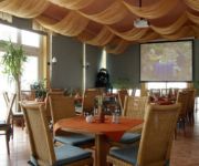
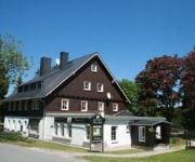
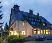
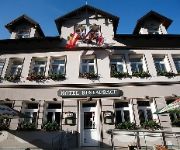
Hotels and Places to Stay
Alte Schleiferei
Reit- & Sporthotel Eibenstock
Zum Kranichsee
Zum Schützenhaus Pension und Gasthof
Bühlhaus
Hotel Am Bühl Das Blaue Wunder
Hotel Seifert
Videos from this area
These are videos related to the place based on their proximity to this place.
Talsperre Sosa im Erzgebirge
Die Talsperre Sosa im Erzgebirge Loop: Movietools.Info Musik: Quelle: Youtube / Audio Library Titel: Road to Moscow / Künstler: Jingle Punks The Creek / Künstler: Topher Mohr and...
Wasserfall Blauenthal
Cascada Blauenthal. Montaña de agua congelada. Invierno. El fluir que no se detiene.
Fields of the Nephilim Moonchild live @ MERA LUNA 2008
Fields of the Nephilim Mera Luna 2008 - Moonchild live.
Tschechenmarkt Johanngeorgenstadt
Tschechenmarkt Johanngeorgenstadt. Mir wurde 2x von den Verkäufern gesagt das ich dort nicht filmen soll :D.
ČD-Diesel in Deutschland: Abfahrt von 714 212 in Johanngeorgenstadt am 13.12.2014
714 212 am Os 17111 nach Karlovy Vary dolní nádraží (Karlsbad unterer Bahnhof) bei der Abfahrt am 13.12.2014 in Johanngeorgenstadt.
Haus der Hoffnung - Jahresrückblick 2014
Der Jahresrückblick 2014 der Landeskirchlichen Gemeinschaft Johanngeorgenstadt.
Starke Schwäche - Gottesdienst mit Michael Soldner
"Hoffnung zum mitnehmen" - Gottesdienst in der Landeskirchliche Gemeinschaft Johanngeorgenstadt,
Videos provided by Youtube are under the copyright of their owners.
Attractions and noteworthy things
Distances are based on the centre of the city/town and sightseeing location. This list contains brief abstracts about monuments, holiday activities, national parcs, museums, organisations and more from the area as well as interesting facts about the region itself. Where available, you'll find the corresponding homepage. Otherwise the related wikipedia article.
Auersberg
Auersberg is a mountain of Saxony, southeastern Germany.
Kleiner Kranichsee
The Kleiner Kranichsee is one of the most important raised bogs in the Ore Mountains of Central Europe. The bog straddles the German/Czech border; the part lying in the German state of Saxony has been protected since 1930, whilst the Czech part (6.02 hectares) was declared a nature reserve in 1962.
Schattenberg (Ore Mountains)
The Schattenberg is a wooded mountain southwest of Jugel and northeast of Hirschenstand (Jelení) in the western Bohemian Ore Mountains, which is 950 metres high. East of the mountain lies the 980-metre-high Scheffelsberg and to the north is the 973-metre-high Buchschachtelberg. These three mountains form the main crest in this part of the Ore Mountains. A footpath runs immediately past the Schattenberg that, in winter, is used as a cross-country skiing trail.
Buchschachtelberg
The Buchschachtelberg is a forested mountain south of Henneberg in the western Saxon Ore Mountains, which is 973 metres high. The border between Germany and the Czech Republic runs over its summit. Northwest of the Buchschachtelberg lies the Kleiner Kranichsee. In winter a cross-country skiing trail runs past the Buchschachtelberg and via the Scheffelsberg from Henneberg towards the border.


