Safety Score: 3,0 of 5.0 based on data from 9 authorites. Meaning we advice caution when travelling to Germany.
Travel warnings are updated daily. Source: Travel Warning Germany. Last Update: 2024-08-13 08:21:03
Discover Neuwaltersdorf
Neuwaltersdorf in Saxony is a city in Germany about 120 mi (or 194 km) south of Berlin, the country's capital city.
Local time in Neuwaltersdorf is now 06:29 PM (Saturday). The local timezone is named Europe / Berlin with an UTC offset of one hour. We know of 8 airports in the vicinity of Neuwaltersdorf, of which 4 are larger airports. The closest airport in Germany is Dresden Airport in a distance of 31 mi (or 50 km), North-East. Besides the airports, there are other travel options available (check left side).
There are several Unesco world heritage sites nearby. The closest heritage site in Germany is Dresden Elbe Valley in a distance of 28 mi (or 45 km), North-East. Looking for a place to stay? we compiled a list of available hotels close to the map centre further down the page.
When in this area, you might want to pay a visit to some of the following locations: Grosshartmannsdorf, Eppendorf, Pfaffroda, Pockau and Freiberg. To further explore this place, just scroll down and browse the available info.
Local weather forecast
Todays Local Weather Conditions & Forecast: 6°C / 43 °F
| Morning Temperature | 1°C / 35 °F |
| Evening Temperature | 5°C / 40 °F |
| Night Temperature | 2°C / 35 °F |
| Chance of rainfall | 0% |
| Air Humidity | 67% |
| Air Pressure | 1020 hPa |
| Wind Speed | Light breeze with 5 km/h (3 mph) from East |
| Cloud Conditions | Clear sky, covering 1% of sky |
| General Conditions | Sky is clear |
Sunday, 17th of November 2024
4°C (39 °F)
2°C (35 °F)
Light rain, moderate breeze, overcast clouds.
Monday, 18th of November 2024
2°C (36 °F)
0°C (32 °F)
Snow, moderate breeze, overcast clouds.
Tuesday, 19th of November 2024
5°C (41 °F)
6°C (43 °F)
Rain and snow, moderate breeze, overcast clouds.
Hotels and Places to Stay
Sporthotel Glück Auf Mönchenfrei
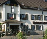
Trakehnerhof Landhotel
Landhotel Pockau
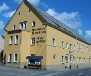
Erbgericht Gaststätte & Pension
Videos from this area
These are videos related to the place based on their proximity to this place.
Freiberg _Zug _Berg Andacht _07.09.2014
Der Berg Gottes Dienst auf der Halde "Beschert Glück" in Zug krönte am Sonntag den Abschluss der 175-Jahr-Feier. Danach setzte sich die Freiberger Berg- und Hüttenknappschaft mit reichlich...
8. BeBoTTa Freiberg
Ja Beton schwimmt, die Freiberger zeigten das auf dem Soldatenteich dieses Jahr zum achten mal (8x).
Hochwasser 2013 aus der Luft - Flöhadamm Olbernhau
Flug am Flöhadamm über die Kleingartenanlage in Olbernhau. Aufgenommen am 03.06.2013. Hardware Plane: Easystar RC: DX8 Cam: FlyCamOne Eco V2.
Auspuffsound Battle KS-Tuning
Auspuffsound Battle bei Ks-Tuning and more Mit 2 Nissan Sunny N14, Nissan Skyline R33, Honda Civic und Ford Fiesta. Wer hat den lautesten Auspuff? ...
Zugspitze im Erzgebirge
Sachsen hat auch eine "Zugspitze". Die ehemalige Bergbauhalde im Freiberger Ortsteil Zug wurde leibevoll restauriert. Sie ist auf jeden Fall einen Besuch wert.
Presentation of Samarpan House of Spirituality in Voigtsdorf, Germany
This is a video of Samarpan House of Spirituality in Voigtsdorf in German Erzgebirge mountains which was visited by Shree Shivkrupanand Swami, the founder of the spiritual method of Samarpan...
Mulda Sachsen
Schon vor 100 Jahren wurde für Konsumprodukte geworben. Damals nannte man die Werbung jedoch Reklame und jede Firma welche was auf sich hielt, produzierte kleine Briefmarken ähnliche ...
Bauernkapelle Mindersdorf - Jasmin
Auftritt in Mulda bei Dresden am 15.09.2012. Wir bedanken uns für diesen wunderschönen Abend bei all unseren Fans, Zuhörern und Gönnern der Bauernkapelle Mindersdorf!
Videos provided by Youtube are under the copyright of their owners.
Attractions and noteworthy things
Distances are based on the centre of the city/town and sightseeing location. This list contains brief abstracts about monuments, holiday activities, national parcs, museums, organisations and more from the area as well as interesting facts about the region itself. Where available, you'll find the corresponding homepage. Otherwise the related wikipedia article.
Schattenberg (Allgäu Alps)
Schattenberg (Allgäuer Alpen) is a mountain of Bavaria, Germany.


