Safety Score: 3,0 of 5.0 based on data from 9 authorites. Meaning we advice caution when travelling to Germany.
Travel warnings are updated daily. Source: Travel Warning Germany. Last Update: 2024-08-13 08:21:03
Explore Leuba
Leuba in Saxony is a city in Germany about 122 mi (or 196 km) south-east of Berlin, the country's capital.
Local time in Leuba is now 08:15 AM (Sunday). The local timezone is named Europe / Berlin with an UTC offset of one hour. We know of 9 airports in the vicinity of Leuba, of which 4 are larger airports. The closest airport in Germany is Dresden Airport in a distance of 52 mi (or 83 km), West. Besides the airports, there are other travel options available (check left side).
There are several Unesco world heritage sites nearby. The closest heritage site in Germany is Muskauer Park / Park Mużakowski in a distance of 38 mi (or 62 km), North. If you need a place to sleep, we compiled a list of available hotels close to the map centre further down the page.
Depending on your travel schedule, you might want to pay a visit to some of the following locations: Markersdorf, Goerlitz, Zgorzelec, Konigshain and Kodersdorf. To further explore this place, just scroll down and browse the available info.
Local weather forecast
Todays Local Weather Conditions & Forecast: 4°C / 40 °F
| Morning Temperature | 2°C / 36 °F |
| Evening Temperature | 6°C / 43 °F |
| Night Temperature | 7°C / 44 °F |
| Chance of rainfall | 7% |
| Air Humidity | 79% |
| Air Pressure | 1018 hPa |
| Wind Speed | Strong breeze with 19 km/h (12 mph) from North-East |
| Cloud Conditions | Overcast clouds, covering 100% of sky |
| General Conditions | Rain and snow |
Monday, 25th of November 2024
9°C (49 °F)
7°C (44 °F)
Overcast clouds, strong breeze.
Tuesday, 26th of November 2024
9°C (48 °F)
4°C (39 °F)
Moderate rain, fresh breeze, overcast clouds.
Wednesday, 27th of November 2024
5°C (41 °F)
5°C (40 °F)
Overcast clouds, fresh breeze.
Hotels and Places to Stay
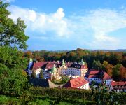
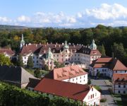
Gästehäuser St. Marienthal
Kloster St. Marienthal
Videos from this area
These are videos related to the place based on their proximity to this place.
Zgorzelec, przerwanie zapory na Witce, TVN24.pl - 07.08.2010.
Video vom gebrochenen Staudamm der Wittig (n. Gorlitz). Wczoraj wieczorem po przerwaniu tamy prawie 5mln litrów wody ze sztucznego zalewu na Witce wylało się i popłynęło w kierunku Zgorzelca.
Ośrodek Wypoczynkowy i Sportów Wodnych „Witka
Ośrodek Wypoczynkowy i Sportów Wodnych „Witka" położony jest nad brzegiem zalewu rzeki Witka, pośród zieleni i lasów. Cisza, bliskość przyrody oraz akwenu wodnego sprawia, iż jest...
Grenzübergang Ostritz (D) - Krzewina / Grunau (PL) Border crossing
Standing in the middle of the border bridge across river Neisse. First looking to the west towards Ostritz in Germany, then panning the camera to the east towards Krzewina / Grunau in Poland....
Ostritz
Geschichte auf Reklamemarken & Siegelmarken aus veikkos-archiv Schon vor 100 Jahren wurde für Konsumprodukte geworben. Damals nannte man die Werbung jedoch Reklame und jede Firma ...
PPG Motorschirm-Flug um Görlitz
Ostritz, Stausee Quitzdorf und Königshainer Berge Motoren: Orbiter XP mit Corsair Black Devil u. Paramotor Snap.
Kart - ROK - Görlitz Ring - Crash and Victory
Fahrer/ Driver 1: Kart: Chassi Zanardi Motor/ Engine: TM KF3 125 ccm Fahrer/ Driver 2: Kart: Chassi Birel Motor/ Engine: Senior ROK 125 ccm Reifen/ Tires: Bridgestone ROK (YLR) Kamera/Camera:...
Here Is Why @ Moxxom Festival Freibad Hagenwerder 2012
Here Is Why @ Moxxom Openair Freibad Hagenwerder Germany 07.07.12 - pix @ http://www.sound-of-e.de/moxxom2012 Line Up: Adam Port, Alec Troniq, Bureaumaschine, Chasing Kurt, DJ Lyrics ...
Rundflug am winterlichen Kloster St. Marienthal / St. Marienthal abbey in winter FPV
Friedvoll liegt das Kloster überdeckt von einer zarten Schneeschicht und beleuchtet wie zu Weihnachten.
Videos provided by Youtube are under the copyright of their owners.
Attractions and noteworthy things
Distances are based on the centre of the city/town and sightseeing location. This list contains brief abstracts about monuments, holiday activities, national parcs, museums, organisations and more from the area as well as interesting facts about the region itself. Where available, you'll find the corresponding homepage. Otherwise the related wikipedia article.
Berzdorfer See
The Berzdorfer See or Lake Berzdorf is situated near the southern border of Görlitz in Saxony, Germany. The artificial lake was created out of a former lignite mine — the process of flooding it is ongoing, and it is expected to be finished in 26. 06. 2010. The planned surface of the lake is expected to be about 10 km². Its name derives from the small village Schönau-Berzdorf to the southwest of the lake. It is expected to be one of the largest lakes in Saxony.
Bratków, Lower Silesian Voivodeship
Bratków is a village in the administrative district of Gmina Bogatynia, within Zgorzelec County, Lower Silesian Voivodeship, in south-western Poland, close to the Czech and German borders. Prior to 1945 it was in Germany. It lies approximately 10 kilometres north of Bogatynia, 17 kilometres south of Zgorzelec, and 148 kilometres west of the regional capital Wrocław.
Krzewina, Lower Silesian Voivodeship
Krzewina is a village in the administrative district of Gmina Bogatynia, within Zgorzelec County, Lower Silesian Voivodeship, in south-western Poland, close to the Czech and German borders. Prior to 1945 it was in Germany. It lies approximately 12 kilometres north of Bogatynia, 16 km south of Zgorzelec, and 147 km west of the regional capital Wrocław.
Posada, Lower Silesian Voivodeship
Posada is a village in the administrative district of Gmina Bogatynia, within Zgorzelec County, Lower Silesian Voivodeship, in south-western Poland, close to the Czech and German borders. Prior to 1945 it was in Germany. It lies approximately 10 kilometres north of Bogatynia, 18 km south of Zgorzelec, and 148 km west of the regional capital Wrocław.
Niedów
Niedów (German: Nieda, 1937-45: Wolfsberg} is a village in the administrative district of Gmina Zgorzelec, within Zgorzelec County, Lower Silesian Voivodeship, in south-western Poland, close to the German border. Prior to 1945 it was in Germany. It lies approximately 13 kilometres south of Zgorzelec, and 144 kilometres west of the regional capital Wrocław. The village has a population of 15.
Radomierzyce, Zgorzelec County
Radomierzyce is a village in the administrative district of Gmina Zgorzelec, within Zgorzelec County, Lower Silesian Voivodeship, in south-western Poland, close to the German border. Prior to 1945 it was in Germany. It lies approximately 10 kilometres south of Zgorzelec, and 146 kilometres west of the regional capital Wrocław.
Pließnitz
Pließnitz is a river of Saxony, Germany.


