Safety Score: 3,0 of 5.0 based on data from 9 authorites. Meaning we advice caution when travelling to Germany.
Travel warnings are updated daily. Source: Travel Warning Germany. Last Update: 2024-08-13 08:21:03
Delve into Waldidylle
The district Waldidylle of Hirschsprung in Saxony is a district located in Germany about 120 mi south of Berlin, the country's capital town.
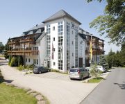
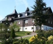
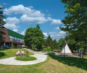
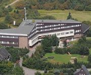
In need of a room? We compiled a list of available hotels close to the map centre further down the page.
Since you are here already, you might want to pay a visit to some of the following locations: Schmiedeberg, Kreischa, Bannewitz, Rechenberg-Bienenmuehle and Dorfhain. To further explore this place, just scroll down and browse the available info.
Local weather forecast
Todays Local Weather Conditions & Forecast: 5°C / 40 °F
| Morning Temperature | 0°C / 33 °F |
| Evening Temperature | 2°C / 35 °F |
| Night Temperature | 1°C / 34 °F |
| Chance of rainfall | 0% |
| Air Humidity | 68% |
| Air Pressure | 1021 hPa |
| Wind Speed | Gentle Breeze with 6 km/h (3 mph) from North-East |
| Cloud Conditions | Clear sky, covering 0% of sky |
| General Conditions | Sky is clear |
Sunday, 17th of November 2024
3°C (37 °F)
1°C (34 °F)
Rain and snow, moderate breeze, broken clouds.
Monday, 18th of November 2024
1°C (34 °F)
-1°C (30 °F)
Light snow, fresh breeze, scattered clouds.
Tuesday, 19th of November 2024
3°C (38 °F)
-2°C (29 °F)
Rain and snow, fresh breeze, overcast clouds.
Hotels and Places to Stay
Zum Bären
Ladenmühle
Zum Silberstollen
AHORN Waldhotel Altenberg (ex. Stephanshöhe)
Sartor
Naturhotel Gasthof Bärenfels
Lugsteinhof
Rothmanns Waldhotel am Aschergraben
Am Rennberg
Wettin Landhotel
Videos from this area
These are videos related to the place based on their proximity to this place.
Weißeritztalbahn Mahnwache 14.08.2010 (3/5)
Im Rahmen des Kipsdorfer Heimatfestes 2010 gab es am 14.8.2010 erneut eine Mahnwache und Demo für den Erhalt und den vollständigen Wiederaufbau der Weißeritztalbahn bis Kipsdorf.
Video Abriß Erzgebirgsbaude
Im September 2014 wurde die "Erzgebirgsbaude" in Waldidylle abgerissen. Damit endete unwiderruflich die Geschichte des Hotels und Restaurants, das Anfang des20. Jahrhunderts zu den ersten...
Zeitraffer Webcam BD Seifert Baerenstein 30 06 2014
Meine Webcam gewährt Ihnen einen Blick vom Giebel des Wohnhauses über das Bärensteiner Oberdorf hin zur Börnchener Höhe.
Tandem-Skitour zum Kahleberg im Osterzgebirge
Den Winter hassen viele Rollifahrer wegen der Kälte und des weißen Katastrophenpulvers. Daß man dieser Jahreszeit auch seinen Reiz abgewinnen kann, zeigt dieses Video. Vor allem mit ...
Ausflug in das Osterzgebirge
Der Ausflug in das Osterzgebirge beginnt mit dem Besuch von Weesenstein im Tal der Müglitz. Nach dem Besuch des Schlosses fahren wir nach Altenberg, dem bekannten Wintersportort. Weiter geht...
Berühmter Wasserfall in Schellerhau/Altenberg - Freistaat Sachsen/Erzgebirge
Ein wunderschöner Wasserfall mitten im Osterzegebirge (Kurort Altenberg OT Schellerhau nahe Dresden). Erinnerungen aus unserem Trip nach Sachen/sächsische Schweiz. An diesem Ort war es ...
SEBA Beton On Fire 2012 Altenberg, Germany'
FIRST STEP OF THE SEBA BETON ON FIRE TOUR 2012, ALTENBERG, Germany, June 2nd & 3rd The Bobsleigh track of the City of Altenberg (8000 inhabitants) was the host of a great show involving ...
Fahrt von der A17 ins Skigebiet nach Altenberg
In 20 Minuten von der A17 (Abfahrt Geising) direkt an den Skihang nach Altenberg.
Videos provided by Youtube are under the copyright of their owners.
Attractions and noteworthy things
Distances are based on the centre of the city/town and sightseeing location. This list contains brief abstracts about monuments, holiday activities, national parcs, museums, organisations and more from the area as well as interesting facts about the region itself. Where available, you'll find the corresponding homepage. Otherwise the related wikipedia article.
Na Stínadlech
Na Stinadlech is a multi-purpose stadium in Teplice, Czech Republic. It is currently used mostly for football matches and is the home ground of FK Teplice. The stadium holds 18,221 and was built in 1973. The Czech Republic national football team often plays qualification games at the stadium and has very positive statistics there. As of October 2010, they have won 18 times from 19 games, drawing the other, in a 2002 friendly game against Sweden where they tied 3–3.
Wesenitz
The Wesenitz is a river in the Free State of Saxony, Germany, right tributary of the Elbe. Its total length is 83 km. The Wesenitz runs through the tourist regions of the Lusatian Highlands and Saxon Switzerland. Its name is derived from Sorbian language wjaz.
Modlany
Modlany is a village approximately 4 kilometres east of the Czech town of Teplice. It is a village of about 900 people that includes a football complex and a World War II memorial. The village lacks many important buildings like an elementary school or a hospital, but ČSAD buses travel regularly between Modlany and Teplice, although city buses do not.
Teplice District
The Teplice District is a district in the Czech Republic and is part of the Ústí nad Labem Region along with the districts of Most, Louny, Chomutov, Litoměřice, Děčín and Ústí nad Labem. The Teplice District takes up only about a twelfth of the Ústí nad Labem Region but is central part in a bain between Ore Mountains and hills of the České středohoří is heavily urbanised and densely populated.
Novosedlice
Novosedlice is a village in the Czech Republic located in the Teplice District of the Ústí nad Labem Region.
Altenberg bobsleigh, luge, and skeleton track
The Altenberg bobsleigh, luge, and skeleton track is a venue for bobsleigh, luge and skeleton located in Altenberg, Germany.
Sächsische Schweiz-Osterzgebirge
Sächsische Schweiz-Osterzgebirge is a district in the Free State of Saxony, Germany. It is named after the mountain ranges Saxon Switzerland and Erzgebirge.
Glashütte Observatory
Glashütte Observatory is an observatory located in Glashütte, Saxony, Germany. Hugo Müller led the way and supplied a plot of land in Dittersdorfer Weg for the construction of an observatory, which began construction when the foundation stone was set on 27 August 1906. When the observatory opened four years later in 1910, on 26 June, it cemented Glashütte as the hub of Germany’s watchmaking industry.
Botanischer Garten Schellerhau
The Botanischer Garten Schellerhau (1.4 hectares) is a botanical garden located near the hamlet of Schellerhau at Hauptstrasse 41, Altenberg, Saxony, Germany. It is open daily in the warmer months; an admission fee is charged. The garden was established in 1906 by Gustav Adolf Poscharsky, inspector of the Royal Botanical Garden of Dresden, as his private garden. As he subsequently wrote, "As far as I know it was the first attempt with such a garden in the Erzgebirge (Ore Mountains).
Sobědruhy
Sobědruhy, fully Sobědruhy u Teplic is, now a district of Teplice, Czech Republic.
Drachenkopf bei Nassau
Drachenkopf bei Nassau is a mountain of Saxony, southeastern Germany.
Kahleberg
Kahleberg (Bald Mountain) is a mountain of Saxony, southeastern Germany.
Steinkuppe
Steinkuppe is a mountain of Saxony, southeastern Germany.
Hirschsprung, Germany
Hirschsprung is a village in the eastern Ore Mountains in Saxony, Germany. It is 35 kilometres south of Dresden, 6 kilometres from Czech border. Since 1965 it has been part of the town of Altenberg.
Erdbach (Mümling)
Erdbach is a river of Hesse, Germany.
Pöbelbach
Pöbelbach is a river of Saxony, Germany.
Georgenfelder Hochmoor
The Georgenfelder Hochmoor is a raised bog (Hochmoor) in the German Ore Mountains of central Europe, not far from Zinnwald-Georgenfeld. It is part of a larger bog or moor complex, that lies to the south, mainly on the far side of the Germany's national border in Czechia and which, since time immemorial, has been known simply as "The Lake" (Die See). The Georgenfelder Hochmoor is one of the oldest nature reserves in Saxony.


