Safety Score: 3,0 of 5.0 based on data from 9 authorites. Meaning we advice caution when travelling to Germany.
Travel warnings are updated daily. Source: Travel Warning Germany. Last Update: 2024-08-13 08:21:03
Discover Wietfeld
Wietfeld in Saxony-Anhalt is a city in Germany about 129 mi (or 208 km) south-west of Berlin, the country's capital city.
Local time in Wietfeld is now 12:33 AM (Wednesday). The local timezone is named Europe / Berlin with an UTC offset of one hour. We know of 12 airports in the vicinity of Wietfeld, of which 5 are larger airports. The closest airport in Germany is Oschersleben Airport in a distance of 32 mi (or 51 km), North-East. Besides the airports, there are other travel options available (check left side).
There are several Unesco world heritage sites nearby. The closest heritage site in Germany is Mines of Rammelsberg, Historic Town of Goslar and Upper Harz Water Management System in a distance of 16 mi (or 25 km), North-West. We discovered 1 points of interest in the vicinity of this place. Looking for a place to stay? we compiled a list of available hotels close to the map centre further down the page.
When in this area, you might want to pay a visit to some of the following locations: Zorge, Wieda, Walkenried, Harzungen and Etzelsrode. To further explore this place, just scroll down and browse the available info.
Local weather forecast
Todays Local Weather Conditions & Forecast: 9°C / 49 °F
| Morning Temperature | 3°C / 38 °F |
| Evening Temperature | 6°C / 43 °F |
| Night Temperature | 4°C / 40 °F |
| Chance of rainfall | 0% |
| Air Humidity | 67% |
| Air Pressure | 1025 hPa |
| Wind Speed | Calm with 2 km/h (1 mph) from North-West |
| Cloud Conditions | Overcast clouds, covering 95% of sky |
| General Conditions | Overcast clouds |
Wednesday, 6th of November 2024
10°C (50 °F)
4°C (39 °F)
Few clouds, calm.
Thursday, 7th of November 2024
10°C (50 °F)
3°C (38 °F)
Sky is clear, calm, clear sky.
Friday, 8th of November 2024
8°C (47 °F)
3°C (38 °F)
Sky is clear, light breeze, clear sky.
Hotels and Places to Stay
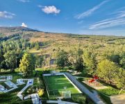
Maritim Berghotel
waldhotel AUSZEIT
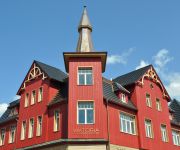
Designhotel Viktoria
Sonneneck Vitalhotel
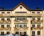
Residenz Hohenzollern
Brockenblick Ferienpark
Memory
Der Berghof Pension
Hasselhof Garni
Wellnesshotel Harzromantik
Videos from this area
These are videos related to the place based on their proximity to this place.
Motorrad Harz: Elend - Braunlage NHQ.7.3.2.2
NHR-HHS-Querung7 Abschnitt3 Teil2 Variante2 Die Trasse führt durch den Oberharz von Elend über die Grenze Sachsen-Anhalts und Niedersachsens nach Braunlage zur Harzhochstraße. Nachtrag:.
Grenzöffnungsfeier Braunlage - Elend
20. Jahrestag der Grenzöffnung zwischen Braunlage und Elend im Harz. Feier an der B27 an der Bremke u.a. mit den Jagdhornfreunden Schierke. Bürgermeister Stefan Grote (Braunlage) und Carsten.
(HD) 99 7245 in Sorge mit lauter Ausfahrt
Am 16. Mai 2010 begegnet uns die Nordhäuser Planlok in Sorge. Nachdem der Zug einfuhr lief ich nach vorne, daher die zwei Perspektiven, und auch die Ausfahrt war äußerst laut.
Harzhochstraße HHS.6
Streckenabschnitt Tanne - Braunlage Auf dieser Etappe überschreitet man die Landesgrenze zwischen Sachsen-Anhalt und Niedersachsen. Die erwähnte Schluppe nach Elend (nach dem ...
Motorrad Harz: Elend - Sorge NHQ.7.3.2.1
NHR-HHS-Querung7 Abschnitt3 Teil2 Variante1 Über die urige Strecke von Elend nach Sorge. Der asphalt ist nicht im besten Zustand, jedoch eine gemütliche alte Trasse mit einem gewissen Reiz...
Br 187 der HSB bei Elend
Am Abend des 24.Februar.2014 verlässt der Triebwagen der Br 187 den Bh Elend in Richtung Sorge. Leider kann ich nicht mehr sagen um welchen Triebwagen es sich hier genau handelt.
Schierke am Brocken im Hochharz-OT Wernigerode*Nationalpark Harz *Sachsen-Anhalt
Schierke am Brocken, i. ein OT v. Wernigerode u. liegt im Oberharz, am Fusse des Brocken. Es grenzt etwa im Norden an den Nationalpark Harz und befindet sich im Naturpark Harz/Sachsen-Anhalt...
Sommerrodelbahn Brocken Coaster in Schierke
Abfahrt auf dem Brocken Coaster, gefilmt bei meinem Besuch im Sommer 2012 mit dem iPhone 4. Meine GoPro lag zu diesem Zeitpunkt leider noch bei der Post. Ich hatte den Zusteller um zwei ...
Videos provided by Youtube are under the copyright of their owners.
Attractions and noteworthy things
Distances are based on the centre of the city/town and sightseeing location. This list contains brief abstracts about monuments, holiday activities, national parcs, museums, organisations and more from the area as well as interesting facts about the region itself. Where available, you'll find the corresponding homepage. Otherwise the related wikipedia article.
Harz
The Harz is the highest mountain range in northern Germany and its rugged terrain extends across parts of Lower Saxony, Saxony-Anhalt and Thuringia. The name Harz derives from the Middle High German word Hardt or Hart (mountain forest), Latinized as Hercynia. The legendary Brocken is the highest summit in the Harz with a height of 1,141.1 metres above sea level. The Wurmberg (971 metres) is the highest peak located entirely within Lower Saxony.
Schnarcherklippen
Schnarcherklippen is the name of a rock formation south of the village of Schierke in the High Harz mountains of Saxony-Anhalt in central Germany. The name translates roughly to "snoring crags" or "snoring rocks".
Scherstorklippen
The Scherstorklippen is a granite tor in the Harz Mountains of central Germany. It is located near the village of Schierke in the county of Harz in the state of Saxony-Anhalt. It was formed by the process of spheroidal weathering.
Barenberg (Schierke)
The Barenberg, also called the Bärenberg or Bärenkopf, is a mountain, 695.5 m above sea level, in the Harz Mountains o f Germany near the village of Schierke, Harz county, in the state of Saxony-Anhalt.
Sorge Border Museum
The Sorge Border Museum is an open-air museum that is open to the public and free of charge near Sorge in the Harz Mountains of central Germany. It is located immediately by the former Inner German Border, southeast of Braunlage and aims to recall the division of Germany into East and West Germany.
Helenenruh
The Helenenruh ("Helen's Rest") is a 629 metre high rocky ridge near the village of Elend in the Harz Mountains of central Germany. Today there is a refuge hut and rest area here, from which there are outstanding views over the village of Schierke across to the Brocken, the highest mountain in the Harz. Other sights are the gorge of the Cold Bode river and the Schnarcherklippen rocks. The Helenenruh is checkpoint no. 21 in the Harzer Wandernadel hiking system.


