Safety Score: 3,0 of 5.0 based on data from 9 authorites. Meaning we advice caution when travelling to Germany.
Travel warnings are updated daily. Source: Travel Warning Germany. Last Update: 2024-08-13 08:21:03
Discover Neu Biendorf
Neu Biendorf in Saxony-Anhalt is a city in Germany about 108 mi (or 174 km) south-west of Berlin, the country's capital city.
Local time in Neu Biendorf is now 12:51 AM (Friday). The local timezone is named Europe / Berlin with an UTC offset of one hour. We know of 12 airports in the vicinity of Neu Biendorf, of which 5 are larger airports. The closest airport in Germany is Leipzig Halle Airport in a distance of 20 mi (or 32 km), North-East. Besides the airports, there are other travel options available (check left side).
There are several Unesco world heritage sites nearby. The closest heritage site in Germany is Classical Weimar in a distance of 31 mi (or 50 km), South-West. Looking for a place to stay? we compiled a list of available hotels close to the map centre further down the page.
When in this area, you might want to pay a visit to some of the following locations: Goseck, Gleina, Balgstaedt, Schoenburg and Schkopau. To further explore this place, just scroll down and browse the available info.
Local weather forecast
Todays Local Weather Conditions & Forecast: 2°C / 36 °F
| Morning Temperature | 1°C / 33 °F |
| Evening Temperature | 2°C / 35 °F |
| Night Temperature | -0°C / 31 °F |
| Chance of rainfall | 0% |
| Air Humidity | 73% |
| Air Pressure | 999 hPa |
| Wind Speed | Fresh Breeze with 15 km/h (9 mph) from East |
| Cloud Conditions | Broken clouds, covering 80% of sky |
| General Conditions | Broken clouds |
Friday, 22nd of November 2024
3°C (37 °F)
3°C (37 °F)
Rain and snow, strong breeze, scattered clouds.
Saturday, 23rd of November 2024
3°C (37 °F)
4°C (39 °F)
Broken clouds, fresh breeze.
Sunday, 24th of November 2024
9°C (48 °F)
9°C (47 °F)
Light rain, fresh breeze, overcast clouds.
Hotels and Places to Stay
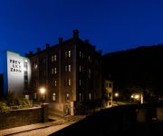
Hotel - Pension Geiseltalsee Mücheln
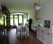
Hotel Alter Speicher
Herberge am Jakobsweg
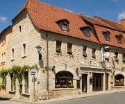
Zur Traube
Videos from this area
These are videos related to the place based on their proximity to this place.
Beseitigung der Radwegeschäden im Burgenlandkreis
Das Hochwasser 2013 hat auch den Radwegen im Burgenlandkreis zugesetzt. Nun hat das Land 7 Millionen Euro zur Reparatur und Instandsetzung bereitgestellt. Auch der Unstrut-Radweg profitiert...
Feuerwehr Übung / Ausbildung neu ICE Strecke Bad Lauchstädt [HD]
Ausbildung Technische Hilfeleistung Bahn (Brand + TH) beteiligte Feuerwehren Korbetha Bündorf Bad Lauchstädt Leuna Lochau.
ARDIE 500 Jubiläumsmodell VOL.1
nach über 70 Jahren auf dem Dachboden,aus dem Schlaf erwacht. Neuaufbauf 2013 durch ZAPPEL.
Bauabnahme der Seebrücke Braunsbedra
Es ist endlich soweit, nicht ohne Stolz konnte Steffen Schmitz (Bürgermeister der Stadt Braunsbedra) zusammen mit Wirtschaftsstaatssekretärin Frau Dr. Zieschang die neue Seebrücke in Braunsbedra.
Stadt Mücheln / Geiseltalsee Infofilm 1080p
Erleben Sie die wechselnde Geschichte einer Stadt bis hin zum touristischen Kleinod. Entdecken Sie die Spuren der Geschichte die hier hinterlassen wurden. Von den weltweit bekannten Fossilien...
Mücheln Marina Geiseltalsee aus der Luft gefilmt [HD]
Denkt daran den Film in HD QUALITÄT zu schauen. Falls er euch gefällt: Kommentieren, Daumen HOCH, teilen und ABONNIEREN! Danke!
Multikopter Luftaufnahmen Marina Mücheln
Marina Mücheln http://www.marina-muecheln.de/ Geiseltalsee Luftaufnahmen www.schwebeauge.de.
seen-sucht part 1 (auf dem drahtesel entlang des geiseltalsee) ein denkgelage-film
ein altes klappriges fahrrad führt uns 23 minuten ufernah entlang des entstehenden geiseltalsee, einem ehemaligen tagebaues im geiseltal... film, schnitt, idee: jenne jens könig http://denk...
Videos provided by Youtube are under the copyright of their owners.
Attractions and noteworthy things
Distances are based on the centre of the city/town and sightseeing location. This list contains brief abstracts about monuments, holiday activities, national parcs, museums, organisations and more from the area as well as interesting facts about the region itself. Where available, you'll find the corresponding homepage. Otherwise the related wikipedia article.
Wettin, Saxony-Anhalt
Wettin is a small town and a former municipality in the Saalekreis district of Saxony-Anhalt, Germany, situated on the River Saale north of Halle. Since 1 January 2011, it is part of the town Löbejün-Wettin. It is known for Wettin Castle, the ancestral seat of the House of Wettin, ruling dynasty of Saxony and Poland. Wettin sights include the Tower of Bismarck, the town hall, and the castle (used as the Burggymnasium).
Oberes Geiseltal
Oberes Geiseltal was a Verwaltungsgemeinschaft ("collective municipality") in the Saalekreis district, in Saxony-Anhalt, Germany. It was situated southwest of Halle (Saale). The seat of the Verwaltungsgemeinschaft was in Mücheln. It was disbanded on 1 January 2010. The Verwaltungsgemeinschaft Oberes Geiseltal consisted of the following municipalities: Mücheln
Zschorgula
Zschorgula is part of the small village Schkölen located in the province of Thuringia in East Germany. The Zschorgula has a population of about 80. The village is surrounded by beautiful farms and hills. There is a church in the village. The closest airport is AOC - Altenburg Nobitz, located 45.5 km east of Zschorgula. More nearby airports include LEJ - Leipzig Halle 50.0 km north east, ERF - Erfurt 64.2 km west, HOQ - Hof Plauen 84.7 km south, BYU - Bayreuth 119.6 km south,
Geisel valley
The Geisel valley is a valley in Saxony-Anhalt, Germany, situated west of Merseburg, Saalekreis district. It is named after the River Geisel which rises in Mücheln and is a tributary of the Saale, just under 25 km long. Its main settlements are Braunsbedra and Mücheln, which in future will merge into the 'collective municipality' of Geiseltal. The Geisel valley was quarried for coal from the 17th century until 1994. The valley is notable for its fossil record.


!['Feuerwehr Übung / Ausbildung neu ICE Strecke Bad Lauchstädt [HD]' preview picture of video 'Feuerwehr Übung / Ausbildung neu ICE Strecke Bad Lauchstädt [HD]'](https://img.youtube.com/vi/jtFs-0p0Lkc/mqdefault.jpg)


!['Mücheln Marina Geiseltalsee aus der Luft gefilmt [HD]' preview picture of video 'Mücheln Marina Geiseltalsee aus der Luft gefilmt [HD]'](https://img.youtube.com/vi/oXPdxwOVZq4/mqdefault.jpg)


